TopoQuest Logo
Do you find TopoQuest useful?
Help keep TopoQuest running and adding new maps/features by donating!
Bitcoin:  19c7KJd3qBynnjoSw5npx9KScwjBe4ifkT
Litecoin:  LXs6TkuXGGXo1vDsWCkWVdjQX94eUKd6ui
Home View Maps Find Maps Find Places Resources & Links


Hendricks, Minnesota Topographic Map

USGS Map Title: Hendricks, MN
USGS Map MRC: 44096E4
DRG (GeoTIFF) Download: o44096e4.tif


Neighboring USGS Topographic Map Quads:


  Brandt, SD  
44096F5
 

  Canby NW, MN  
44096F4
 

  Canby, MN  
44096F3
 

  Astoria, SD  
44096E5
 

  Hendricks, MN  
44096E4
 

  Canby SE, MN  
44096E3
 

  White NE, SD  
44096D5
 

  Lake Benton NW, MN  
44096D4
 

  Lake Benton NE, MN  
44096D3


Map MRC Location:

N45°
W97°
N45°
W96°
H8 H7 H6 H5 H4 H3 H2 H1
G8 G7 G6 G5 G4 G3 G2 G1
F8 F7 F6 F5 F4 F3 F2 F1
E8 E7 E6 E5 E4 E3 E2 E1
D8 D7 D6 D5 D4 D3 D2 D1
C8 C7 C6 C5 C4 C3 C2 C1
B8 B7 B6 B5 B4 B3 B2 B1
A8 A7 A6 A5 A4 A3 A2 A1
N44°
W97°
N44°
W96°

Hendricks, MN USGS 1:24K Topographic Map Preview:
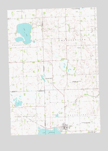
Hendricks, MN USGS Topographic Map
Click on map above to begin viewing in our Map Viewer.

This topographic map contains these locations and features:
Feature Name Type Latitude Longitude GNIS ID View Map
Black SloughSwampN44.5375°W96.4930°1253954View Map
Bohemian CemeteryCemeteryN44.6233°W96.3781°640338View Map
Calvary CemeteryCemeteryN44.5086°W96.4053°640763View Map
Calvary Lutheran ChurchChurchN44.5080°W96.4225°2051767View Map
City of HendricksCivilN44.5076°W96.4282°2394350View Map
Faith Lutheran Brethren ChurchChurchN44.5069°W96.4184°2051768View Map
Fish LakeLakeN44.6016°W96.4773°1255059View Map
Gerald Christianson Farm Pond DamDamN44.5600°W96.3803°1777235View Map
Hansonville CemeteryCemeteryN44.5847°W96.4025°2051775View Map
Hansonville ChurchChurchN44.5847°W96.3998°644650View Map
HendricksPopulated PlaceN44.5072°W96.4242°644865View Map
Hendricks (historical)LocaleN44.5047°W96.4275°2051756View Map
Hendricks City HallBuildingN44.5072°W96.4248°2051763View Map
Hendricks ClinicHospitalN44.5080°W96.4239°2051759View Map
Hendricks Community HospitalHospitalN44.5057°W96.4184°2051760View Map
Hendricks Fire DepartmentBuildingN44.5055°W96.4239°2666245View Map
Hendricks Police DepartmentBuildingN44.5054°W96.4239°2051762View Map
Hendricks Post OfficePost OfficeN44.5064°W96.4239°2051757View Map
Hendricks Public LibraryBuildingN44.5072°W96.4248°2051761View Map
Hendricks Public SchoolSchoolN44.5064°W96.4223°2051758View Map
Hendricks State Wildlife Management AreaParkN44.5097°W96.3889°644867View Map
Lake ParkParkN44.5061°W96.4337°646377View Map
Little Twin State Wildlife Management AreaParkN44.5505°W96.4120°646958View Map
Marble Lutheran ChurchChurchN44.5094°W96.4239°2051765View Map
Prairie Farm (historical)LocaleN44.5272°W96.4817°1263302View Map
Singsaas ChurchChurchN44.5261°W96.4650°1258083View Map
Skjold Post Office (historical)Post OfficeN44.5597°W96.4614°1267157View Map
Sokota State Wildlife Management AreaParkN44.5536°W96.4498°652225View Map
Swedish Mission ChurchChurchN44.6236°W96.4812°1258474View Map
Swedish Mission Church CemeteryCemeteryN44.6231°W96.4810°2773646View Map
Township of HansonvilleCivilN44.5875°W96.3949°664394View Map
Township of HendricksCivilN44.5013°W96.3862°664449View Map
Trinity Lutheran ChurchChurchN44.5083°W96.4253°2051764View Map
Twin LakeLakeN44.5675°W96.4198°653416View Map
United Methodist ChurchChurchN44.5083°W96.4259°2051766View Map
Wood Lake CemeteryCemeteryN44.6166°W96.4998°1259075View Map

Note: Coordinates in the location and feature list above are referenced to NAD83 datum.


Copyright (C) 2008-2025 Ryan Niemi / Sunset Dynamics ... All Rights Reserved