TopoQuest Logo
Do you find TopoQuest useful?
Help keep TopoQuest running and adding new maps/features by donating!
Bitcoin:  19c7KJd3qBynnjoSw5npx9KScwjBe4ifkT
Litecoin:  LXs6TkuXGGXo1vDsWCkWVdjQX94eUKd6ui
Home View Maps Find Maps Find Places Resources & Links


Canby, Minnesota Topographic Map

USGS Map Title: Canby, MN
USGS Map MRC: 44096F3
DRG (GeoTIFF) Download: o44096f3.tif


Neighboring USGS Topographic Map Quads:


  Gary, SD  
44096G4
 

  Gary SE, MN  
44096G3
 

  Dawson SW, MN  
44096G2
 

  Canby NW, MN  
44096F4
 

  Canby, MN  
44096F3
 

  Porter, MN  
44096F2
 

  Hendricks, MN  
44096E4
 

  Canby SE, MN  
44096E3
 

  Porter SW, MN  
44096E2


Map MRC Location:

N45°
W97°
N45°
W96°
H8 H7 H6 H5 H4 H3 H2 H1
G8 G7 G6 G5 G4 G3 G2 G1
F8 F7 F6 F5 F4 F3 F2 F1
E8 E7 E6 E5 E4 E3 E2 E1
D8 D7 D6 D5 D4 D3 D2 D1
C8 C7 C6 C5 C4 C3 C2 C1
B8 B7 B6 B5 B4 B3 B2 B1
A8 A7 A6 A5 A4 A3 A2 A1
N44°
W97°
N44°
W96°

Canby, MN USGS 1:24K Topographic Map Preview:
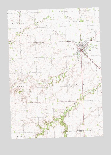
Canby, MN USGS Topographic Map
Click on map above to begin viewing in our Map Viewer.

This topographic map contains these locations and features:
Feature Name Type Latitude Longitude GNIS ID View Map
BurrPopulated PlaceN44.7483°W96.3592°640675View Map
Burr (historical)LocaleN44.7481°W96.3594°2066302View Map
Burr (historical)LocaleN44.7481°W96.3594°2065665View Map
Burr Post Office (historical)Post OfficeN44.7481°W96.3594°2066301View Map
Burr Post Office (historical)Post OfficeN44.7481°W96.3594°2065664View Map
CanbyPopulated PlaceN44.7089°W96.2764°640861View Map
Canby (historical)LocaleN44.7097°W96.2800°2066287View Map
Canby (historical)LocaleN44.7097°W96.2800°2065650View Map
Canby Elementary SchoolSchoolN44.7164°W96.2781°2066299View Map
Canby Elementary SchoolSchoolN44.7164°W96.2781°2065662View Map
Canby Fire DepartmentBuildingN44.7063°W96.2738°2666530View Map
Canby Golf ClubLocaleN44.7089°W96.2761°2066283View Map
Canby Golf ClubLocaleN44.7089°W96.2761°2065646View Map
Canby HospitalHospitalN44.7078°W96.2775°2066295View Map
Canby Junior-Senior High SchoolSchoolN44.7111°W96.2792°2066298View Map
Canby Junior-Senior High SchoolSchoolN44.7111°W96.2792°2065661View Map
Canby LakeReservoirN44.7066°W96.2770°1776148View Map
Canby Lake DamDamN44.7066°W96.2770°1776147View Map
Canby Police DepartmentBuildingN44.7086°W96.2742°2066285View Map
Canby Police DepartmentBuildingN44.7085°W96.2748°2065648View Map
Canby Post OfficePost OfficeN44.7106°W96.2747°2066286View Map
Canby Post OfficePost OfficeN44.7106°W96.2747°2065649View Map
Canby Public LibraryBuildingN44.7086°W96.2742°2066284View Map
Canby Public LibraryBuildingN44.7086°W96.2742°2065647View Map
Canby Triangle Park CampgroundLocaleN44.7186°W96.2553°2066300View Map
Canby Triangle Park CampgroundLocaleN44.7186°W96.2553°2065663View Map
City of CanbyCivilN44.7158°W96.2694°2393728View Map
First Baptist Church of CanbyChurchN44.7097°W96.2725°2066289View Map
First Baptist Church of CanbyChurchN44.7097°W96.2725°2065652View Map
Full Gospel AssemblyChurchN44.7139°W96.2717°2066290View Map
Full Gospel AssemblyChurchN44.7139°W96.2717°2065653View Map
Lake SylvanLakeN44.7058°W96.2789°652966View Map
Minnesota West Community CollegeSchoolN44.7161°W96.2853°2066297View Map
Minnesota West Community CollegeSchoolN44.7161°W96.2853°2065660View Map
Myers FieldAirportN44.7274°W96.2591°660094View Map
Nicolai Lutheran ChurchChurchN44.7189°W96.2722°2066288View Map
Nicolai Lutheran ChurchChurchN44.7189°W96.2722°2065651View Map
Our Saviour's Lutheran ChurchChurchN44.7103°W96.2769°2066291View Map
Our Saviour's Lutheran ChurchChurchN44.7103°W96.2769°2065654View Map
Presbyterian ChurchChurchN44.7108°W96.2731°2066292View Map
Presbyterian ChurchChurchN44.7108°W96.2731°2065655View Map
Saint Pauls CemeteryCemeteryN44.7039°W96.2967°650982View Map
Saint Peter Elementary SchoolSchoolN44.7139°W96.2744°2066296View Map
Saint Peter Elementary SchoolSchoolN44.7139°W96.2744°2065659View Map
Saint Peter's Catholic ChurchChurchN44.7139°W96.2744°2066293View Map
Saint Peter's Catholic ChurchChurchN44.7139°W96.2744°2065656View Map
Saint Peters CemeteryCemeteryN44.7183°W96.3067°651019View Map
Saint Stephens CemeteryCemeteryN44.6961°W96.2653°651059View Map
Sanford Canby AmbulanceBuildingN44.7079°W96.2782°2721363View Map
Sanford Canby Medical CenterHospitalN44.7078°W96.2785°2065658View Map
Senior Haven Nursing HomeHospitalN44.7078°W96.2775°2066294View Map
Senior Haven Nursing HomeHospitalN44.7078°W96.2775°2065657View Map
Swenson CemeteryCemeteryN44.6456°W96.2911°2065675View Map
Township of NormanCivilN44.6731°W96.2772°665139View Map
Trinity CemeteryCemeteryN44.6604°W96.3060°2065676View Map

Note: Coordinates in the location and feature list above are referenced to NAD83 datum.


Copyright (C) 2008-2024 Ryan Niemi / Sunset Dynamics ... All Rights Reserved