TopoQuest Logo
Do you find TopoQuest useful?
Help keep TopoQuest running and adding new maps/features by donating!
Bitcoin:  19c7KJd3qBynnjoSw5npx9KScwjBe4ifkT
Litecoin:  LXs6TkuXGGXo1vDsWCkWVdjQX94eUKd6ui
Home View Maps Find Maps Find Places Resources & Links


Henlawson, West Virginia Topographic Map

USGS Map Title: Henlawson, WV
USGS Map MRC: 37081H8
DRG (GeoTIFF) Download: o37081h8.tif


Neighboring USGS Topographic Map Quads:


  Big Creek, WV  
38082A1
 

  Mud, WV  
38081A8
 

  Madison, WV  
38081A7
 

  Chapmanville, WV  
37082H1
 

  Henlawson, WV  
37081H8
 

  Clothier, WV  
37081H7
 

  Holden, WV  
37082G1
 

  Logan, WV  
37081G8
 

  Amherstdale, WV  
37081G7


Map MRC Location:

N38°
W82°
N38°
W81°
H8 H7 H6 H5 H4 H3 H2 H1
G8 G7 G6 G5 G4 G3 G2 G1
F8 F7 F6 F5 F4 F3 F2 F1
E8 E7 E6 E5 E4 E3 E2 E1
D8 D7 D6 D5 D4 D3 D2 D1
C8 C7 C6 C5 C4 C3 C2 C1
B8 B7 B6 B5 B4 B3 B2 B1
A8 A7 A6 A5 A4 A3 A2 A1
N37°
W82°
N37°
W81°

Henlawson, WV USGS 1:24K Topographic Map Preview:
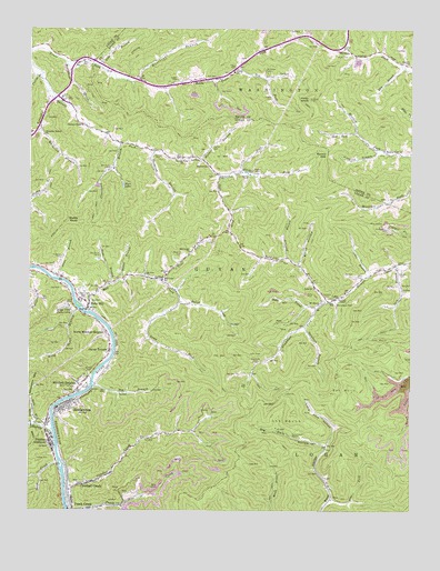
Henlawson, WV USGS Topographic Map
Click on map above to begin viewing in our Map Viewer.

This topographic map contains these locations and features:
Feature Name Type Latitude Longitude GNIS ID View Map
Albright CemeteryCemeteryN37.9373°W81.8779°1534851View Map
Aleshire BranchStreamN37.9679°W81.8835°1534864View Map
AnchorPopulated PlaceN37.9970°W81.9151°1741701View Map
Baldwin CemeteryCemeteryN37.9315°W81.8768°1535169View Map
Baldwin ForkStreamN37.9290°W81.9015°1535172View Map
Balls BranchStreamN37.9276°W81.9054°1535193View Map
Barker CemeteryCemeteryN37.9623°W81.9296°1535221View Map
Barker CemeteryCemeteryN37.9629°W81.9257°1535222View Map
Barker ForkStreamN37.9662°W81.9451°1535228View Map
Barker Fork ChurchChurchN37.9618°W81.9379°1535229View Map
Barker GapGapN37.9676°W81.9026°1535230View Map
Barker School (historical)SchoolN37.9643°W81.9418°1535237View Map
Bell CemeteryCemeteryN37.9057°W81.9871°1535597View Map
Big BranchStreamN37.9073°W81.9790°1535789View Map
Big Dark HollowValleyN37.8918°W81.9029°1535834View Map
Bills BranchStreamN37.8965°W81.9948°1535999View Map
Broad HollowValleyN37.9387°W81.9121°1536361View Map
Buffalo CreekStreamN37.8959°W81.9921°1536628View Map
Butch ForkStreamN37.9287°W81.9512°1536786View Map
Cloverlick BranchStreamN37.9698°W81.9704°1537433View Map
Covey CemeteryCemeteryN37.9359°W81.8929°1537733View Map
Craddock CemeteryCemeteryN37.9137°W81.9260°1537771View Map
Craddock ForkStreamN37.9290°W81.9015°1537772View Map
Crooked CreekStreamN37.8782°W81.9879°1537832View Map
Crooked CreekPopulated PlaceN37.8820°W81.9812°1554226View Map
Crooked Creek School (historical)SchoolN37.8829°W81.9769°1742512View Map
Curry ForkStreamN37.9634°W81.9307°1537931View Map
Dent ForkStreamN37.9732°W81.8929°1538132View Map
Dog ForkStreamN37.9895°W81.9326°1538237View Map
Ellis BranchStreamN37.9907°W81.8782°1538670View Map
Forest Lawn CemeteryCemeteryN37.9318°W81.9829°1539125View Map
Fowler CemeteryCemeteryN37.9820°W81.9212°1539194View Map
Garrett CemeteryCemeteryN37.9670°W81.9596°1539342View Map
Garrett ChapelChurchN37.9748°W81.9832°1539345View Map
Garrett Fork ChurchChurchN37.9662°W81.9504°1539349View Map
Godby KnobSummitN37.9493°W81.9837°1539486View Map
Gore ForkStreamN37.9615°W81.9379°1539536View Map
Guyan TerracePopulated PlaceN37.9165°W81.9737°1554622View Map
Hager CemeteryCemeteryN37.9870°W81.9521°1539828View Map
Hager CemeteryCemeteryN37.9904°W81.9343°1539831View Map
Hainer BranchStreamN37.9662°W81.9451°1539842View Map
Hainer CemeteryCemeteryN37.9687°W81.9404°1539843View Map
HenlawsonPopulated PlaceN37.9023°W81.9882°1540150View Map
Henlawson Census Designated PlaceCensusN37.8999°W81.9820°2586825View Map
Henlawson Post OfficePost OfficeN37.9025°W81.9884°1742537View Map
Henlawson Thru Truss BridgeBridgeN37.9035°W81.9751°2647276View Map
Henlawson Volunteer Fire DepartmentBuildingN37.8974°W81.9941°2577586View Map
Hill CemeteryCemeteryN37.9876°W81.9429°1540282View Map
Homer D Nelson BridgeBridgeN37.9270°W81.9818°2647268View Map
Huffman CemeteryCemeteryN37.9409°W81.9896°1540559View Map
Hurricane BranchStreamN37.9865°W81.9648°1540618View Map
Hyer LakeReservoirN37.9596°W81.9693°1540645View Map
Isom BranchStreamN37.9387°W81.8798°1540749View Map
Jims BranchStreamN37.9359°W81.8885°1540908View Map
Justice AdditionPopulated PlaceN37.8926°W81.9929°1554838View Map
Justice CemeteryCemeteryN37.8882°W81.9935°1541049View Map
Justice Elementary SchoolSchoolN37.8939°W81.9919°2088237View Map
Kanawha BranchStreamN37.9820°W81.9923°1541060View Map
King Shoal BranchStreamN37.9268°W81.9835°1541215View Map
LakePopulated PlaceN37.9298°W81.9004°1541312View Map
Lake BranchStreamN37.9904°W81.9782°1541315View Map
Lake ChurchChurchN37.9329°W81.9068°1541318View Map
Lake Elementary School (historical)SchoolN37.9315°W81.8965°1742550View Map
Lake Post OfficePost OfficeN37.9297°W81.9015°2774643View Map
Lake Volunteer Fire DepartmentBuildingN37.9404°W81.9144°2577536View Map
Lane School (historical)SchoolN37.9820°W81.9896°1541344View Map
Little Dark HollowValleyN37.8918°W81.9029°1542082View Map
Long ForkStreamN37.9290°W81.9512°1542369View Map
ManilaPopulated PlaceN37.9868°W81.9429°1555036View Map
Manila School (historical)SchoolN37.9887°W81.9335°1542711View Map
Meadow Fork ChurchChurchN37.9684°W81.8843°1543067View Map
Meetinghouse BranchStreamN37.9915°W81.9885°1543112View Map
Mill CreekStreamN37.9268°W81.9804°1543308View Map
Mill Creek ChurchChurchN37.9420°W81.9476°1543327View Map
Mill Creek School (historical)SchoolN37.9351°W81.9565°1543332View Map
Miller CemeteryCemeteryN37.9929°W81.8960°1543360View Map
Mitchell CemeteryCemeteryN37.9109°W81.9804°1543465View Map
Mitchell HeightsPopulated PlaceN37.9073°W81.9832°1555140View Map
Mitchell Heights Police DepartmentBuildingN37.9076°W81.9822°2728002View Map
Mount Mission ChurchChurchN37.9293°W81.9043°1543673View Map
Mount Zion ChurchChurchN37.9362°W81.9621°1543811View Map
Neds BranchStreamN37.9337°W81.9729°1544074View Map
North Mitchell HeightsPopulated PlaceN37.9212°W81.9746°1555234View Map
Peach Creek DamDamN37.8751°W81.9582°1558966View Map
Peach Creek ImpoundmentReservoirN37.8751°W81.9582°1558967View Map
Peach Creek Post OfficePost OfficeN37.8792°W81.9858°1742596View Map
Peach Creek Public School (historical)SchoolN37.8754°W81.9818°1742597View Map
Pecks MillPopulated PlaceN37.9282°W81.9810°1544680View Map
Pecks Mill Post OfficePost OfficeN37.9289°W81.9812°1742598View Map
Perrys BranchStreamN37.9884°W81.9962°1544734View Map
Pine ForkStreamN37.8782°W81.9012°1544869View Map
Piney KnobSummitN37.9818°W81.9087°1555361View Map
Piney Knob Lookout TowerLocaleN37.9818°W81.9087°1741784View Map
Price BranchStreamN37.9354°W81.9918°1545246View Map
Raccoon BranchStreamN37.9407°W81.9154°1545356View Map
RalumcoPopulated PlaceN37.9109°W81.9760°1742601View Map
Richardson CemeteryCemeteryN37.9290°W81.8987°1545554View Map
Ridge View Twin LakesReservoirN37.9276°W81.9876°1545577View Map
Rocklick BranchStreamN37.9682°W81.9593°1545988View Map
Sander CemeteryCemeteryN37.9909°W81.8765°1546380View Map
Sanders CemeteryCemeteryN37.9304°W81.9023°1546382View Map
Snap CreekStreamN37.8873°W81.9901°1547028View Map
Stable BranchStreamN37.9348°W81.9704°1547306View Map
Stevens ChapelChurchN37.9304°W81.8973°1547397View Map
Stowers CemeteryCemeteryN37.9418°W81.9504°1547540View Map
Sycamore BranchStreamN37.9229°W81.9101°1547815View Map
Town of Mitchell HeightsCivilN37.9087°W81.9866°2391309View Map
Trace ForkStreamN37.9351°W81.9579°1548211View Map
Verner-Ball CemeteryCemeteryN37.9303°W81.9032°2586353View Map
Victory ChurchChurchN37.9362°W81.9554°1548658View Map
Wheatley BranchStreamN37.9743°W81.9965°1548984View Map
Wheatley Branch ChurchChurchN37.9723°W81.9957°1548985View Map
Workman CemeteryCemeteryN37.9887°W81.9226°1549409View Map

Note: Coordinates in the location and feature list above are referenced to NAD83 datum.


Copyright (C) 2008-2024 Ryan Niemi / Sunset Dynamics ... All Rights Reserved