TopoQuest Logo
Do you find TopoQuest useful?
Help keep TopoQuest running and adding new maps/features by donating!
Bitcoin:  19c7KJd3qBynnjoSw5npx9KScwjBe4ifkT
Litecoin:  LXs6TkuXGGXo1vDsWCkWVdjQX94eUKd6ui
Home View Maps Find Maps Find Places Resources & Links


Heppner, Oregon Topographic Map

USGS Map Title: Heppner, OR
USGS Map MRC: 45119C5
DRG (GeoTIFF) Download: o45119c5.tif


Neighboring USGS Topographic Map Quads:


  Lexington, OR  
45119D6
 

  Swaggart Buttes, OR  
45119D5
 

  Gleason Butte, OR  
45119D4
 

  Ruggs, OR  
45119C6
 

  Heppner, OR  
45119C5
 

  Skinners Fork, OR  
45119C4
 

  Hardman, OR  
45119B6
 

  Balm Canyon, OR  
45119B5
 

  Summerfield Ridge, OR  
45119B4


Map MRC Location:

N46°
W120°
N46°
W119°
H8 H7 H6 H5 H4 H3 H2 H1
G8 G7 G6 G5 G4 G3 G2 G1
F8 F7 F6 F5 F4 F3 F2 F1
E8 E7 E6 E5 E4 E3 E2 E1
D8 D7 D6 D5 D4 D3 D2 D1
C8 C7 C6 C5 C4 C3 C2 C1
B8 B7 B6 B5 B4 B3 B2 B1
A8 A7 A6 A5 A4 A3 A2 A1
N45°
W120°
N45°
W119°

Heppner, OR USGS 1:24K Topographic Map Preview:
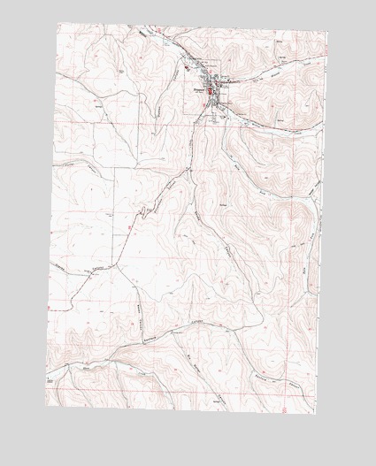
Heppner, OR USGS Topographic Map
Click on map above to begin viewing in our Map Viewer.

This topographic map contains these locations and features:
Feature Name Type Latitude Longitude GNIS ID View Map
Balm ForkStreamN45.3460°W119.5428°1137489View Map
Basey CanyonValleyN45.2718°W119.5803°1117290View Map
City of HeppnerCivilN45.3547°W119.5560°2410745View Map
City of Heppner Fire DepartmentBuildingN45.3548°W119.5545°2576622View Map
City ParkParkN45.3574°W119.5525°2058330View Map
Department of Motor Vehicles HeppnerBuildingN45.3710°W119.5725°2699291View Map
Donaldson CanyonValleyN45.3304°W119.5609°1120025View Map
Dutton CanyonValleyN45.3682°W119.5667°1120246View Map
Hager ParkParkN45.3496°W119.5484°2058331View Map
HeppnerPopulated PlaceN45.3532°W119.5578°1121763View Map
Heppner City HallBuildingN45.3537°W119.5539°2699440View Map
Heppner Elementary SchoolSchoolN45.3574°W119.5507°1166935View Map
Heppner Elementary SchoolSchoolN45.3575°W119.5511°1166936View Map
Heppner Junior - Senior High SchoolSchoolN45.3616°W119.5649°1166934View Map
Heppner Justice CourtBuildingN45.3534°W119.5503°2700456View Map
Heppner Police DepartmentBuildingN45.3544°W119.5544°2770135View Map
Heppner Post OfficePost OfficeN45.3542°W119.5538°1165388View Map
Heppner Public Works DepartmentBuildingN45.3539°W119.5545°2700410View Map
Heppner Ranger StationBuildingN45.3612°W119.5597°1875814View Map
Heppner Wastewater Treatment PlantLocaleN45.3648°W119.5641°2697118View Map
Heritage ParkParkN45.3590°W119.5547°2058332View Map
Hinton CreekStreamN45.3590°W119.5536°1121848View Map
Masonic CemeteryCemeteryN45.3457°W119.5513°1123831View Map
Morrow County Agriculture MuseumBuildingN45.3608°W119.5563°2699623View Map
Morrow County CourthouseBuildingN45.3534°W119.5503°2700457View Map
Morrow County FairgroundsLocaleN45.3575°W119.5454°1166933View Map
Morrow County Fairgrounds Rodeo ArenaLocaleN45.3579°W119.5471°2700459View Map
Morrow County Health Department OfficeBuildingN45.3532°W119.5532°2699624View Map
Morrow County Law LibraryBuildingN45.3534°W119.5503°2700458View Map
Morrow County MuseumBuildingN45.3567°W119.5530°2699625View Map
Morrow County Sheriff's OfficeBuildingN45.3591°W119.5617°2737685View Map
Oregon Trail Library District Heppner Branch LibraryBuildingN45.3567°W119.5530°2700455View Map
Pioneer Memorial HospitalHospitalN45.3561°W119.5488°1125432View Map
Sanford CanyonValleyN45.2640°W119.5992°1149061View Map
Shobe CanyonValleyN45.3268°W119.5620°1126898View Map
Shobe CreekStreamN45.3510°W119.5497°1126899View Map
Six Dollar CanyonValleyN45.2754°W119.5672°1127013View Map
Soocup CanyonValleyN45.3198°W119.5075°1127212View Map
Stalter CanyonValleyN45.3193°W119.5095°1127522View Map
United States Forest Service Guard StationLocaleN45.3582°W119.5622°1161866View Map
Veterans Mini ParkParkN45.3585°W119.5539°2058333View Map
Willow Creek DamDamN45.3470°W119.5446°1166938View Map
Willow Creek Lake Boat RampLocaleN45.3435°W119.5394°2700194View Map
Willow Creek ReservoirReservoirN45.3437°W119.5379°1166937View Map

Note: Coordinates in the location and feature list above are referenced to NAD83 datum.


Copyright (C) 2008-2025 Ryan Niemi / Sunset Dynamics ... All Rights Reserved