TopoQuest Logo
Do you find TopoQuest useful?
Help keep TopoQuest running and adding new maps/features by donating!
Bitcoin:  19c7KJd3qBynnjoSw5npx9KScwjBe4ifkT
Litecoin:  LXs6TkuXGGXo1vDsWCkWVdjQX94eUKd6ui
Home View Maps Find Maps Find Places Resources & Links


Hardman, Oregon Topographic Map

USGS Map Title: Hardman, OR
USGS Map MRC: 45119B6
DRG (GeoTIFF) Download: o45119b6.tif


Neighboring USGS Topographic Map Quads:


  Eightmile, OR  
45119C7
 

  Ruggs, OR  
45119C6
 

  Heppner, OR  
45119C5
 

  Buttermilk Canyon, OR  
45119B7
 

  Hardman, OR  
45119B6
 

  Balm Canyon, OR  
45119B5
 

  Lefevre Prairie, OR  
45119A7
 

  Chapin Creek, OR  
45119A6
 

  Big Rock Flat, OR  
45119A5


Map MRC Location:

N46°
W120°
N46°
W119°
H8 H7 H6 H5 H4 H3 H2 H1
G8 G7 G6 G5 G4 G3 G2 G1
F8 F7 F6 F5 F4 F3 F2 F1
E8 E7 E6 E5 E4 E3 E2 E1
D8 D7 D6 D5 D4 D3 D2 D1
C8 C7 C6 C5 C4 C3 C2 C1
B8 B7 B6 B5 B4 B3 B2 B1
A8 A7 A6 A5 A4 A3 A2 A1
N45°
W120°
N45°
W119°

Hardman, OR USGS 1:24K Topographic Map Preview:
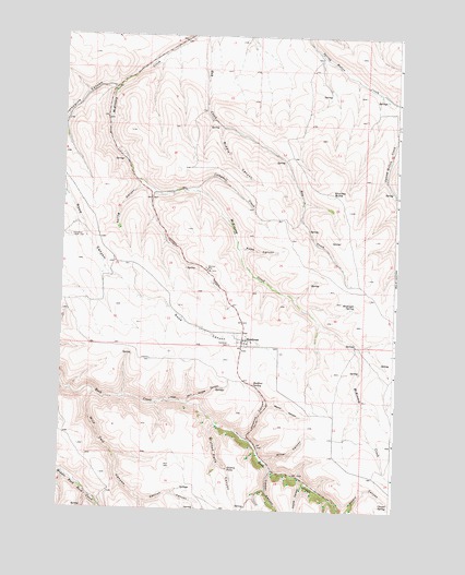
Hardman, OR USGS Topographic Map
Click on map above to begin viewing in our Map Viewer.

This topographic map contains these locations and features:
Feature Name Type Latitude Longitude GNIS ID View Map
Adamsville Post Office (historical)Post OfficeN45.1793°W119.7117°1164168View Map
Biddle CanyonValleyN45.2265°W119.6911°1117574View Map
Buck CanyonValleyN45.1282°W119.6483°1158910View Map
Campbell CreekStreamN45.2090°W119.7000°1118541View Map
Cannon CanyonValleyN45.1271°W119.7189°1139308View Map
Chapel SpringSpringN45.1272°W119.6265°1118823View Map
Coyote CanyonValleyN45.1326°W119.6583°1140315View Map
Deadman HillSlopeN45.1290°W119.6761°1132088View Map
Glutton FallsFallsN45.1359°W119.6871°1121174View Map
Glutton Falls CanyonValleyN45.1479°W119.6917°1142777View Map
Hardman (historical)Populated PlaceN45.1699°W119.6820°1136356View Map
Hardman CemeteryCemeteryN45.1685°W119.6873°1121593View Map
Hardman IOOF CemeteryCemeteryN45.1971°W119.7472°1158278View Map
Hardman Post Office (historical)Post OfficeN45.1699°W119.6820°1165369View Map
Hoskins CanyonValleyN45.1432°W119.6806°1122052View Map
Hoskins SpringSpringN45.1581°W119.6779°1122053View Map
McGee CanyonValleyN45.1529°W119.7017°1123959View Map
Merrill CanyonValleyN45.1524°W119.6725°1124070View Map
Miller CanyonValleyN45.1385°W119.6739°1124183View Map
Porcupine CanyonValleyN45.2357°W119.7306°1125562View Map
Reininger SpringSpringN45.1788°W119.6408°1125940View Map
Road CanyonValleyN45.1935°W119.6836°1126081View Map
Spring CanyonValleyN45.2118°W119.7220°1127412View Map
Stuckey ButteSummitN45.2087°W119.6497°1136794View Map
Stuckey Butte ReservoirReservoirN45.2188°W119.6712°1131066View Map
Timber CanyonValleyN45.1349°W119.6703°1151236View Map
Wild Calf CanyonValleyN45.1551°W119.7372°1152326View Map

Note: Coordinates in the location and feature list above are referenced to NAD83 datum.


Copyright (C) 2008-2025 Ryan Niemi / Sunset Dynamics ... All Rights Reserved