TopoQuest Logo
Do you find TopoQuest useful?
Help keep TopoQuest running and adding new maps/features by donating!
Bitcoin:  19c7KJd3qBynnjoSw5npx9KScwjBe4ifkT
Litecoin:  LXs6TkuXGGXo1vDsWCkWVdjQX94eUKd6ui
Home View Maps Find Maps Find Places Resources & Links


Hermit Lakes, Colorado Topographic Map

USGS Map Title: Hermit Lakes, CO
USGS Map MRC: 37107G2
DRG (GeoTIFF) Download: o37107g2.tif


Neighboring USGS Topographic Map Quads:


  Lake San Cristobal, CO  
37107H3
 

  Slumgullion Pass, CO  
37107H2
 

  Baldy Cinco, CO  
37107H1
 

  Finger Mesa, CO  
37107G3
 

  Hermit Lakes, CO  
37107G2
 

  Bristol Head, CO  
37107G1
 

  Weminuche Pass, CO  
37107F3
 

  Little Squaw Creek, CO  
37107F2
 

  Workman Creek, CO  
37107F1


Map MRC Location:

N38°
W108°
N38°
W107°
H8 H7 H6 H5 H4 H3 H2 H1
G8 G7 G6 G5 G4 G3 G2 G1
F8 F7 F6 F5 F4 F3 F2 F1
E8 E7 E6 E5 E4 E3 E2 E1
D8 D7 D6 D5 D4 D3 D2 D1
C8 C7 C6 C5 C4 C3 C2 C1
B8 B7 B6 B5 B4 B3 B2 B1
A8 A7 A6 A5 A4 A3 A2 A1
N37°
W108°
N37°
W107°

Hermit Lakes, CO USGS 1:24K Topographic Map Preview:
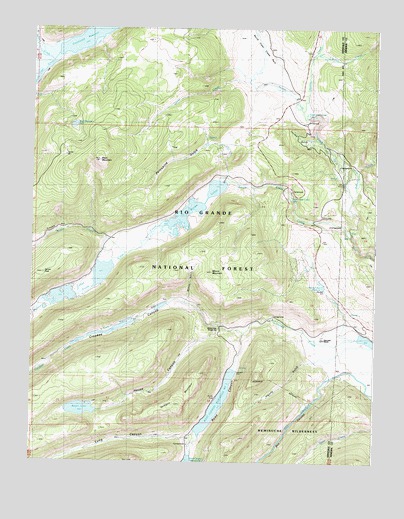
Hermit Lakes, CO USGS Topographic Map
Click on map above to begin viewing in our Map Viewer.

This topographic map contains these locations and features:
Feature Name Type Latitude Longitude GNIS ID View Map
Bennett CreekStreamN37.8150°W107.1342°186996View Map
Big Buck CreekStreamN37.8714°W107.2495°187452View Map
Black MountainSummitN37.8364°W107.2259°186993View Map
Black Mountain LakeLakeN37.8467°W107.2353°186992View Map
Box CanyonValleyN37.7754°W107.1404°187031View Map
Bristol View Ranger StationLocaleN37.7883°W107.1831°187004View Map
Brown LakesLakeN37.8233°W107.1923°186998View Map
Buck CreekStreamN37.8653°W107.2431°187054View Map
Carcass GulchValleyN37.8431°W107.1473°187019View Map
Corral CreekStreamN37.8594°W107.1726°186994View Map
Crooked CanyonValleyN37.7886°W107.1830°187709View Map
Crooked CreekStreamN37.7850°W107.1281°187706View Map
Hermit LakesReservoirN37.7976°W107.2387°169550View Map
Hermit Number 1 DamDamN37.8083°W107.2273°199956View Map
Hermit Number 1 ReservoirReservoirN37.8043°W107.2245°199957View Map
Hermit Number 2 DamDamN37.7967°W107.2423°200898View Map
Hermit PeakSummitN37.8050°W107.2442°187000View Map
Hermit Reservoir Number 2ReservoirN37.7967°W107.2423°200899View Map
House CanyonValleyN37.7883°W107.1832°187022View Map
Ingalls GulchValleyN37.7793°W107.1487°187021View Map
Kitty CreekStreamN37.8608°W107.2481°187696View Map
Long CanyonValleyN37.7567°W107.1929°187029View Map
Mason CreekStreamN37.8092°W107.2162°187700View Map
Minnie GulchValleyN37.7958°W107.1943°187002View Map
Minnie MountainSummitN37.8092°W107.1848°187001View Map
North Clear CreekStreamN37.8150°W107.1339°187055View Map
North Clear Creek CampgroundLocaleN37.8353°W107.1387°196951View Map
North Clear Creek FallsFallsN37.8492°W107.1503°186995View Map
North Clear Creek Falls OverlookLocaleN37.8483°W107.1498°196950View Map
North Clear Creek ParkFlatN37.8667°W107.1673°187039View Map
Porcupine GulchValleyN37.8416°W107.1827°187020View Map
Ptarmigan MeadowsFlatN37.8075°W107.1576°196956View Map
Regan DamDamN37.7650°W107.2339°199632View Map
Regan LakeLakeN37.7650°W107.2318°187005View Map
Road CanyonValleyN37.7875°W107.1730°187030View Map
Road Canyon CampgroundLocaleN37.7550°W107.1923°196954View Map
Road Canyon Number 1 DamDamN37.7769°W107.1762°199656View Map
Road Canyon Number 2 DamDamN37.7519°W107.1923°199588View Map
Road Canyon Reservoir Number 1ReservoirN37.7668°W107.1823°187007View Map
Road Canyon Reservoir Number 2ReservoirN37.7504°W107.1927°169510View Map
Ruby CreekStreamN37.8658°W107.2426°187451View Map
S Lazy U ReservoirsReservoirN37.7843°W107.2329°187003View Map
San Juan RanchLocaleN37.7825°W107.1442°187012View Map
Shotgun MountainSummitN37.7669°W107.1962°187006View Map
South Clear CreekStreamN37.8150°W107.1339°187705View Map
South Clear Creek CamproundsLocaleN37.8183°W107.1423°196955View Map
South Clear Creek FallsFallsN37.8253°W107.1559°187008View Map
South Clear Creek Falls CampgroundLocaleN37.8275°W107.1564°196952View Map
South Lazy U DamDamN37.7917°W107.2173°199936View Map
South Lazy U Dude Ranch ReservoirReservoirN37.7917°W107.2173°199937View Map
South Lazy U Number 2 DamDamN37.7867°W107.2306°199626View Map
South Lazy U Reservoir Number 2ReservoirN37.7867°W107.2306°199627View Map
Spring CreekStreamN37.8517°W107.1526°187037View Map
Spring Creek ReservoirReservoirN37.8006°W107.1442°187011View Map
Spring Creek Reservoir Picnic AreaLocaleN37.8017°W107.1437°196957View Map
Trouble HillGapN37.8172°W107.2367°186999View Map
Troutvale Number 1 DamDamN37.8300°W107.1856°199648View Map
Troutvale Number 2 DamDamN37.8233°W107.1923°199650View Map
Troutvale Reservoir Number 1ReservoirN37.8288°W107.1836°199649View Map
Troutvale Reservoir Number 2ReservoirN37.8214°W107.1943°199651View Map
Willow CreekStreamN37.8675°W107.1473°187045View Map

Note: Coordinates in the location and feature list above are referenced to NAD83 datum.


Copyright (C) 2008-2025 Ryan Niemi / Sunset Dynamics ... All Rights Reserved