TopoQuest Logo
Do you find TopoQuest useful?
Help keep TopoQuest running and adding new maps/features by donating!
Bitcoin:  19c7KJd3qBynnjoSw5npx9KScwjBe4ifkT
Litecoin:  LXs6TkuXGGXo1vDsWCkWVdjQX94eUKd6ui
Home View Maps Find Maps Find Places Resources & Links


Hermosa NW, South Dakota Topographic Map

USGS Map Title: Hermosa NW, SD
USGS Map MRC: 43103H2
DRG (GeoTIFF) Download: o43103h2.tif


Neighboring USGS Topographic Map Quads:


  Rapid City West, SD  
44103A3
 

  Rapid City East, SD  
44103A2
 

  Box Elder, SD  
44103A1
 

  Rockerville, SD  
43103H3
 

  Hermosa NW, SD  
43103H2
 

  Hermosa NE, SD  
43103H1
 

  Hayward, SD  
43103G3
 

  Hermosa, SD  
43103G2
 

  Hermosa SE, SD  
43103G1


Map MRC Location:

N44°
W104°
N44°
W103°
H8 H7 H6 H5 H4 H3 H2 H1
G8 G7 G6 G5 G4 G3 G2 G1
F8 F7 F6 F5 F4 F3 F2 F1
E8 E7 E6 E5 E4 E3 E2 E1
D8 D7 D6 D5 D4 D3 D2 D1
C8 C7 C6 C5 C4 C3 C2 C1
B8 B7 B6 B5 B4 B3 B2 B1
A8 A7 A6 A5 A4 A3 A2 A1
N43°
W104°
N43°
W103°

Hermosa NW, SD USGS 1:24K Topographic Map Preview:
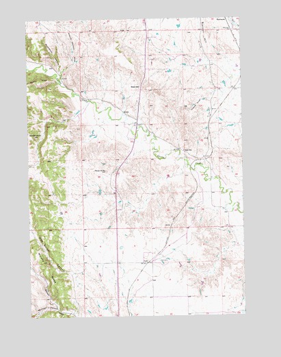
Hermosa NW, SD USGS Topographic Map
Click on map above to begin viewing in our Map Viewer.

This topographic map contains these locations and features:
Feature Name Type Latitude Longitude GNIS ID View Map
AjaxPopulated PlaceN43.8975°W103.1819°1260972View Map
Black GapGapN43.9714°W103.1846°1253950View Map
Brennan HillSummitN43.9913°W103.1464°1254054View Map
Coyote DrawValleyN43.9657°W103.1444°1254527View Map
Gobbler KnobSummitN43.9511°W103.2466°1255268View Map
Mannhan CanyonValleyN43.8785°W103.2346°1262020View Map
Moonshine CanyonValleyN43.9780°W103.2318°1256531View Map
Murphy RidgeRidgeN43.8955°W103.2405°1256629View Map
Neely SchoolSchoolN43.9444°W103.1599°1256649View Map
Potato ButteSummitN43.9361°W103.2051°1257187View Map
Prairie Chicken DrawValleyN43.9769°W103.2301°1257196View Map
Rapid City Christian High SchoolSchoolN43.9604°W103.2181°2729444View Map
Rapid City Christian Middle SchoolSchoolN43.9604°W103.2181°2729445View Map
Spiken RidgeRidgeN43.9739°W103.2499°1262480View Map
Walt Smith CanyonValleyN43.8941°W103.2265°1262655View Map
WarbonnetPopulated PlaceN43.9992°W103.1332°1265709View Map

Note: Coordinates in the location and feature list above are referenced to NAD83 datum.


Copyright (C) 2008-2024 Ryan Niemi / Sunset Dynamics ... All Rights Reserved