TopoQuest Logo
Do you find TopoQuest useful?
Help keep TopoQuest running and adding new maps/features by donating!
Bitcoin:  19c7KJd3qBynnjoSw5npx9KScwjBe4ifkT
Litecoin:  LXs6TkuXGGXo1vDsWCkWVdjQX94eUKd6ui
Home View Maps Find Maps Find Places Resources & Links


Rockerville, South Dakota Topographic Map

USGS Map Title: Rockerville, SD
USGS Map MRC: 43103H3
DRG (GeoTIFF) Download: o43103h3.tif


Neighboring USGS Topographic Map Quads:


  Pactola Dam, SD  
44103A4
 

  Rapid City West, SD  
44103A3
 

  Rapid City East, SD  
44103A2
 

  Mount Rushmore, SD  
43103H4
 

  Rockerville, SD  
43103H3
 

  Hermosa NW, SD  
43103H2
 

  Iron Mountain, SD  
43103G4
 

  Hayward, SD  
43103G3
 

  Hermosa, SD  
43103G2


Map MRC Location:

N44°
W104°
N44°
W103°
H8 H7 H6 H5 H4 H3 H2 H1
G8 G7 G6 G5 G4 G3 G2 G1
F8 F7 F6 F5 F4 F3 F2 F1
E8 E7 E6 E5 E4 E3 E2 E1
D8 D7 D6 D5 D4 D3 D2 D1
C8 C7 C6 C5 C4 C3 C2 C1
B8 B7 B6 B5 B4 B3 B2 B1
A8 A7 A6 A5 A4 A3 A2 A1
N43°
W104°
N43°
W103°

Rockerville, SD USGS 1:24K Topographic Map Preview:
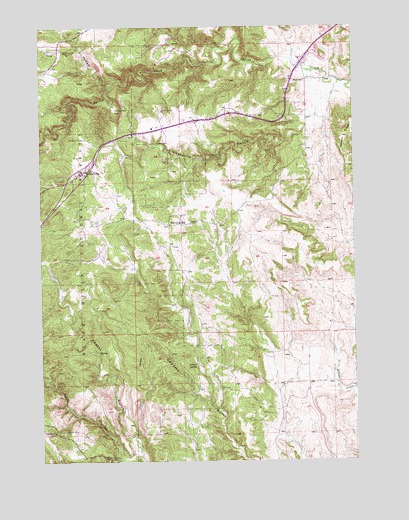
Rockerville, SD USGS Topographic Map
Click on map above to begin viewing in our Map Viewer.

This topographic map contains these locations and features:
Feature Name Type Latitude Longitude GNIS ID View Map
Beermug DamDamN43.8875°W103.3463°1260702View Map
Blair SchoolSchoolN43.9844°W103.2696°1261298View Map
Deadman CreekStreamN43.9839°W103.3460°1261538View Map
Ferguson MineMineN43.8792°W103.3735°1264868View Map
Foster GulchValleyN43.8816°W103.3399°1261690View Map
Four Ranch (historical)LocaleN43.9875°W103.3060°1264588View Map
Giltedge MineMineN43.8839°W103.3669°1261715View Map
Gold HillSummitN43.9572°W103.3477°1263086View Map
Hayward CemeteryCemeteryN43.8879°W103.3512°2779304View Map
Jackson SpringSpringN43.9026°W103.3140°1261880View Map
Lead DrawValleyN43.8820°W103.3395°1261942View Map
Mica MineMineN43.8764°W103.3488°1262061View Map
Pine Grove SchoolSchoolN43.9430°W103.3241°1262206View Map
Ponca Group MineMineN43.8761°W103.3732°1264852View Map
Rattlesnake MineMineN43.8830°W103.3707°1262263View Map
RockervillePopulated PlaceN43.9580°W103.3585°1262320View Map
Rockerville Airport (historical)AirportN43.9619°W103.3602°1262783View Map
Rockerville CemeteryCemeteryN43.9680°W103.3576°1262321View Map
Rockerville Post Office (historical)Post OfficeN43.9580°W103.3585°1926744View Map
Rockerville Volunteer Fire Department Station 1BuildingN43.9735°W103.3151°2580814View Map
Strato Rim Overlook CampgroundLocaleN43.9805°W103.3424°1263085View Map
Stratosphere BowlPopulated PlaceN43.9767°W103.3457°1265386View Map
Tiger Lode MineMineN43.8925°W103.3477°1264851View Map
Victoria GulchValleyN43.9944°W103.3597°1262640View Map

Note: Coordinates in the location and feature list above are referenced to NAD83 datum.


Copyright (C) 2008-2024 Ryan Niemi / Sunset Dynamics ... All Rights Reserved