TopoQuest Logo
Do you find TopoQuest useful?
Help keep TopoQuest running and adding new maps/features by donating!
Bitcoin:  19c7KJd3qBynnjoSw5npx9KScwjBe4ifkT
Litecoin:  LXs6TkuXGGXo1vDsWCkWVdjQX94eUKd6ui
Home View Maps Find Maps Find Places Resources & Links


Hickman, Kentucky Topographic Map

USGS Map Title: Hickman, KY
USGS Map MRC: 36089E2
DRG (GeoTIFF) Download: o36089e2.tif


Neighboring USGS Topographic Map Quads:


  Bayouville, MO  
36089F3
 

  Wolf Island, MO  
36089F2
 

  Oakton, KY  
36089F1
 

  Bondurant, KY  
36089E3
 

  Hickman, KY  
36089E2
 

  Cayce, KY  
36089E1
 

  Samburg, TN  
36089D3
 

  Clayton, TN  
36089D2
 

  Union City, TN  
36089D1


Map MRC Location:

N37°
W90°
N37°
W89°
H8 H7 H6 H5 H4 H3 H2 H1
G8 G7 G6 G5 G4 G3 G2 G1
F8 F7 F6 F5 F4 F3 F2 F1
E8 E7 E6 E5 E4 E3 E2 E1
D8 D7 D6 D5 D4 D3 D2 D1
C8 C7 C6 C5 C4 C3 C2 C1
B8 B7 B6 B5 B4 B3 B2 B1
A8 A7 A6 A5 A4 A3 A2 A1
N36°
W90°
N36°
W89°

Hickman, KY USGS 1:24K Topographic Map Preview:
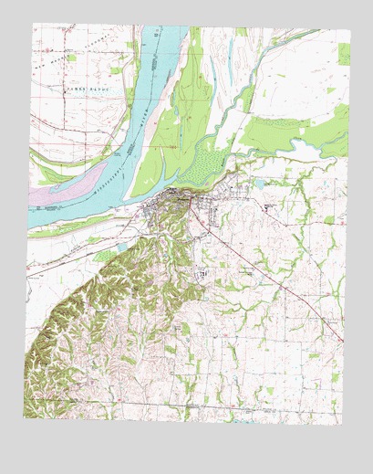
Hickman, KY USGS Topographic Map
Click on map above to begin viewing in our Map Viewer.

This topographic map contains these locations and features:
Feature Name Type Latitude Longitude GNIS ID View Map
Ayers Pond (historical)ReservoirN36.5906°W89.2356°737964View Map
Barnett CemeteryCemeteryN36.5170°W89.2237°486394View Map
Bayou de ChienStreamN36.5767°W89.1920°486489View Map
Beech Grove (historical)Populated PlaceN36.5167°W89.2407°2743888View Map
Beech Grove CemeteryCemeteryN36.5164°W89.2428°2775547View Map
Beech Grove United Methodist ChurchChurchN36.5173°W89.2406°486714View Map
Brown Family Cemetery No 2CemeteryN36.5107°W89.2160°2775555View Map
BrownsvillePopulated PlaceN36.5348°W89.2170°507597View Map
Brownsville CemeteryCemeteryN36.5357°W89.2188°2775558View Map
City of HickmanCivilN36.5650°W89.1836°2404692View Map
Combs SpringSpringN36.5298°W89.1917°489906View Map
DorenaPopulated PlaceN36.6162°W89.2373°716988View Map
Dorena ChurchChurchN36.6067°W89.2376°741764View Map
Dorena Church (historical)ChurchN36.6237°W89.2341°741762View Map
Dorena Church (historical)ChurchN36.6045°W89.2376°741765View Map
Dorena CrevasseLakeN36.6119°W89.2079°739573View Map
Dorena LandingPopulated PlaceN36.5842°W89.2173°740812View Map
Dorena SchoolSchoolN36.6164°W89.2423°741763View Map
Dorena SchoolSchoolN36.5917°W89.2323°741766View Map
Downing - Wilson CemeteryCemeteryN36.5533°W89.1860°2775568View Map
Fulton CountyCivilN36.5541°W89.1876°516884View Map
Fulton County High SchoolSchoolN36.5681°W89.1567°492617View Map
Fulton County Sheriff's OfficeBuildingN36.5497°W89.1834°2767429View Map
Hammes - Gray CemeteryCemeteryN36.5002°W89.2474°2775768View Map
HickmanPopulated PlaceN36.5712°W89.1862°494109View Map
Hickman BendBendN36.5706°W89.2234°739575View Map
Hickman City CemeteryCemeteryN36.5568°W89.1781°2775529View Map
Hickman DivisionCivilN36.5619°W89.2485°1937059View Map
Hickman Fire DepartmentBuildingN36.5710°W89.1858°2636310View Map
Hickman Police DepartmentBuildingN36.5709°W89.1858°2767433View Map
Hubbard CemeteryCemeteryN36.5509°W89.1612°494701View Map
Leet Family CemeteryCemeteryN36.5653°W89.1276°2775571View Map
Lester Post LightBuildingN36.5834°W89.1667°517046View Map
Little Mud CreekStreamN36.5870°W89.1359°496810View Map
Locust Grove SchoolSchoolN36.6159°W89.2140°746841View Map
Obion CreekStreamN36.5687°W89.2134°499767View Map
Owens (historical)Populated PlaceN36.5503°W89.2365°2743915View Map
Pace CemeteryCemeteryN36.5047°W89.1622°2775573View Map
Parker LandingLocaleN36.6106°W89.2067°736028View Map
Poplar Grove CemeteryCemeteryN36.5331°W89.1304°2775576View Map
Poplar Grove ChurchChurchN36.5328°W89.1315°501109View Map
Smith GraveyardCemeteryN36.5533°W89.1950°2775577View Map
StubbsPopulated PlaceN36.5547°W89.1701°2743922View Map
Upshaw - Lewis GraveyardCemeteryN36.5453°W89.2447°2775579View Map
Walker CemeteryCemeteryN36.5045°W89.1626°1273617View Map
Wilson HillSummitN36.5251°W89.2415°506909View Map

Note: Coordinates in the location and feature list above are referenced to NAD83 datum.


Copyright (C) 2008-2024 Ryan Niemi / Sunset Dynamics ... All Rights Reserved