TopoQuest Logo
Do you find TopoQuest useful?
Help keep TopoQuest running and adding new maps/features by donating!
Bitcoin:  19c7KJd3qBynnjoSw5npx9KScwjBe4ifkT
Litecoin:  LXs6TkuXGGXo1vDsWCkWVdjQX94eUKd6ui
Home View Maps Find Maps Find Places Resources & Links


High Falls, Georgia Topographic Map

USGS Map Title: High Falls, GA
USGS Map MRC: 33084B1
DRG (GeoTIFF) Download: o33084b1.tif


Neighboring USGS Topographic Map Quads:


  Luella, GA  
33084C2
 

  Locust Grove, GA  
33084C1
 

  Jackson, GA  
33083C8
 

  Orchard Hill, GA  
33084B2
 

  High Falls, GA  
33084B1
 

  Indian Springs, GA  
33083B8
 

  Barnesville, GA  
33084A2
 

  Johnstonville, GA  
33084A1
 

  Forsyth, GA  
33083A8


Map MRC Location:

N34°
W85°
N34°
W84°
H8 H7 H6 H5 H4 H3 H2 H1
G8 G7 G6 G5 G4 G3 G2 G1
F8 F7 F6 F5 F4 F3 F2 F1
E8 E7 E6 E5 E4 E3 E2 E1
D8 D7 D6 D5 D4 D3 D2 D1
C8 C7 C6 C5 C4 C3 C2 C1
B8 B7 B6 B5 B4 B3 B2 B1
A8 A7 A6 A5 A4 A3 A2 A1
N33°
W85°
N33°
W84°

High Falls, GA USGS 1:24K Topographic Map Preview:
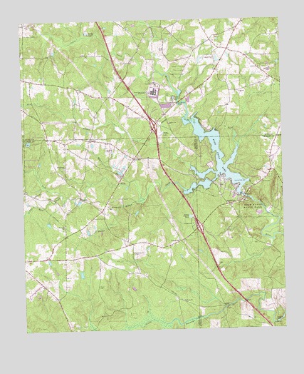
High Falls, GA USGS Topographic Map
Click on map above to begin viewing in our Map Viewer.

This topographic map contains these locations and features:
Feature Name Type Latitude Longitude GNIS ID View Map
Ball BranchStreamN33.1848°W84.0732°310756View Map
Brushy CreekStreamN33.1912°W84.0441°354881View Map
Buck CreekStreamN33.1810°W84.0460°311959View Map
Bucksnort (historical)LocaleN33.1954°W84.0363°334207View Map
Cabin CreekStreamN33.2296°W84.0588°312145View Map
Central School (historical)SchoolN33.1732°W84.0877°351967View Map
ChappelPopulated PlaceN33.1779°W84.0974°355118View Map
Corrections DamDamN33.2151°W84.0549°339124View Map
Corrections LakeReservoirN33.2156°W84.0552°339125View Map
County Line ChurchChurchN33.2085°W84.0544°355347View Map
County Line School (historical)SchoolN33.2101°W84.0546°334128View Map
Elgin (historical)Populated PlaceN33.2265°W84.0044°345811View Map
English DamDamN33.1885°W84.0766°337438View Map
English LakeReservoirN33.1889°W84.0785°337439View Map
English LakeReservoirN33.1478°W84.0973°340677View Map
English Lake DamDamN33.1468°W84.0966°340676View Map
Exit 65CrossingN33.1662°W84.0405°1685678View Map
Exit 66CrossingN33.2073°W84.0610°1685679View Map
Fellowship ChurchChurchN33.2451°W84.0644°355789View Map
Fenner Airport (historical)AirportN33.2096°W84.1099°351799View Map
Flat Shoals BridgeBridgeN33.2168°W84.0499°314202View Map
Flying H Ranch Inc AirportAirportN33.1977°W84.0845°351802View Map
Foster - Jester - Huddleston CemeteryCemeteryN33.2362°W84.1105°345821View Map
Georgia Diagnostic and Classification PrisonBuildingN33.2212°W84.0608°2735757View Map
Georgia Diagnostic Prison Fire DepartmentBuildingN33.2210°W84.0607°2604257View Map
Glens BridgeBridgeN33.2473°W84.0616°345824View Map
Harters Mill (historical)LocaleN33.2457°W84.1138°345829View Map
Head CemeteryCemeteryN33.2168°W84.0502°345831View Map
Higgins MillPopulated PlaceN33.1285°W84.0044°356278View Map
High FallsPopulated PlaceN33.1757°W84.0255°356280View Map
High Falls Baptist ChurchChurchN33.1737°W84.0244°343057View Map
High Falls LakeReservoirN33.1873°W84.0316°315384View Map
High Falls Lake DamDamN33.1793°W84.0199°340774View Map
High Falls State ParkParkN33.1812°W84.0160°354242View Map
High Shoals ChurchChurchN33.1565°W84.0721°356286View Map
Kinards Mill (historical)LocaleN33.2351°W84.0707°345850View Map
Lamar County Station 6 Chappell MillBuildingN33.1613°W84.0755°2625433View Map
Liberty ChurchChurchN33.2307°W84.0105°316824View Map
Little Buck CreekStreamN33.1804°W84.1066°356361View Map
Monroe County Fire Department Station 2BuildingN33.1950°W84.0057°2604819View Map
Mount Zion CemeteryCemeteryN33.2057°W84.0257°318927View Map
Mount Zion ChurchChurchN33.2210°W84.0199°319038View Map
Parker BranchStreamN33.1779°W84.0674°320210View Map
PatilloPopulated PlaceN33.2018°W84.0924°326454View Map
Pleasant Hill ChurchChurchN33.1946°W84.0719°320890View Map
Providence CemeteryCemeteryN33.1837°W84.0107°343092View Map
Providence ChurchChurchN33.1840°W84.0105°321208View Map
Rock Springs ChurchChurchN33.1912°W84.1046°321754View Map
Sandy Plains School (historical)SchoolN33.2354°W84.0319°345871View Map
School Number 3 (historical)SchoolN33.1840°W84.0102°343105View Map
Socrates (historical)Populated PlaceN33.1346°W84.0285°343109View Map
Southwest Butts DivisionCivilN33.2344°W84.0520°1936595View Map
Swan CreekStreamN33.1273°W84.0571°323800View Map
Taylor CemeteryCemeteryN33.1429°W84.0888°323948View Map
Towaliga (historical)Populated PlaceN33.2385°W84.0680°345880View Map
Towaliga ChurchChurchN33.2443°W84.0524°324235View Map
UnionvillePopulated PlaceN33.1610°W84.0499°333308View Map
Unionville ChurchChurchN33.1621°W84.0460°344068View Map
Weaver CemeteryCemeteryN33.2348°W84.0319°324947View Map
Weldons CrossroadsPopulated PlaceN33.1943°W84.0707°344071View Map
West Bluffs School (historical)SchoolN33.2196°W84.0824°345886View Map

Note: Coordinates in the location and feature list above are referenced to NAD83 datum.


Copyright (C) 2008-2025 Ryan Niemi / Sunset Dynamics ... All Rights Reserved