TopoQuest Logo
Do you find TopoQuest useful?
Help keep TopoQuest running and adding new maps/features by donating!
Bitcoin:  19c7KJd3qBynnjoSw5npx9KScwjBe4ifkT
Litecoin:  LXs6TkuXGGXo1vDsWCkWVdjQX94eUKd6ui
Home View Maps Find Maps Find Places Resources & Links


Hillside Colony, Montana Topographic Map

USGS Map Title: Hillside Colony, MT
USGS Map MRC: 48112H1
DRG (GeoTIFF) Download: o48112h1.tif


Neighboring USGS Topographic Map Quads:


  Fitzpatrick Lake, MT  
48112H2
 

  Hillside Colony, MT  
48112H1
 

  Sunburst, MT  
48111H8
 

  Glacier Colony, MT  
48112G2
 

  Mountain View School, MT  
48112G1
 

  Kevin North, MT  
48111G8


Map MRC Location:

N49°
W113°
N49°
W112°
H8 H7 H6 H5 H4 H3 H2 H1
G8 G7 G6 G5 G4 G3 G2 G1
F8 F7 F6 F5 F4 F3 F2 F1
E8 E7 E6 E5 E4 E3 E2 E1
D8 D7 D6 D5 D4 D3 D2 D1
C8 C7 C6 C5 C4 C3 C2 C1
B8 B7 B6 B5 B4 B3 B2 B1
A8 A7 A6 A5 A4 A3 A2 A1
N48°
W113°
N48°
W112°

Hillside Colony, MT USGS 1:24K Topographic Map Preview:
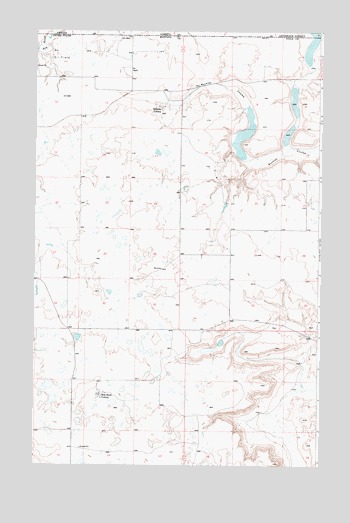
Hillside Colony, MT USGS Topographic Map
Click on map above to begin viewing in our Map Viewer.

This topographic map contains these locations and features:
Feature Name Type Latitude Longitude GNIS ID View Map
36N03W06BA__01 WellWellN48.9130°W112.0509°1637023View Map
36N03W18AB__01 WellWellN48.8842°W112.0456°1636922View Map
36N04W11BB__01 WellWellN48.8989°W112.0992°1636968View Map
36N04W11DD__01 WellWellN48.8880°W112.0828°1636934View Map
36N04W14AA__01 WellWellN48.8844°W112.0828°1636925View Map
36N04W14AB__01 WellWellN48.8844°W112.0881°1636926View Map
36N04W14AB__02 WellWellN48.8844°W112.0881°1636927View Map
36N04W14AC__01 WellWellN48.8808°W112.0881°1636904View Map
36N04W14AD__01 WellWellN48.8808°W112.0828°1636903View Map
36N04W15AC__01 WellWellN48.8808°W112.1100°1636905View Map
37N03W07BA__01 WellWellN48.9842°W112.0525°1637298View Map
37N03W17DB__01 WellWellN48.9625°W112.0253°1637209View Map
37N03W21ACB_01 WellWellN48.9531°W112.0048°1637171View Map
37N03W21BD__01 WellWellN48.9514°W112.0087°1637165View Map
37N03W21BD__02 WellWellN48.9514°W112.0087°1637166View Map
37N03W21DB__01 WellWellN48.9478°W112.0034°1637151View Map
37N03W30ACC_01 WellWellN48.9367°W112.0487°1637105View Map
37N03W31AA__01 WellWellN48.9261°W112.0417°1637066View Map
37N03W32DD__01 WellWellN48.9153°W112.0198°1637032View Map
37N03W33BC__01 WellWellN48.9225°W112.0142°1637058View Map
37N04W01CB__01 WellWellN48.9917°W112.0803°1637339View Map
37N04W01CB__02 WellWellN48.9917°W112.0803°1637340View Map
37N04W01DB__01 WellWellN48.9917°W112.0695°1637338View Map
37N04W02DD__01 WellWellN48.9881°W112.0859°1637316View Map
37N04W02DD__02 WellWellN48.9881°W112.0859°1637317View Map
37N04W02DDC_01 WellWellN48.9872°W112.0887°1637309View Map
37N04W12BA__01 WellWellN48.9844°W112.0750°1637302View Map
37N04W12DB__01 WellWellN48.9772°W112.0695°1637270View Map
37N04W12DB__02 WellWellN48.9772°W112.0695°1637271View Map
37N04W15BC__01 WellWellN48.9664°W112.1245°1637221View Map
37N04W25CC__01 WellWellN48.9300°W112.0803°1637083View Map
37N04W27CB__01 WellWellN48.9336°W112.1245°1637094View Map
37N04W27CB__02 WellWellN48.9336°W112.1245°1637095View Map
37N04W34DD__01 WellWellN48.9155°W112.1081°1637039View Map
Brady Lakes DamDamN48.9933°W112.0209°796484View Map
Davis LakesLakeN48.8812°W112.0731°1749956View Map
Eyraud LakesReservoirN48.9933°W112.0209°796485View Map
Farrell CouleeValleyN48.8883°W112.0337°1749959View Map
GJP Suta DamDamN48.9017°W112.1192°798668View Map
Grassy LakeReservoirN48.9801°W112.0118°1749964View Map
Halfway CouleeValleyN48.9839°W112.0103°1749963View Map
Hemmings LakeLakeN48.9085°W112.0356°1749960View Map
Hillkleberry Coulee DamDamN48.9500°W112.0409°798670View Map
Hillside ColonyPopulated PlaceN48.9792°W112.0684°772420View Map
Hillside Colony DamDamN48.9883°W112.1142°795456View Map
Hillside Colony SchoolSchoolN48.9775°W112.0700°1749995View Map
Johns CouleeValleyN48.9464°W112.1203°1749949View Map
KYYC-FM (Shelby)TowerN48.9314°W112.0695°806716View Map
Looney Tuney DamDamN48.9133°W112.1042°798669View Map
Mansfield CouleeValleyN48.9189°W112.0898°1749950View Map
Mars CouleeValleyN48.9311°W112.1031°1749953View Map
Miss Easy Pride DamDamN48.8933°W112.1175°798671View Map
Rim Rock ColonyPopulated PlaceN48.8958°W112.0953°775770View Map
Rimrock Colony SchoolSchoolN48.8944°W112.0967°1749994View Map
Rocky Ridge CouleeValleyN48.9939°W112.1217°1749951View Map
Treadwell CouleeValleyN48.9378°W112.1139°1749952View Map
Twin LakesLakeN48.9094°W112.0439°1749962View Map

Note: Coordinates in the location and feature list above are referenced to NAD83 datum.


Copyright (C) 2008-2025 Ryan Niemi / Sunset Dynamics ... All Rights Reserved