TopoQuest Logo
Do you find TopoQuest useful?
Help keep TopoQuest running and adding new maps/features by donating!
Bitcoin:  19c7KJd3qBynnjoSw5npx9KScwjBe4ifkT
Litecoin:  LXs6TkuXGGXo1vDsWCkWVdjQX94eUKd6ui
Home View Maps Find Maps Find Places Resources & Links


Glacier Colony, Montana Topographic Map

USGS Map Title: Glacier Colony, MT
USGS Map MRC: 48112G2
DRG (GeoTIFF) Download: o48112g2.tif


Neighboring USGS Topographic Map Quads:


  Headlight Butte NE, MT  
48112H3
 

  Fitzpatrick Lake, MT  
48112H2
 

  Hillside Colony, MT  
48112H1
 

  Headlight Butte, MT  
48112G3
 

  Glacier Colony, MT  
48112G2
 

  Mountain View School, MT  
48112G1
 

  Cut Bank, MT  
48112F3
 

  Ethridge NW, MT  
48112F2
 

  Aloe, MT  
48112F1


Map MRC Location:

N49°
W113°
N49°
W112°
H8 H7 H6 H5 H4 H3 H2 H1
G8 G7 G6 G5 G4 G3 G2 G1
F8 F7 F6 F5 F4 F3 F2 F1
E8 E7 E6 E5 E4 E3 E2 E1
D8 D7 D6 D5 D4 D3 D2 D1
C8 C7 C6 C5 C4 C3 C2 C1
B8 B7 B6 B5 B4 B3 B2 B1
A8 A7 A6 A5 A4 A3 A2 A1
N48°
W113°
N48°
W112°

Glacier Colony, MT USGS 1:24K Topographic Map Preview:
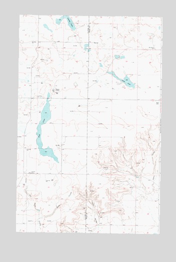
Glacier Colony, MT USGS Topographic Map
Click on map above to begin viewing in our Map Viewer.

This topographic map contains these locations and features:
Feature Name Type Latitude Longitude GNIS ID View Map
35N05W01CC__01 WellWellN48.8142°W112.2081°1636677View Map
35N05W02AA__01 WellWellN48.8250°W112.2134°1636731View Map
35N05W12CC__01 WellWellN48.7997°W112.2081°1636603View Map
35N05W15AB__01 WellWellN48.7961°W112.2406°1636582View Map
35N05W15DC__01 WellWellN48.7853°W112.2406°1636534View Map
35N05W23DA__01 WellWellN48.7742°W112.2134°1636473View Map
35N05W34AB__01 WellWellN48.7525°W112.2406°1636376View Map
36N04W21DC__01 WellWellN48.8589°W112.1317°1636841View Map
36N04W33BB__01 WellWellN48.8408°W112.1428°1636790View Map
36N05W23AC__01 WellWellN48.8667°W112.2195°1636864View Map
36N05W24DA__01 WellWellN48.8630°W112.1923°1636854View Map
36N05W26BA__01 WellWellN48.8558°W112.2248°1636830View Map
36N05W27CD__01 WellWellN48.8450°W112.2467°1636804View Map
36N05W35CD__01 WellWellN48.8305°W112.2248°1636747View Map
Glacier ColonyPopulated PlaceN48.8328°W112.2189°771790View Map
Glacier County Waterfowl Production AreaParkN48.8410°W112.2415°2765311View Map
Glacier Elementary SchoolSchoolN48.8298°W112.2203°1750446View Map
Hay LakeLakeN48.7965°W112.2236°772269View Map
Long LakeLakeN48.8381°W112.1574°773649View Map
Long Lake DamDamN48.8383°W112.1559°798715View Map
Mud LakeLakeN48.8254°W112.1256°774466View Map
Snake CouleeValleyN48.7586°W112.2267°776691View Map

Note: Coordinates in the location and feature list above are referenced to NAD83 datum.


Copyright (C) 2008-2025 Ryan Niemi / Sunset Dynamics ... All Rights Reserved