TopoQuest Logo
Do you find TopoQuest useful?
Help keep TopoQuest running and adding new maps/features by donating!
Bitcoin:  19c7KJd3qBynnjoSw5npx9KScwjBe4ifkT
Litecoin:  LXs6TkuXGGXo1vDsWCkWVdjQX94eUKd6ui
Home View Maps Find Maps Find Places Resources & Links


Hogback Mountain, Montana Topographic Map

USGS Map Title: Hogback Mountain, MT
USGS Map MRC: 46111G6
DRG (GeoTIFF) Download: o46111g6.tif


Neighboring USGS Topographic Map Quads:


  Candle Mountain, MT  
46111H7
 

  Middle Creek Lake, MT  
46111H6
 

  B K Ranch, MT  
46111H5
 

  Nelson, MT  
46111G7
 

  Hogback Mountain, MT  
46111G6
 

  Snedaker Basin, MT  
46111G5
 

  Hauser Lake, MT  
46111F7
 

  Canyon Ferry, MT  
46111F6
 

  Hellgate Gulch, MT  
46111F5


Map MRC Location:

N47°
W112°
N47°
W111°
H8 H7 H6 H5 H4 H3 H2 H1
G8 G7 G6 G5 G4 G3 G2 G1
F8 F7 F6 F5 F4 F3 F2 F1
E8 E7 E6 E5 E4 E3 E2 E1
D8 D7 D6 D5 D4 D3 D2 D1
C8 C7 C6 C5 C4 C3 C2 C1
B8 B7 B6 B5 B4 B3 B2 B1
A8 A7 A6 A5 A4 A3 A2 A1
N46°
W112°
N46°
W111°

Hogback Mountain, MT USGS 1:24K Topographic Map Preview:
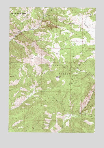
Hogback Mountain, MT USGS Topographic Map
Click on map above to begin viewing in our Map Viewer.

This topographic map contains these locations and features:
Feature Name Type Latitude Longitude GNIS ID View Map
Barking DogPillarN46.8074°W111.6339°800387View Map
Beartrap GulchValleyN46.7683°W111.6647°800422View Map
Bowman GulchValleyN46.8133°W111.6511°800492View Map
Burnt GulchValleyN46.8663°W111.6989°800520View Map
Cottontail GulchValleyN46.8519°W111.7183°800630View Map
Diamond GulchValleyN46.8430°W111.7469°800699View Map
Gilman GulchValleyN46.8669°W111.7000°800846View Map
Goodman GulchValleyN46.7658°W111.6614°800862View Map
Grouse RidgeRidgeN46.8266°W111.6519°800898View Map
Hanging ValleyValleyN46.7911°W111.6280°800908View Map
Hidden ValleyValleyN46.8086°W111.6336°800936View Map
Hogback MountainSummitN46.8263°W111.7103°800950View Map
Indian FlatsFlatN46.8355°W111.6661°800972View Map
Indian Flats Work CenterLocaleN46.8227°W111.6794°794697View Map
KTVH-TV (Helena)TowerN46.8263°W111.7100°806735View Map
Middleman MountainSummitN46.8052°W111.6828°801164View Map
Moors CreekStreamN46.8488°W111.7378°801190View Map
Pike CreekStreamN46.8577°W111.7078°801301View Map
Pike Gulch CampgroundLocaleN46.8472°W111.6625°794695View Map
Porcupine CreekStreamN46.8736°W111.6891°801312View Map
Refrigerator CanyonValleyN46.8488°W111.7375°801357View Map
Slaughter Pen GulchValleyN46.7958°W111.7119°794698View Map
SmithLocaleN46.8380°W111.6291°794696View Map
Sulphur GulchValleyN46.8649°W111.7019°794694View Map
Swamp GulchValleyN46.7649°W111.6480°801580View Map
Trout Creek CanyonValleyN46.7688°W111.6466°801622View Map
Vigilante CampgroundLocaleN46.7669°W111.6505°801647View Map
Vigilante GulchValleyN46.7686°W111.6466°801648View Map

Note: Coordinates in the location and feature list above are referenced to NAD83 datum.


Copyright (C) 2008-2024 Ryan Niemi / Sunset Dynamics ... All Rights Reserved