TopoQuest Logo
Do you find TopoQuest useful?
Help keep TopoQuest running and adding new maps/features by donating!
Bitcoin:  19c7KJd3qBynnjoSw5npx9KScwjBe4ifkT
Litecoin:  LXs6TkuXGGXo1vDsWCkWVdjQX94eUKd6ui
Home View Maps Find Maps Find Places Resources & Links


Hellgate Gulch, Montana Topographic Map

USGS Map Title: Hellgate Gulch, MT
USGS Map MRC: 46111F5
DRG (GeoTIFF) Download: o46111f5.tif


Neighboring USGS Topographic Map Quads:


  Hogback Mountain, MT  
46111G6
 

  Snedaker Basin, MT  
46111G5
 

  Lingshire, MT  
46111G4
 

  Canyon Ferry, MT  
46111F6
 

  Hellgate Gulch, MT  
46111F5
 

  Whites City, MT  
46111F4
 

  Canyon Ferry SW, MT  
46111E6
 

  Canyon Ferry SE, MT  
46111E5
 

  Diamond City, MT  
46111E4


Map MRC Location:

N47°
W112°
N47°
W111°
H8 H7 H6 H5 H4 H3 H2 H1
G8 G7 G6 G5 G4 G3 G2 G1
F8 F7 F6 F5 F4 F3 F2 F1
E8 E7 E6 E5 E4 E3 E2 E1
D8 D7 D6 D5 D4 D3 D2 D1
C8 C7 C6 C5 C4 C3 C2 C1
B8 B7 B6 B5 B4 B3 B2 B1
A8 A7 A6 A5 A4 A3 A2 A1
N46°
W112°
N46°
W111°

Hellgate Gulch, MT USGS 1:24K Topographic Map Preview:
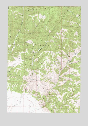
Hellgate Gulch, MT USGS Topographic Map
Click on map above to begin viewing in our Map Viewer.

This topographic map contains these locations and features:
Feature Name Type Latitude Longitude GNIS ID View Map
10N01E14BACA01 WellWellN46.6294°W111.5689°817261View Map
Argo MineMineN46.6888°W111.5836°779126View Map
Argo Post Office (historical)Post OfficeN46.6860°W111.5814°1762152View Map
Bar GulchValleyN46.6960°W111.6208°800386View Map
Blackwells (historical)LocaleN46.7041°W111.6147°1762214View Map
Carpenter GulchValleyN46.6997°W111.5702°780964View Map
Cayuse CreekStreamN46.6933°W111.5116°781080View Map
Cayuse GulchValleyN46.6933°W111.5108°781082View Map
Cooney GulchValleyN46.7447°W111.5208°781624View Map
Cow GulchValleyN46.6638°W111.5377°781793View Map
Davis GulchValleyN46.6258°W111.5508°782115View Map
Doolittle GulchValleyN46.6580°W111.5430°782482View Map
Doolittle Gulch MineMineN46.6597°W111.5441°802668View Map
Fisher GulchValleyN46.6827°W111.5819°783453View Map
Gabish GulchValleyN46.6752°W111.5808°783794View Map
Goon GulchValleyN46.6847°W111.5214°784104View Map
Grouse CreekStreamN46.7191°W111.6061°784370View Map
Harris GulchValleyN46.6872°W111.5830°784570View Map
Hunters GulchValleyN46.7119°W111.6116°785172View Map
Kilgallon GulchValleyN46.6808°W111.5839°785730View Map
Mc Gregor GulchValleyN46.6763°W111.5319°786976View Map
Never Sweat GulchValleyN46.7052°W111.6141°787959View Map
Quartz GulchValleyN46.6638°W111.5839°789274View Map
Rocky GulchValleyN46.6494°W111.5544°789731View Map
Shannon GulchValleyN46.6949°W111.5100°790284View Map
Sheep GulchValleyN46.7369°W111.5041°790352View Map
Sheriff GulchValleyN46.7488°W111.5980°790407View Map
Spilling GulchValleyN46.6866°W111.5208°791157View Map
Thompson Creek MineMineN46.7299°W111.5005°802670View Map
Timber GulchValleyN46.6577°W111.5411°792194View Map

Note: Coordinates in the location and feature list above are referenced to NAD83 datum.


Copyright (C) 2008-2025 Ryan Niemi / Sunset Dynamics ... All Rights Reserved