TopoQuest Logo
Do you find TopoQuest useful?
Help keep TopoQuest running and adding new maps/features by donating!
Bitcoin:  19c7KJd3qBynnjoSw5npx9KScwjBe4ifkT
Litecoin:  LXs6TkuXGGXo1vDsWCkWVdjQX94eUKd6ui
Home View Maps Find Maps Find Places Resources & Links


Holbrook, Iowa Topographic Map

USGS Map Title: Holbrook, IA
USGS Map MRC: 41091E8
DRG (GeoTIFF) Download: o41091e8.tif


Neighboring USGS Topographic Map Quads:


  Williamsburg, IA  
41092F1
 

  Conroy, IA  
41091F8
 

  Oxford, IA  
41091F7
 

  North English, IA  
41092E1
 

  Holbrook, IA  
41091E8
 

  Amish, IA  
41091E7
 

  South English, IA  
41092D1
 

  Kinross, IA  
41091D8
 

  Wellman, IA  
41091D7


Map MRC Location:

N42°
W92°
N42°
W91°
H8 H7 H6 H5 H4 H3 H2 H1
G8 G7 G6 G5 G4 G3 G2 G1
F8 F7 F6 F5 F4 F3 F2 F1
E8 E7 E6 E5 E4 E3 E2 E1
D8 D7 D6 D5 D4 D3 D2 D1
C8 C7 C6 C5 C4 C3 C2 C1
B8 B7 B6 B5 B4 B3 B2 B1
A8 A7 A6 A5 A4 A3 A2 A1
N41°
W92°
N41°
W91°

Holbrook, IA USGS 1:24K Topographic Map Preview:
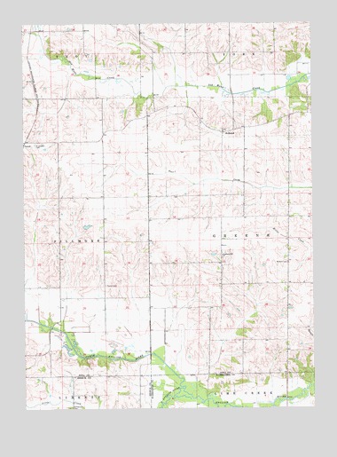
Holbrook, IA USGS Topographic Map
Click on map above to begin viewing in our Map Viewer.

This topographic map contains these locations and features:
Feature Name Type Latitude Longitude GNIS ID View Map
Champion Hill CemeteryCemeteryN41.5489°W91.9143°2047406View Map
English River Wildlife AreaParkN41.5006°W91.9266°1981612View Map
Foote (historical)LocaleN41.5167°W91.9766°466094View Map
Foote Post Office (historical)Post OfficeN41.5167°W91.9752°1999737View Map
Green CenterPopulated PlaceN41.5403°W91.8866°464227View Map
Green Center Post Office (historical)Post OfficeN41.5403°W91.8866°1999738View Map
Hinkleville Foot Post Office (historical)Post OfficeN41.5120°W91.8827°466614View Map
HolbrookPopulated PlaceN41.5908°W91.9130°464582View Map
Holbrook Post Office (historical)Post OfficeN41.5908°W91.9130°1999741View Map
Ione Post Office (historical)Post OfficeN41.5906°W91.9127°1999739View Map
Lantz Wildlife ReserveParkN41.5167°W91.8863°1999718View Map
Lytle City (historical)LocaleN41.6006°W91.9502°466093View Map
Lytle City Post Office (historical)Post OfficeN41.5917°W91.9557°1999740View Map
McArtor CemeteryCemeteryN41.5489°W91.8863°458881View Map
North English RiverStreamN41.5056°W91.9314°459578View Map
Piersol CemeteryCemeteryN41.5406°W91.9621°460128View Map
Ricord CemeteryCemeteryN41.5875°W91.8779°1999843View Map
Saint Josephs CemeteryCemeteryN41.5861°W91.9949°461113View Map
Saint Michaels Catholic CemeteryCemeteryN41.5903°W91.9135°2047407View Map
South English RiverStreamN41.5064°W91.9316°461777View Map
Teener CreekStreamN41.5042°W91.9285°465393View Map
Township of GreeneCivilN41.5561°W91.8873°467971View Map
Walsh CemeteryCemeteryN41.5083°W91.9918°1976302View Map
Watters CemeteryCemeteryN41.5083°W91.9752°1976301View Map

Note: Coordinates in the location and feature list above are referenced to NAD83 datum.


Copyright (C) 2008-2024 Ryan Niemi / Sunset Dynamics ... All Rights Reserved