TopoQuest Logo
Do you find TopoQuest useful?
Help keep TopoQuest running and adding new maps/features by donating!
Bitcoin:  19c7KJd3qBynnjoSw5npx9KScwjBe4ifkT
Litecoin:  LXs6TkuXGGXo1vDsWCkWVdjQX94eUKd6ui
Home View Maps Find Maps Find Places Resources & Links


Wellman, Iowa Topographic Map

USGS Map Title: Wellman, IA
USGS Map MRC: 41091D7
DRG (GeoTIFF) Download: o41091d7.tif


Neighboring USGS Topographic Map Quads:


  Holbrook, IA  
41091E8
 

  Amish, IA  
41091E7
 

  Williamstown, IA  
41091E6
 

  Kinross, IA  
41091D8
 

  Wellman, IA  
41091D7
 

  Kalona, IA  
41091D6
 

  Keota, IA  
41091C8
 

  West Chester, IA  
41091C7
 

  Washington, IA  
41091C6


Map MRC Location:

N42°
W92°
N42°
W91°
H8 H7 H6 H5 H4 H3 H2 H1
G8 G7 G6 G5 G4 G3 G2 G1
F8 F7 F6 F5 F4 F3 F2 F1
E8 E7 E6 E5 E4 E3 E2 E1
D8 D7 D6 D5 D4 D3 D2 D1
C8 C7 C6 C5 C4 C3 C2 C1
B8 B7 B6 B5 B4 B3 B2 B1
A8 A7 A6 A5 A4 A3 A2 A1
N41°
W92°
N41°
W91°

Wellman, IA USGS 1:24K Topographic Map Preview:
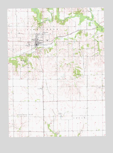
Wellman, IA USGS Topographic Map
Click on map above to begin viewing in our Map Viewer.

This topographic map contains these locations and features:
Feature Name Type Latitude Longitude GNIS ID View Map
Asbury United Methodist ChurchChurchN41.4678°W91.8382°1981733View Map
Birch CreekStreamN41.4997°W91.8391°454641View Map
City of WellmanCivilN41.4693°W91.8354°2397248View Map
Coffman CemeteryCemeteryN41.4889°W91.7585°1981795View Map
DaytonvillePopulated PlaceN41.4761°W91.8291°455822View Map
Daytonville Mennonite ChurchChurchN41.4750°W91.8321°1981736View Map
Daytonville Post Office (historical)Post OfficeN41.4761°W91.8291°1981620View Map
Deer CreekStreamN41.4872°W91.7660°455854View Map
Foster Woods ParkParkN41.4492°W91.8527°456694View Map
LexingtonPopulated PlaceN41.3978°W91.8071°464617View Map
Lexington CemeteryCemeteryN41.3945°W91.8074°1981803View Map
Lexington Post Office (historical)Post OfficeN41.3978°W91.8071°1981621View Map
Lime CreekStreamN41.4897°W91.7754°458344View Map
Mennonite CemeteryCemeteryN41.4658°W91.8468°458987View Map
Mid - Prairie High SchoolSchoolN41.4683°W91.8240°1981745View Map
Murphy Field Private AirportAirportN41.4232°W91.8314°466977View Map
Parkview ManorHospitalN41.4750°W91.8341°1981739View Map
Pilot Grove CemeteryCemeteryN41.4345°W91.7821°460147View Map
Pilotburg Post Office (historical)Post OfficeN41.4361°W91.7779°1981622View Map
PilotsburgLocaleN41.4358°W91.7760°465509View Map
Saint Joseph's ChurchChurchN41.4722°W91.8321°1981734View Map
Smith CreekStreamN41.4692°W91.7888°461695View Map
Smith Creek School (historical)SchoolN41.4672°W91.8363°1981749View Map
South ParkParkN41.4625°W91.8349°1981747View Map
Taylor CemeteryCemeteryN41.4381°W91.8307°1981804View Map
Township of CedarCivilN41.3832°W91.7700°467565View Map
Township of Lime CreekCivilN41.4677°W91.8590°468236View Map
Wassonville CemeteryCemeteryN41.4849°W91.8317°462724View Map
WellmanPopulated PlaceN41.4642°W91.8382°462787View Map
Wellman (historical)LocaleN41.4625°W91.8379°1981748View Map
Wellman Baptist ChurchChurchN41.4661°W91.8354°1981737View Map
Wellman CemeteryCemeteryN41.4636°W91.8477°462788View Map
Wellman City HallBuildingN41.4656°W91.8377°1981741View Map
Wellman City ParkParkN41.4820°W91.8321°1981746View Map
Wellman Elementary SchoolSchoolN41.4699°W91.8348°1981744View Map
Wellman Golf CourseLocaleN41.4695°W91.8288°1981743View Map
Wellman Historical ParkParkN41.4672°W91.8363°1981750View Map
Wellman Lutheran ChurchChurchN41.4664°W91.8332°1981735View Map
Wellman Mennonite ChurchChurchN41.4753°W91.8382°1981732View Map
Wellman Post OfficePost OfficeN41.4653°W91.8385°1981742View Map
Wellman Volunteer Ambulance ServiceBuildingN41.4646°W91.8289°2599895View Map
Wellman Volunteer Fire DepartmentBuildingN41.4646°W91.8289°1981740View Map
Zion Christian FellowshipChurchN41.4642°W91.8382°1981738View Map

Note: Coordinates in the location and feature list above are referenced to NAD83 datum.


Copyright (C) 2008-2024 Ryan Niemi / Sunset Dynamics ... All Rights Reserved