TopoQuest Logo
Do you find TopoQuest useful?
Help keep TopoQuest running and adding new maps/features by donating!
Bitcoin:  19c7KJd3qBynnjoSw5npx9KScwjBe4ifkT
Litecoin:  LXs6TkuXGGXo1vDsWCkWVdjQX94eUKd6ui
Home View Maps Find Maps Find Places Resources & Links


Holden, Utah Topographic Map

USGS Map Title: Holden, UT
USGS Map MRC: 39112A3
DRG (GeoTIFF) Download: o39112a3.tif


Neighboring USGS Topographic Map Quads:


  McCornick, UT  
39112B4
 

  Duggins Creek, UT  
39112B3
 

  Scipio Pass, UT  
39112B2
 

  The Sink, UT  
39112A4
 

  Holden, UT  
39112A3
 

  Coffee Peak, UT  
39112A2
 

  Meadow, UT  
38112H4
 

  Fillmore, UT  
38112H3
 

  Mount Catherine, UT  
38112H2


Map MRC Location:

N40°
W113°
N40°
W112°
H8 H7 H6 H5 H4 H3 H2 H1
G8 G7 G6 G5 G4 G3 G2 G1
F8 F7 F6 F5 F4 F3 F2 F1
E8 E7 E6 E5 E4 E3 E2 E1
D8 D7 D6 D5 D4 D3 D2 D1
C8 C7 C6 C5 C4 C3 C2 C1
B8 B7 B6 B5 B4 B3 B2 B1
A8 A7 A6 A5 A4 A3 A2 A1
N39°
W113°
N39°
W112°

Holden, UT USGS 1:24K Topographic Map Preview:
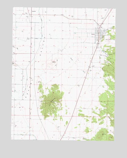
Holden, UT USGS Topographic Map
Click on map above to begin viewing in our Map Viewer.

This topographic map contains these locations and features:
Feature Name Type Latitude Longitude GNIS ID View Map
Bennett Field Wildlife Management AreaParkN39.0705°W112.2519°1448128View Map
Cedar MountainSummitN39.0361°W112.3258°1426463View Map
Circus Hollow Wildlife Management AreaParkN39.0155°W112.2855°1435306View Map
Current Spring DitchCanalN39.0827°W112.2638°1427166View Map
GreenwoodPopulated PlaceN39.1225°W112.3527°1437573View Map
HoldenPopulated PlaceN39.0989°W112.2708°1428763View Map
Holden CemeteryCemeteryN39.0977°W112.2660°1435684View Map
Holden Fire DepartmentBuildingN39.0981°W112.2712°2627449View Map
Johnson DitchCanalN39.0747°W112.2580°1429218View Map
Maple HollowValleyN39.0864°W112.2663°1443174View Map
North CanyonValleyN39.0025°W112.3044°1443860View Map
Pioneer CreekStreamN39.0886°W112.3427°1444442View Map
Pioneer DitchCanalN39.0736°W112.2683°1444443View Map
Red Cedar HillSummitN39.0064°W112.2655°1431626View Map
The Church of Jesus Christ of Latter Day SaintsChurchN39.1005°W112.2680°1436944View Map
Town of HoldenCivilN39.1003°W112.2705°2412760View Map
Wild Goose CreekStreamN39.1030°W112.2697°1447344View Map

Note: Coordinates in the location and feature list above are referenced to NAD83 datum.


Copyright (C) 2008-2024 Ryan Niemi / Sunset Dynamics ... All Rights Reserved