TopoQuest Logo
Do you find TopoQuest useful?
Help keep TopoQuest running and adding new maps/features by donating!
Bitcoin:  19c7KJd3qBynnjoSw5npx9KScwjBe4ifkT
Litecoin:  LXs6TkuXGGXo1vDsWCkWVdjQX94eUKd6ui
Home View Maps Find Maps Find Places Resources & Links


Holland, Iowa Topographic Map

USGS Map Title: Holland, IA
USGS Map MRC: 42092D7
DRG (GeoTIFF) Download: o42092d7.tif


Neighboring USGS Topographic Map Quads:


  Aplington, IA  
42092E8
 

  Parkersburg, IA  
42092E7
 

  Stout, IA  
42092E6
 

  Wellsburg, IA  
42092D8
 

  Holland, IA  
42092D7
 

  Dike, IA  
42092D6
 

  Ivester, IA  
42092C8
 

  Grundy Center, IA  
42092C7
 

  Lincoln, IA  
42092C6


Map MRC Location:

N43°
W93°
N43°
W92°
H8 H7 H6 H5 H4 H3 H2 H1
G8 G7 G6 G5 G4 G3 G2 G1
F8 F7 F6 F5 F4 F3 F2 F1
E8 E7 E6 E5 E4 E3 E2 E1
D8 D7 D6 D5 D4 D3 D2 D1
C8 C7 C6 C5 C4 C3 C2 C1
B8 B7 B6 B5 B4 B3 B2 B1
A8 A7 A6 A5 A4 A3 A2 A1
N42°
W93°
N42°
W92°

Holland, IA USGS 1:24K Topographic Map Preview:
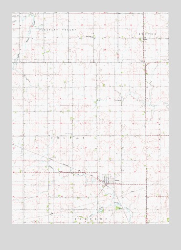
Holland, IA USGS Topographic Map
Click on map above to begin viewing in our Map Viewer.

This topographic map contains these locations and features:
Feature Name Type Latitude Longitude GNIS ID View Map
Beaver Roadside ParkParkN42.4708°W92.7699°1983344View Map
City of HollandCivilN42.4000°W92.7988°2394401View Map
Colfax Center ChurchChurchN42.4283°W92.8277°455530View Map
Colfax Center Presbyterian Church CemeteryCemeteryN42.4276°W92.8277°455529View Map
FernPopulated PlaceN42.4847°W92.7705°456576View Map
Fern Post Office (historical)Post OfficeN42.4847°W92.7705°1983354View Map
Grundy CountyCivilN42.4019°W92.7914°465226View Map
HollandPopulated PlaceN42.3989°W92.8005°457555View Map
Holland (historical)LocaleN42.3986°W92.8030°1983432View Map
Holland CemeteryCemeteryN42.3994°W92.7948°457556View Map
Holland Christian Reformed ChurchChurchN42.3989°W92.8005°1983434View Map
Holland CreekStreamN42.3866°W92.7930°457557View Map
Holland Post OfficePost OfficeN42.3989°W92.8005°1983433View Map
Holland Reformed ChurchChurchN42.3994°W92.7930°457558View Map
Lincoln Post Office (historical)Post OfficeN42.4680°W92.7780°1983358View Map
Middle Fork South Beaver CreekStreamN42.4989°W92.8599°459040View Map
North Fork South Beaver CreekStreamN42.4955°W92.8671°459588View Map
Pleasant Valley Reformed CemeteryCemeteryN42.4855°W92.8110°460306View Map
Pleasant Valley Reformed ChurchChurchN42.4850°W92.8113°460307View Map
Township of ColfaxCivilN42.4270°W92.8275°467634View Map

Note: Coordinates in the location and feature list above are referenced to NAD83 datum.


Copyright (C) 2008-2024 Ryan Niemi / Sunset Dynamics ... All Rights Reserved