TopoQuest Logo
Do you find TopoQuest useful?
Help keep TopoQuest running and adding new maps/features by donating!
Bitcoin:  19c7KJd3qBynnjoSw5npx9KScwjBe4ifkT
Litecoin:  LXs6TkuXGGXo1vDsWCkWVdjQX94eUKd6ui
Home View Maps Find Maps Find Places Resources & Links


Grundy Center, Iowa Topographic Map

USGS Map Title: Grundy Center, IA
USGS Map MRC: 42092C7
DRG (GeoTIFF) Download: o42092c7.tif


Neighboring USGS Topographic Map Quads:


  Wellsburg, IA  
42092D8
 

  Holland, IA  
42092D7
 

  Dike, IA  
42092D6
 

  Ivester, IA  
42092C8
 

  Grundy Center, IA  
42092C7
 

  Lincoln, IA  
42092C6
 

  Conrad West, IA  
42092B8
 

  Conrad East, IA  
42092B7
 

  Gladbrook, IA  
42092B6


Map MRC Location:

N43°
W93°
N43°
W92°
H8 H7 H6 H5 H4 H3 H2 H1
G8 G7 G6 G5 G4 G3 G2 G1
F8 F7 F6 F5 F4 F3 F2 F1
E8 E7 E6 E5 E4 E3 E2 E1
D8 D7 D6 D5 D4 D3 D2 D1
C8 C7 C6 C5 C4 C3 C2 C1
B8 B7 B6 B5 B4 B3 B2 B1
A8 A7 A6 A5 A4 A3 A2 A1
N42°
W93°
N42°
W92°

Grundy Center, IA USGS 1:24K Topographic Map Preview:
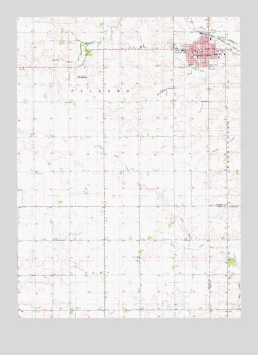
Grundy Center, IA USGS Topographic Map
Click on map above to begin viewing in our Map Viewer.

This topographic map contains these locations and features:
Feature Name Type Latitude Longitude GNIS ID View Map
Bethany Presbyterian ChurchChurchN42.3619°W92.7674°1983390View Map
City of Grundy CenterCivilN42.3637°W92.7740°2394256View Map
City of Grundy Center AmbulanceBuildingN42.3627°W92.7710°2599658View Map
Fifteen Mile Post Office (historical)Post OfficeN42.2847°W92.7571°1983139View Map
First Baptist ChurchChurchN42.3594°W92.7591°1983391View Map
First Presbyterian ChurchChurchN42.3603°W92.7741°1983393View Map
Grundy Care CenterHospitalN42.3580°W92.7624°1983383View Map
Grundy CenterPopulated PlaceN42.3617°W92.7685°457172View Map
Grundy Center (historical)LocaleN42.3683°W92.7713°1983373View Map
Grundy Center CemeteryCemeteryN42.3641°W92.7888°457173View Map
Grundy Center Elementary SchoolSchoolN42.3592°W92.7758°1983395View Map
Grundy Center Fire DepartmentBuildingN42.3628°W92.7709°1983377View Map
Grundy Center High SchoolSchoolN42.3553°W92.7788°1983394View Map
Grundy Center Learning CenterSchoolN42.3582°W92.7624°2719961View Map
Grundy Center LibraryBuildingN42.3605°W92.7724°1983374View Map
Grundy Center Middle SchoolSchoolN42.3553°W92.7778°2719876View Map
Grundy Center Municipal AirportAirportN42.3528°W92.8419°466807View Map
Grundy Center Police DepartmentBuildingN42.3632°W92.7732°1983376View Map
Grundy Center Post OfficePost OfficeN42.3628°W92.7719°1983379View Map
Grundy City HallBuildingN42.3628°W92.7724°1983378View Map
Grundy County CourthouseBuildingN42.3611°W92.7733°1983372View Map
Grundy County Memorial HospitalHospitalN42.3594°W92.7620°1983384View Map
Grundy County Sheriff's OfficeBuildingN42.3610°W92.7743°1983380View Map
Grundy Medical CenterHospitalN42.3611°W92.7613°1983385View Map
Grundy Medical CenterHospitalN42.3594°W92.7619°1983387View Map
Herbert Quick School (historical)SchoolN42.3625°W92.7808°1983382View Map
Herbert Quick Schoolhouse Historical MarkerParkN42.3625°W92.7808°1983371View Map
Iowa Health Physicians CenterHospitalN42.3594°W92.7619°1983386View Map
Lincoln Township CemeteryCemeteryN42.2961°W92.7571°458400View Map
Lutheran ChurchChurchN42.3628°W92.7783°1983388View Map
Methodist ChurchChurchN42.3605°W92.7716°1983392View Map
Orion ParkParkN42.3625°W92.7808°1983381View Map
Palermo Township CemeteryCemeteryN42.3653°W92.7885°1983467View Map
Rosehill CemeteryCemeteryN42.3650°W92.7885°1983468View Map
Sacred Heart Catholic ChurchChurchN42.3614°W92.7646°1983389View Map
Sacred Heart CemeteryCemeteryN42.3651°W92.7884°1983466View Map
Town and Country Golf ClubLocaleN42.3539°W92.7802°1983375View Map
Township of ClayCivilN42.2533°W92.8265°467603View Map
Township of PalermoCivilN42.3418°W92.8227°468494View Map
Upper Elementary SchoolSchoolN42.3583°W92.7744°1983396View Map

Note: Coordinates in the location and feature list above are referenced to NAD83 datum.


Copyright (C) 2008-2025 Ryan Niemi / Sunset Dynamics ... All Rights Reserved