TopoQuest Logo
Do you find TopoQuest useful?
Help keep TopoQuest running and adding new maps/features by donating!
Bitcoin:  19c7KJd3qBynnjoSw5npx9KScwjBe4ifkT
Litecoin:  LXs6TkuXGGXo1vDsWCkWVdjQX94eUKd6ui
Home View Maps Find Maps Find Places Resources & Links


Holland Lake, Montana Topographic Map

USGS Map Title: Holland Lake, MT
USGS Map MRC: 47113D5
DRG (GeoTIFF) Download: o47113d5.tif


Neighboring USGS Topographic Map Quads:


  Condon, MT  
47113E6
 

  Holland Peak, MT  
47113E5
 

  Big Salmon Lake West, MT  
47113E4
 

  Cygnet Lake, MT  
47113D6
 

  Holland Lake, MT  
47113D5
 

  Shaw Creek, MT  
47113D4
 

  Lake Marshall, MT  
47113C6
 

  Lake Inez, MT  
47113C5
 

  Morrell Lake, MT  
47113C4


Map MRC Location:

N48°
W114°
N48°
W113°
H8 H7 H6 H5 H4 H3 H2 H1
G8 G7 G6 G5 G4 G3 G2 G1
F8 F7 F6 F5 F4 F3 F2 F1
E8 E7 E6 E5 E4 E3 E2 E1
D8 D7 D6 D5 D4 D3 D2 D1
C8 C7 C6 C5 C4 C3 C2 C1
B8 B7 B6 B5 B4 B3 B2 B1
A8 A7 A6 A5 A4 A3 A2 A1
N47°
W114°
N47°
W113°

Holland Lake, MT USGS 1:24K Topographic Map Preview:
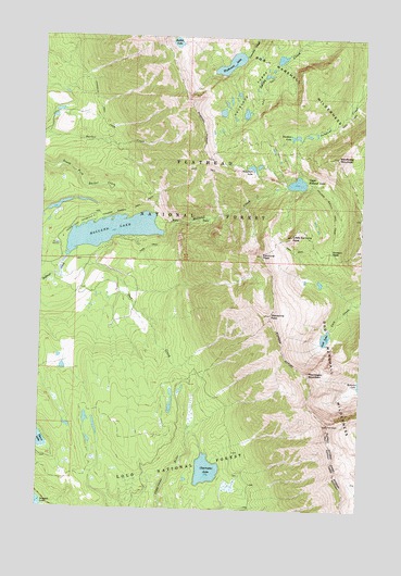
Holland Lake, MT USGS Topographic Map
Click on map above to begin viewing in our Map Viewer.

This topographic map contains these locations and features:
Feature Name Type Latitude Longitude GNIS ID View Map
19N16W03ABCD01 WellWellN47.4380°W113.6215°822923View Map
19N16W03ACAB01 WellWellN47.4363°W113.6193°822913View Map
Carmine PeakSummitN47.4427°W113.5401°780953View Map
Clearwater LakeLakeN47.3855°W113.5600°781366View Map
Gordon PassGapN47.4435°W113.5129°784122View Map
Holland Falls National Recreation TrailTrailN47.4533°W113.5879°794227View Map
Holland LakeLakeN47.4484°W113.5986°772475View Map
Holland Lake CampgroundLocaleN47.4527°W113.6054°798991View Map
Lick LakeLakeN47.4208°W113.5146°786101View Map
Little Carmine PeakSummitN47.4477°W113.5284°786268View Map
Necklace LakesLakeN47.4944°W113.5339°787920View Map
Owl CreekStreamN47.4360°W113.6181°788543View Map
Owl Creek Packer CampLocaleN47.4408°W113.6059°794228View Map
Pendent LakeLakeN47.4738°W113.5276°788748View Map
Ptarmigan MountainSummitN47.4113°W113.5209°789224View Map
Rubble LakeLakeN47.4984°W113.5746°793902View Map
Sapphire LakeLakeN47.4655°W113.5443°790018View Map
Upper Holland LakeLakeN47.4615°W113.5266°792638View Map
Waldbillig MountainSummitN47.4688°W113.5109°792757View Map
Wolverine PeakSummitN47.4266°W113.5362°793475View Map
Woodward LakeLakeN47.4930°W113.5533°793532View Map

Note: Coordinates in the location and feature list above are referenced to NAD83 datum.


Copyright (C) 2008-2024 Ryan Niemi / Sunset Dynamics ... All Rights Reserved