TopoQuest Logo
Do you find TopoQuest useful?
Help keep TopoQuest running and adding new maps/features by donating!
Bitcoin:  19c7KJd3qBynnjoSw5npx9KScwjBe4ifkT
Litecoin:  LXs6TkuXGGXo1vDsWCkWVdjQX94eUKd6ui
Home View Maps Find Maps Find Places Resources & Links


Condon, Montana Topographic Map

USGS Map Title: Condon, MT
USGS Map MRC: 47113E6
DRG (GeoTIFF) Download: o47113e6.tif


Neighboring USGS Topographic Map Quads:


  Salmon Prairie, MT  
47113F7
 

  Swan Peak, MT  
47113F6
 

  Sunburst Lake, MT  
47113F5
 

  Peck Lake, MT  
47113E7
 

  Condon, MT  
47113E6
 

  Holland Peak, MT  
47113E5
 

  Hemlock Lake, MT  
47113D7
 

  Cygnet Lake, MT  
47113D6
 

  Holland Lake, MT  
47113D5


Map MRC Location:

N48°
W114°
N48°
W113°
H8 H7 H6 H5 H4 H3 H2 H1
G8 G7 G6 G5 G4 G3 G2 G1
F8 F7 F6 F5 F4 F3 F2 F1
E8 E7 E6 E5 E4 E3 E2 E1
D8 D7 D6 D5 D4 D3 D2 D1
C8 C7 C6 C5 C4 C3 C2 C1
B8 B7 B6 B5 B4 B3 B2 B1
A8 A7 A6 A5 A4 A3 A2 A1
N47°
W114°
N47°
W113°

Condon, MT USGS 1:24K Topographic Map Preview:
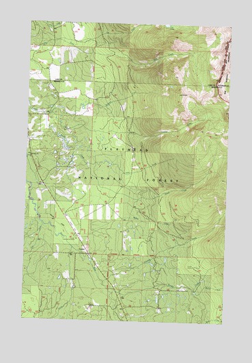
Condon, MT USGS Topographic Map
Click on map above to begin viewing in our Map Viewer.

This topographic map contains these locations and features:
Feature Name Type Latitude Longitude GNIS ID View Map
20N16W06CBAA01 WellWellN47.5199°W113.6929°823568View Map
20N16W06DCD_01 WellWellN47.5144°W113.6823°823522View Map
20N16W07ADAA01 WellWellN47.5091°W113.6768°823478View Map
20N16W07CABB01 WellWellN47.5055°W113.6906°823457View Map
20N16W07CACB01 WellWellN47.5030°W113.6906°823449View Map
20N17W01ABCD01 WellWellN47.5252°W113.7062°823602View Map
20N17W01BAAB01 WellWellN47.5274°W113.7095°823612View Map
20N17W01BDDD01 WellWellN47.5216°W113.7090°823582View Map
20N17W01DCBD01 WellWellN47.5155°W113.7062°823536View Map
20N17W02BAAA01 WellWellN47.5274°W113.7304°823613View Map
20N17W02DCBA01 WellWellN47.5166°W113.7276°823543View Map
20N17W12DADB01 WellWellN47.5033°W113.6990°823450View Map
21N16W32ACBA01 WellWellN47.5377°W113.6768°823671View Map
21N17W14BBAB01 WellWellN47.5858°W113.7490°823901View Map
21N17W14CABC01 WellWellN47.5772°W113.7470°823848View Map
21N17W23BBDA01 WellWellN47.5685°W113.7490°823811View Map
21N17W24DBDB01 WellWellN47.5613°W113.7176°823778View Map
21N17W26ABCD01 WellWellN47.5541°W113.7409°823739View Map
21N17W26ADBD01 WellWellN47.5519°W113.7356°823734View Map
21N17W26BADA01 WellWellN47.5541°W113.7437°823740View Map
21N17W26DAAA01 WellWellN47.5491°W113.7329°823721View Map
21N17W26DACC01 WellWellN47.5469°W113.7362°823716View Map
21N17W26DCBC01 WellWellN47.5447°W113.7426°823700View Map
21N17W26DDDB01 WellWellN47.5433°W113.7334°823690View Map
21N17W36ACCA01 WellWellN47.5360°W113.7195°823661View Map
21N17W36DDBA01 WellWellN47.5310°W113.7143°823632View Map
Cat CreekStreamN47.6249°W113.6751°781044View Map
CondonPopulated PlaceN47.5277°W113.7106°781557View Map
Condon Census Designated PlaceCensusN47.5225°W113.6986°2583798View Map
Condon Community ChurchChurchN47.5277°W113.7106°1781136View Map
Condon Forest Service StationBuildingN47.5349°W113.7181°794232View Map
Condon Lookout TowerTowerN47.5847°W113.7356°799299View Map
Condon Post OfficePost OfficeN47.5697°W113.7488°806296View Map
Condon USFS AirportAirportN47.5410°W113.7226°806390View Map
Cooney CreekStreamN47.5163°W113.7015°781622View Map
Cooney Lookout TowerTowerN47.5233°W113.6448°799300View Map
Elk CreekStreamN47.5410°W113.7404°783067View Map
Faith Lutheran ChurchChurchN47.5277°W113.7106°1781135View Map
Falls CreekStreamN47.5658°W113.7140°783288View Map
Glacier CreekStreamN47.5305°W113.7209°783964View Map
McKay CreekStreamN47.5380°W113.7104°787072View Map
Rumble CreekStreamN47.5133°W113.6981°789849View Map
Rumble Creek Post Office (historical)Post OfficeN47.5494°W113.7323°1781240View Map
Simpson CreekStreamN47.5872°W113.7365°790543View Map
Smith CreekStreamN47.5869°W113.7409°790717View Map
Smith FlatsFlatN47.5410°W113.7304°790723View Map
South Fork Rumble CreekStreamN47.5138°W113.6445°791042View Map
Stroms StoreLocaleN47.5272°W113.7087°798913View Map
Swan Valley Branch LibraryBuildingN47.5277°W113.7106°1781487View Map
Swan Valley Emergency Services Station 1BuildingN47.5263°W113.7082°1781338View Map

Note: Coordinates in the location and feature list above are referenced to NAD83 datum.


Copyright (C) 2008-2025 Ryan Niemi / Sunset Dynamics ... All Rights Reserved