TopoQuest Logo
Do you find TopoQuest useful?
Help keep TopoQuest running and adding new maps/features by donating!
Bitcoin:  19c7KJd3qBynnjoSw5npx9KScwjBe4ifkT
Litecoin:  LXs6TkuXGGXo1vDsWCkWVdjQX94eUKd6ui
Home View Maps Find Maps Find Places Resources & Links


Hondo Reservoir, New Mexico Topographic Map

USGS Map Title: Hondo Reservoir, NM
USGS Map MRC: 33104C6
DRG (GeoTIFF) Download: o33104c6.tif


Neighboring USGS Topographic Map Quads:


  Blackwater Hill, NM  
33104D7
 

  Corn Ranch, NM  
33104D6
 

  Roswell North, NM  
33104D5
 

  Diamond A Ranch, NM  
33104C7
 

  Hondo Reservoir, NM  
33104C6
 

  Roswell South, NM  
33104C5
 

  Lucky Lake, NM  
33104B7
 

  Juan Lake, NM  
33104B6
 

  Peters Lake, NM  
33104B5


Map MRC Location:

N34°
W105°
N34°
W104°
H8 H7 H6 H5 H4 H3 H2 H1
G8 G7 G6 G5 G4 G3 G2 G1
F8 F7 F6 F5 F4 F3 F2 F1
E8 E7 E6 E5 E4 E3 E2 E1
D8 D7 D6 D5 D4 D3 D2 D1
C8 C7 C6 C5 C4 C3 C2 C1
B8 B7 B6 B5 B4 B3 B2 B1
A8 A7 A6 A5 A4 A3 A2 A1
N33°
W105°
N33°
W104°

Hondo Reservoir, NM USGS 1:24K Topographic Map Preview:
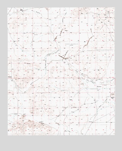
Hondo Reservoir, NM USGS Topographic Map
Click on map above to begin viewing in our Map Viewer.

This topographic map contains these locations and features:
Feature Name Type Latitude Longitude GNIS ID View Map
Blackwater DrawValleyN33.3673°W104.6833°886474View Map
Bloom RanchLocaleN33.2973°W104.6464°886500View Map
Bloom WellWellN33.2632°W104.7122°886501View Map
Coles CampLocaleN33.3204°W104.7283°887739View Map
Duncan TankReservoirN33.2940°W104.6844°888573View Map
Farrar WellWellN33.2845°W104.6764°888979View Map
Hondo DitchCanalN33.3029°W104.6486°890108View Map
Hondo Irrigation ProjectLocaleN33.2993°W104.6369°928959View Map
Hondo ReservoirReservoirN33.3254°W104.6852°890110View Map
Hondo Reservoir Diversion CanalCanalN33.3207°W104.7058°890111View Map
Lambert WellWellN33.2629°W104.6525°890912View Map
Lower MillLocaleN33.2543°W104.6847°891439View Map
Missouri Plaza (historical)Populated PlaceN33.3070°W104.7497°920379View Map
Missouri Plaza Indian RuinsLocaleN33.3070°W104.7497°892117View Map
Number 15 WellWellN33.3482°W104.7191°898060View Map
Outlet CanalCanalN33.3295°W104.6822°892974View Map
Red House WellWellN33.2623°W104.7105°893749View Map
Sherman PlaceLocaleN33.2873°W104.6300°898852View Map
Two Rivers ReservoirReservoirN33.2984°W104.7222°923789View Map
Woods RanchLocaleN33.3720°W104.7319°896761View Map

Note: Coordinates in the location and feature list above are referenced to NAD83 datum.


Copyright (C) 2008-2025 Ryan Niemi / Sunset Dynamics ... All Rights Reserved