TopoQuest Logo
Do you find TopoQuest useful?
Help keep TopoQuest running and adding new maps/features by donating!
Bitcoin:  19c7KJd3qBynnjoSw5npx9KScwjBe4ifkT
Litecoin:  LXs6TkuXGGXo1vDsWCkWVdjQX94eUKd6ui
Home View Maps Find Maps Find Places Resources & Links


Roswell South, New Mexico Topographic Map

USGS Map Title: Roswell South, NM
USGS Map MRC: 33104C5
DRG (GeoTIFF) Download: o33104c5.tif


Neighboring USGS Topographic Map Quads:


  Corn Ranch, NM  
33104D6
 

  Roswell North, NM  
33104D5
 

  Bitter Lake, NM  
33104D4
 

  Hondo Reservoir, NM  
33104C6
 

  Roswell South, NM  
33104C5
 

  South Spring, NM  
33104C4
 

  Juan Lake, NM  
33104B6
 

  Peters Lake, NM  
33104B5
 

  Dexter West, NM  
33104B4


Map MRC Location:

N34°
W105°
N34°
W104°
H8 H7 H6 H5 H4 H3 H2 H1
G8 G7 G6 G5 G4 G3 G2 G1
F8 F7 F6 F5 F4 F3 F2 F1
E8 E7 E6 E5 E4 E3 E2 E1
D8 D7 D6 D5 D4 D3 D2 D1
C8 C7 C6 C5 C4 C3 C2 C1
B8 B7 B6 B5 B4 B3 B2 B1
A8 A7 A6 A5 A4 A3 A2 A1
N33°
W105°
N33°
W104°

Roswell South, NM USGS 1:24K Topographic Map Preview:
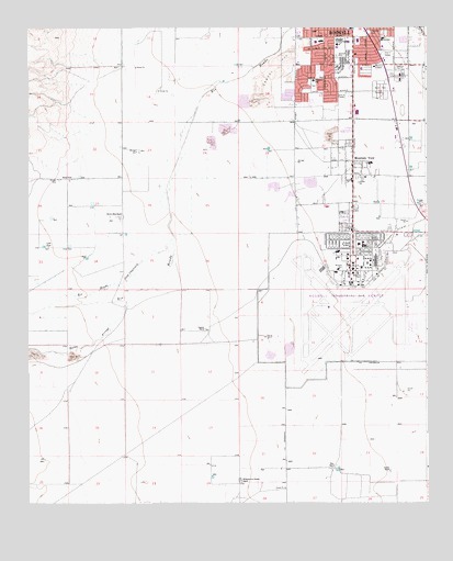
Roswell South, NM USGS Topographic Map
Click on map above to begin viewing in our Map Viewer.

This topographic map contains these locations and features:
Feature Name Type Latitude Longitude GNIS ID View Map
Brasher PitMineN33.3448°W104.5675°917770View Map
Brown Brothers RanchLocaleN33.3254°W104.5964°886758View Map
Carpenter ParkParkN33.3737°W104.5183°887209View Map
Casarez RanchLocaleN33.2959°W104.5700°887253View Map
Chaves County PitMineN33.3590°W104.5169°917771View Map
City of RoswellCivilN33.3729°W104.5294°2411003View Map
City of Roswell Fire Department Station 4BuildingN33.3067°W104.5219°2658080View Map
City of Roswell Fire Department Station 5BuildingN33.3622°W104.5243°2658079View Map
Crusher PitMineN33.3345°W104.5366°917764View Map
Goodin RanchLocaleN33.2584°W104.5119°889502View Map
HondoStreamN33.3201°W104.5797°898120View Map
Kerr RanchLocaleN33.2598°W104.5289°890676View Map
Lyles FarmLocaleN33.3176°W104.6200°891500View Map
Memorial HospitalHospitalN33.3645°W104.5164°891838View Map
Monterey SchoolSchoolN33.3612°W104.5358°892171View Map
Mountain ViewPopulated PlaceN33.3401°W104.5233°899807View Map
Mullinix PitMineN33.2893°W104.6247°917766View Map
New Mexico Rehabilitation CenterHospitalN33.3179°W104.5216°901282View Map
Pecos SchoolSchoolN33.3718°W104.5139°893144View Map
Rocky ArroyoStreamN33.3043°W104.5947°894107View Map
Roswell Army Air Field (historical)MilitaryN33.3058°W104.5233°2095890View Map
Roswell Ed Serv CenterSchoolN33.3667°W104.5319°901586View Map
Roswell Industrial Air CenterLocaleN33.3151°W104.5233°885511View Map
Roswell International Air CenterAirportN33.3016°W104.5306°937011View Map
Roswell Ready Mix PitMineN33.3340°W104.5497°917760View Map
Sacra FarmLocaleN33.3351°W104.6119°894244View Map
Sierra Volunteer Fire Department Station 2BuildingN33.3350°W104.5281°2658162View Map
South Park CemeteryCemeteryN33.3587°W104.5141°895094View Map
Walker Air Force Base (historical)MilitaryN33.3150°W104.5228°920357View Map
Walker Post OfficePost OfficeN33.3238°W104.5236°2781352View Map
Williams and Chesser RanchLocaleN33.2562°W104.5591°896623View Map

Note: Coordinates in the location and feature list above are referenced to NAD83 datum.


Copyright (C) 2008-2025 Ryan Niemi / Sunset Dynamics ... All Rights Reserved