TopoQuest Logo
Do you find TopoQuest useful?
Help keep TopoQuest running and adding new maps/features by donating!
Bitcoin:  19c7KJd3qBynnjoSw5npx9KScwjBe4ifkT
Litecoin:  LXs6TkuXGGXo1vDsWCkWVdjQX94eUKd6ui
Home View Maps Find Maps Find Places Resources & Links


Hoodoo Pass, Idaho Topographic Map

USGS Map Title: Hoodoo Pass, ID
USGS Map MRC: 46115H1
DRG (GeoTIFF) Download: o46115h1.tif


Neighboring USGS Topographic Map Quads:


  Sherlock Peak, ID  
47115A2
 

  Illinois Peak, MT  
47115A1
 

  Landowner Mountain, MT  
47114A8
 

  Chamberlain Mountain, ID  
46115H2
 

  Hoodoo Pass, ID  
46115H1
 

  Straight Peak, MT  
46114H8
 

  Moose Mountain, ID  
46115G2
 

  Osier Ridge, ID  
46115G1
 

  Bruin Hill, ID  
46114G8


Map MRC Location:

N47°
W116°
N47°
W115°
H8 H7 H6 H5 H4 H3 H2 H1
G8 G7 G6 G5 G4 G3 G2 G1
F8 F7 F6 F5 F4 F3 F2 F1
E8 E7 E6 E5 E4 E3 E2 E1
D8 D7 D6 D5 D4 D3 D2 D1
C8 C7 C6 C5 C4 C3 C2 C1
B8 B7 B6 B5 B4 B3 B2 B1
A8 A7 A6 A5 A4 A3 A2 A1
N46°
W116°
N46°
W115°

Hoodoo Pass, ID USGS 1:24K Topographic Map Preview:
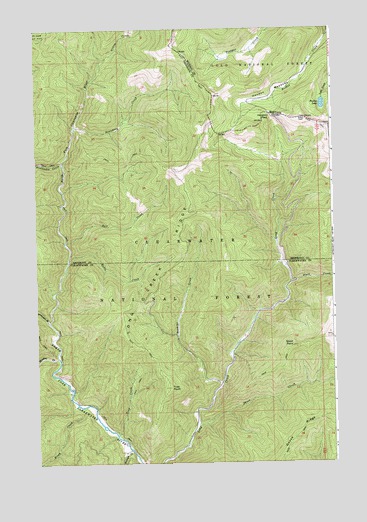
Hoodoo Pass, ID USGS Topographic Map
Click on map above to begin viewing in our Map Viewer.

This topographic map contains these locations and features:
Feature Name Type Latitude Longitude GNIS ID View Map
Birch CreekStreamN46.8913°W115.1065°377666View Map
Bostonian CreekStreamN46.9616°W115.1143°378051View Map
Boundary CreekStreamN46.9721°W115.1087°378117View Map
Dill CreekStreamN46.9385°W115.1132°380593View Map
Goose RidgeRidgeN46.8821°W115.0176°382447View Map
Graves CreekStreamN46.9910°W115.0974°382599View Map
Hoodoo LakeLakeN46.9780°W115.0043°772513View Map
Hoodoo MeadowsFlatN46.9819°W115.0254°772514View Map
Hoodoo PassGapN46.9755°W115.0271°383309View Map
Long Creek RidgeRidgeN46.9238°W115.0749°386041View Map
Meadow CreekStreamN46.9052°W115.1162°386706View Map
Rawhide CreekStreamN46.8980°W115.0479°389172View Map
Ruble CreekStreamN46.9333°W115.1121°389692View Map
Short CreekStreamN46.8855°W115.0576°390361View Map
Short PointSummitN46.9085°W115.0174°390366View Map
Slate CreekStreamN46.9269°W115.0187°390561View Map
Trap CreekStreamN46.8833°W115.0918°392334View Map
Trap PointSummitN46.8969°W115.0696°392338View Map
Vanderbilt GulchValleyN46.9158°W115.1207°392702View Map
Wrangle CreekStreamN46.8788°W115.0854°393707View Map

Note: Coordinates in the location and feature list above are referenced to NAD83 datum.


Copyright (C) 2008-2024 Ryan Niemi / Sunset Dynamics ... All Rights Reserved