TopoQuest Logo
Do you find TopoQuest useful?
Help keep TopoQuest running and adding new maps/features by donating!
Bitcoin:  19c7KJd3qBynnjoSw5npx9KScwjBe4ifkT
Litecoin:  LXs6TkuXGGXo1vDsWCkWVdjQX94eUKd6ui
Home View Maps Find Maps Find Places Resources & Links


Landowner Mountain, Montana Topographic Map

USGS Map Title: Landowner Mountain, MT
USGS Map MRC: 47114A8
DRG (GeoTIFF) Download: o47114a8.tif


Neighboring USGS Topographic Map Quads:


  Wilson Gulch, MT  
47115B1
 

  Superior, MT  
47114B8
 

  Idaho Gulch, MT  
47114B7
 

  Illinois Peak, MT  
47115A1
 

  Landowner Mountain, MT  
47114A8
 

  Lozeau, MT  
47114A7
 

  Hoodoo Pass, ID  
46115H1
 

  Straight Peak, MT  
46114H8
 

  Saint Patrick Peak, MT  
46114H7


Map MRC Location:

N48°
W115°
N48°
W114°
H8 H7 H6 H5 H4 H3 H2 H1
G8 G7 G6 G5 G4 G3 G2 G1
F8 F7 F6 F5 F4 F3 F2 F1
E8 E7 E6 E5 E4 E3 E2 E1
D8 D7 D6 D5 D4 D3 D2 D1
C8 C7 C6 C5 C4 C3 C2 C1
B8 B7 B6 B5 B4 B3 B2 B1
A8 A7 A6 A5 A4 A3 A2 A1
N47°
W115°
N47°
W114°

Landowner Mountain, MT USGS 1:24K Topographic Map Preview:
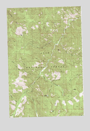
Landowner Mountain, MT USGS Topographic Map
Click on map above to begin viewing in our Map Viewer.

This topographic map contains these locations and features:
Feature Name Type Latitude Longitude GNIS ID View Map
Cement CreekStreamN47.0285°W114.9724°781123View Map
Deep CreekStreamN47.0460°W114.9485°782201View Map
Deep Creek MineMineN47.0510°W114.9707°804796View Map
Dunn CreekStreamN47.0285°W114.9726°770910View Map
Eagle RockSummitN47.0760°W114.9129°770970View Map
Eagle Rock CreekStreamN47.0841°W114.9149°782771View Map
Gold Mountain MineMineN47.0533°W114.9740°804797View Map
Gold Mountain MinesMineN47.0558°W114.9721°771835View Map
Gray GulchValleyN47.0621°W114.9312°771949View Map
Hoodoo CreekStreamN47.0019°W114.9996°772511View Map
Hungary GulchValleyN47.0555°W114.9849°772616View Map
Landowner CreekStreamN47.0369°W114.9265°773208View Map
Landowner MountainSummitN47.0235°W114.9410°773209View Map
Lime CreekStreamN47.0524°W114.9724°807013View Map
Lime GulchValleyN47.0538°W114.9721°773343View Map
North Fork Trout CreekStreamN47.0035°W114.9926°788270View Map
Ohio CreekStreamN47.0252°W114.9101°774915View Map
Prospect GulchValleyN47.0174°W114.9860°789208View Map
Russian Bill CreekStreamN47.0399°W114.9290°776028View Map
South Fork Trout CreekStreamN47.0033°W114.9926°791076View Map
Sunrise MountainSummitN47.0302°W114.8915°777329View Map
Superior DivisionCivilN47.0959°W114.9167°1940723View Map
Tin Cup CreekStreamN47.0608°W114.9349°777672View Map
Trout Creek Stock DrivewayTrailN47.1080°W114.9571°792405View Map
Twin CreekStreamN47.1002°W114.9015°777848View Map
Van Ness CreekStreamN47.0858°W114.9254°777993View Map
Van Ness PointSummitN47.0938°W114.9749°777994View Map
Windfall (historical)LocaleN47.0305°W114.9107°1781587View Map
Windfall LakeLakeN47.0061°W114.9289°778582View Map
Winofall CreekStreamN47.0538°W114.9412°778603View Map

Note: Coordinates in the location and feature list above are referenced to NAD83 datum.


Copyright (C) 2008-2024 Ryan Niemi / Sunset Dynamics ... All Rights Reserved