TopoQuest Logo
Do you find TopoQuest useful?
Help keep TopoQuest running and adding new maps/features by donating!
Bitcoin:  19c7KJd3qBynnjoSw5npx9KScwjBe4ifkT
Litecoin:  LXs6TkuXGGXo1vDsWCkWVdjQX94eUKd6ui
Home View Maps Find Maps Find Places Resources & Links


Horn Canyon, New Mexico Topographic Map

USGS Map Title: Horn Canyon, NM
USGS Map MRC: 36108F1
DRG (GeoTIFF) Download: o36108f1.tif


Neighboring USGS Topographic Map Quads:


  Farmington North, NM  
36108G2
 

  Flora Vista, NM  
36108G1
 

  Aztec, NM  
36107G8
 

  Farmington South, NM  
36108F2
 

  Horn Canyon, NM  
36108F1
 

  Bloomfield, NM  
36107F8
 

  Hugh Lake, NM  
36108E2
 

  Gallegos Trading Post, NM  
36108E1
 

  East Fork Kutz Canyon, NM  
36107E8


Map MRC Location:

N37°
W109°
N37°
W108°
H8 H7 H6 H5 H4 H3 H2 H1
G8 G7 G6 G5 G4 G3 G2 G1
F8 F7 F6 F5 F4 F3 F2 F1
E8 E7 E6 E5 E4 E3 E2 E1
D8 D7 D6 D5 D4 D3 D2 D1
C8 C7 C6 C5 C4 C3 C2 C1
B8 B7 B6 B5 B4 B3 B2 B1
A8 A7 A6 A5 A4 A3 A2 A1
N36°
W109°
N36°
W108°

Horn Canyon, NM USGS 1:24K Topographic Map Preview:
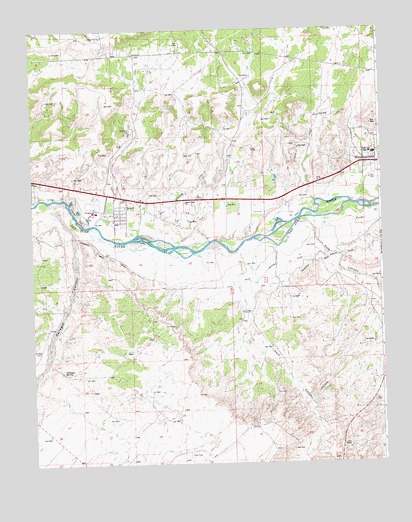
Horn Canyon, NM USGS Topographic Map
Click on map above to begin viewing in our Map Viewer.

This topographic map contains these locations and features:
Feature Name Type Latitude Longitude GNIS ID View Map
Desert Hills ChurchChurchN36.7003°W108.0703°888338View Map
Gallegos CanyonValleyN36.6992°W108.1165°889287View Map
Gallegos SpringSpringN36.6515°W108.1146°889293View Map
George Salmon Homestead Historic SiteLocaleN36.7072°W108.0131°933769View Map
Hammond Main CanalCanalN36.6842°W108.0959°889740View Map
Horn CanyonValleyN36.6867°W108.0515°890131View Map
Keller Field Airport (historical)AirportN36.6859°W108.0857°936951View Map
Kutz CanyonValleyN36.6947°W108.0306°890756View Map
Kutz Canyon DitchCanalN36.6814°W108.0356°890757View Map
Lee AcresPopulated PlaceN36.6989°W108.0367°901673View Map
Lee Acres Census Designated PlaceCensusN36.7103°W108.0721°2584139View Map
Mesa Alta Junior High SchoolSchoolN36.7142°W108.0026°891859View Map
New Mexico State University Agricultural Experimental StationLocaleN36.6833°W108.0256°914266View Map
PN-1 Water WellWellN36.6897°W108.0956°927147View Map
PN-2 Water WellWellN36.6908°W108.0953°927148View Map
PN-3 Water WellWellN36.6925°W108.0953°927149View Map
PN-4 Water WellWellN36.6936°W108.0956°926977View Map
PS-1 Water WellWellN36.6892°W108.0956°927146View Map
PS-3 Water WellWellN36.6869°W108.0956°927144View Map
Riverside ChurchChurchN36.6992°W108.0917°893986View Map
Salmon Ruin Historical MarkerParkN36.7072°W108.0131°932361View Map
Salmon RuinsLocaleN36.7072°W108.0131°901497View Map
San Juan County Archaeological Research CenterBuildingN36.7072°W108.0131°929237View Map
San Juan County Fire District 6 Lee AcresBuildingN36.6979°W108.0961°2657831View Map
West Hammond Census Designated PlaceCensusN36.6808°W108.0494°2584236View Map

Note: Coordinates in the location and feature list above are referenced to NAD83 datum.


Copyright (C) 2008-2025 Ryan Niemi / Sunset Dynamics ... All Rights Reserved