TopoQuest Logo
Do you find TopoQuest useful?
Help keep TopoQuest running and adding new maps/features by donating!
Bitcoin:  19c7KJd3qBynnjoSw5npx9KScwjBe4ifkT
Litecoin:  LXs6TkuXGGXo1vDsWCkWVdjQX94eUKd6ui
Home View Maps Find Maps Find Places Resources & Links


Bloomfield, New Mexico Topographic Map

USGS Map Title: Bloomfield, NM
USGS Map MRC: 36107F8
DRG (GeoTIFF) Download: o36107f8.tif


Neighboring USGS Topographic Map Quads:


  Flora Vista, NM  
36108G1
 

  Aztec, NM  
36107G8
 

  Turley, NM  
36107G7
 

  Horn Canyon, NM  
36108F1
 

  Bloomfield, NM  
36107F8
 

  Blanco, NM  
36107F7
 

  Gallegos Trading Post, NM  
36108E1
 

  East Fork Kutz Canyon, NM  
36107E8
 

  Huerfanito Peak, NM  
36107E7


Map MRC Location:

N37°
W108°
N37°
W107°
H8 H7 H6 H5 H4 H3 H2 H1
G8 G7 G6 G5 G4 G3 G2 G1
F8 F7 F6 F5 F4 F3 F2 F1
E8 E7 E6 E5 E4 E3 E2 E1
D8 D7 D6 D5 D4 D3 D2 D1
C8 C7 C6 C5 C4 C3 C2 C1
B8 B7 B6 B5 B4 B3 B2 B1
A8 A7 A6 A5 A4 A3 A2 A1
N36°
W108°
N36°
W107°

Bloomfield, NM USGS 1:24K Topographic Map Preview:
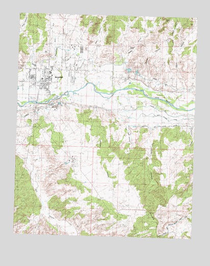
Bloomfield, NM USGS Topographic Map
Click on map above to begin viewing in our Map Viewer.

This topographic map contains these locations and features:
Feature Name Type Latitude Longitude GNIS ID View Map
Berea Baptist ChurchChurchN36.7111°W107.9928°920484View Map
Berean Mission Navajo SchoolSchoolN36.7128°W107.9837°934201View Map
Bible Baptist Shepherd ChurchChurchN36.7111°W107.9928°920461View Map
Blanco Elementary SchoolSchoolN36.7128°W107.9837°901360View Map
BloomfieldPopulated PlaceN36.7111°W107.9845°902180View Map
Bloomfield CanyonValleyN36.7033°W107.9715°886503View Map
Bloomfield Fire DepartmentBuildingN36.7195°W107.9798°2657567View Map
Bloomfield Fire Department Station 3BuildingN36.7007°W107.9921°2658201View Map
Bloomfield Police DepartmentBuildingN36.7198°W107.9798°2722573View Map
Bloomfield Post OfficePost OfficeN36.7120°W107.9918°938111View Map
Bloomfield Weather StationLocaleN36.7111°W107.9845°932440View Map
Calvary Southern Baptist ChurchChurchN36.7111°W107.9928°920483View Map
Church of ChristChurchN36.7111°W107.9928°920500View Map
Citizens DitchCanalN36.7228°W107.9478°887628View Map
City of BloomfieldCivilN36.7266°W107.9792°2409865View Map
Creighton CanyonValleyN36.7036°W107.9062°888067View Map
Dzilth-na-o-dith-hleSchoolN36.7128°W107.9837°934089View Map
First Assembly of God ChurchChurchN36.7111°W107.9928°920474View Map
Hammond CemeteryCemeteryN36.6894°W107.9084°889739View Map
Light of His Way ChurchChurchN36.7111°W107.9928°920441View Map
Mesa Alta Junior High SchoolSchoolN36.7128°W107.9837°934031View Map
Naaba Ani Elementary SchoolSchoolN36.7128°W107.9837°934029View Map
Nageezi-Deer Spring ChurchChurchN36.7111°W107.9928°920501View Map
Potter CanyonValleyN36.7072°W107.9417°893442View Map
Rio Vista Elementary SchoolSchoolN36.7128°W107.9837°934030View Map
Saint Marys ChurchChurchN36.7144°W107.9934°894283View Map
San Juan County Fire District 9 Sullivan RoadBuildingN36.6967°W107.9374°2657873View Map
Seventh Day Adventist-Bloomfield ChurchChurchN36.7111°W107.9928°920469View Map
Slane CanyonValleyN36.7020°W107.8912°894910View Map
Sullivan CanyonValleyN36.7061°W107.9562°895417View Map
The Church of Jesus Christ of Latter Day SaintsChurchN36.7111°W107.9928°920442View Map
Tom Gale CanyonValleyN36.7039°W107.9351°895733View Map
United States Forest Service BloomfieldBuildingN36.7117°W107.9704°2658197View Map
Valdez DrawValleyN36.7100°W107.9126°896069View Map

Note: Coordinates in the location and feature list above are referenced to NAD83 datum.


Copyright (C) 2008-2025 Ryan Niemi / Sunset Dynamics ... All Rights Reserved