TopoQuest Logo
Do you find TopoQuest useful?
Help keep TopoQuest running and adding new maps/features by donating!
Bitcoin:  19c7KJd3qBynnjoSw5npx9KScwjBe4ifkT
Litecoin:  LXs6TkuXGGXo1vDsWCkWVdjQX94eUKd6ui
Home View Maps Find Maps Find Places Resources & Links


Horse Camp Waterhole, Texas Topographic Map

USGS Map Title: Horse Camp Waterhole, TX
USGS Map MRC: 30099B7
DRG (GeoTIFF) Download: o30099b7.tif


Neighboring USGS Topographic Map Quads:


  Telegraph, TX  
30099C8
 

  Junction SE, TX  
30099C7
 

  Allen Creek, TX  
30099C6
 

  Bradford Creek, TX  
30099B8
 

  Horse Camp Waterhole, TX  
30099B7
 

  Y O Ranch, TX  
30099B6
 

  Earwood Creek SW, TX  
30099A8
 

  Earwood Creek, TX  
30099A7
 

  Garven Store, TX  
30099A6


Map MRC Location:

N31°
W100°
N31°
W99°
H8 H7 H6 H5 H4 H3 H2 H1
G8 G7 G6 G5 G4 G3 G2 G1
F8 F7 F6 F5 F4 F3 F2 F1
E8 E7 E6 E5 E4 E3 E2 E1
D8 D7 D6 D5 D4 D3 D2 D1
C8 C7 C6 C5 C4 C3 C2 C1
B8 B7 B6 B5 B4 B3 B2 B1
A8 A7 A6 A5 A4 A3 A2 A1
N30°
W100°
N30°
W99°

Horse Camp Waterhole, TX USGS 1:24K Topographic Map Preview:
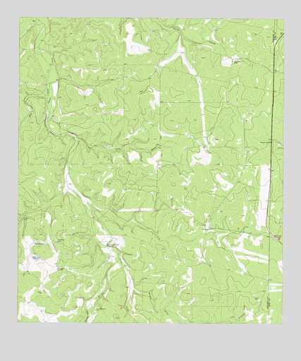
Horse Camp Waterhole, TX USGS Topographic Map
Click on map above to begin viewing in our Map Viewer.

This topographic map contains these locations and features:
Feature Name Type Latitude Longitude GNIS ID View Map
Beasley DrawValleyN30.2236°W99.8617°1330261View Map
Bundy-Ross RanchLocaleN30.2327°W99.7742°1331650View Map
Cedar TankReservoirN30.1516°W99.8659°1332482View Map
Deer Leg WindmillLocaleN30.1471°W99.8537°1334215View Map
Earwood CreekStreamN30.1302°W99.8428°1334867View Map
Goat TankReservoirN30.1574°W99.8672°1336619View Map
Horse Camp WaterholeLakeN30.1560°W99.8323°1338095View Map
Hunger CreekStreamN30.1508°W99.8276°1374177View Map
Jackson RanchLocaleN30.1638°W99.7845°1338602View Map
Louise WindmillLocaleN30.1302°W99.8384°1340653View Map
Lydle DrawValleyN30.2005°W99.8470°1340748View Map
Paint Creek WindmillLocaleN30.1608°W99.7537°1343436View Map
Sampson WindmillLocaleN30.1994°W99.7556°1346284View Map
Valentine TankReservoirN30.1588°W99.8569°1349151View Map
Wildcat DrawValleyN30.1386°W99.8201°1376795View Map

Note: Coordinates in the location and feature list above are referenced to NAD83 datum.


Copyright (C) 2008-2025 Ryan Niemi / Sunset Dynamics ... All Rights Reserved