TopoQuest Logo
Do you find TopoQuest useful?
Help keep TopoQuest running and adding new maps/features by donating!
Bitcoin:  19c7KJd3qBynnjoSw5npx9KScwjBe4ifkT
Litecoin:  LXs6TkuXGGXo1vDsWCkWVdjQX94eUKd6ui
Home View Maps Find Maps Find Places Resources & Links


Y O Ranch, Texas Topographic Map

USGS Map Title: Y O Ranch, TX
USGS Map MRC: 30099B6
DRG (GeoTIFF) Download: o30099b6.tif


Neighboring USGS Topographic Map Quads:


  Junction SE, TX  
30099C7
 

  Allen Creek, TX  
30099C6
 

  Mudge Draw, TX  
30099C5
 

  Horse Camp Waterhole, TX  
30099B7
 

  Y O Ranch, TX  
30099B6
 

  Live Oak Ranch, TX  
30099B5
 

  Earwood Creek, TX  
30099A7
 

  Garven Store, TX  
30099A6
 

  Boneyard Draw, TX  
30099A5


Map MRC Location:

N31°
W100°
N31°
W99°
H8 H7 H6 H5 H4 H3 H2 H1
G8 G7 G6 G5 G4 G3 G2 G1
F8 F7 F6 F5 F4 F3 F2 F1
E8 E7 E6 E5 E4 E3 E2 E1
D8 D7 D6 D5 D4 D3 D2 D1
C8 C7 C6 C5 C4 C3 C2 C1
B8 B7 B6 B5 B4 B3 B2 B1
A8 A7 A6 A5 A4 A3 A2 A1
N30°
W100°
N30°
W99°

Y O Ranch, TX USGS 1:24K Topographic Map Preview:
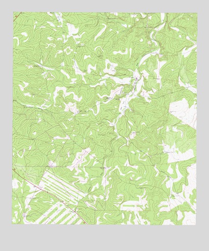
Y O Ranch, TX USGS Topographic Map
Click on map above to begin viewing in our Map Viewer.

This topographic map contains these locations and features:
Feature Name Type Latitude Longitude GNIS ID View Map
Bee Cave WindmillLocaleN30.2463°W99.6856°1330319View Map
Bluff WindmillLocaleN30.2413°W99.6598°1330953View Map
Bundy TankReservoirN30.2186°W99.7318°1331649View Map
Cedar WindmillLocaleN30.1327°W99.7076°1332487View Map
Center New WellWellN30.2299°W99.7059°1332533View Map
Deer ParkFlatN30.1955°W99.6753°1334218View Map
Deer WindmillLocaleN30.1752°W99.7356°1334225View Map
Double Gates WindmillLocaleN30.1594°W99.7234°1334527View Map
Gilmer WindmillLocaleN30.1421°W99.6414°1336536View Map
Gobblers KnobSummitN30.1994°W99.6873°1336626View Map
Kerrville WindmillLocaleN30.1791°W99.6687°1339060View Map
Little Rincon Seco WindmillLocaleN30.1402°W99.7370°1340162View Map
Middle Needham WindmillLocaleN30.1466°W99.6639°1341505View Map
Needham HouseLocaleN30.1588°W99.6859°1342395View Map
New WellWellN30.2155°W99.7023°1342518View Map
OL WindmillLocaleN30.2474°W99.7206°1342936View Map
Old Feed Pen WindmillLocaleN30.1680°W99.6464°1343143View Map
Quatro WindmillLocaleN30.1919°W99.6442°1344650View Map
Rincon Seco House WindmillLocaleN30.1296°W99.7428°1345229View Map
Rocky WindmillLocaleN30.2016°W99.7351°1345497View Map
Shearing Barn WindmillLocaleN30.1913°W99.7065°1347001View Map
Tecolote WindmillLocaleN30.1780°W99.6878°1348320View Map
Trap WindmillLocaleN30.2241°W99.6926°1348703View Map
Walter WindmillLocaleN30.2110°W99.6509°1349458View Map
West Kerr Ranch AirportAirportN30.1313°W99.7429°1386968View Map
Y O Ranch AirportAirportN30.2020°W99.6764°1387221View Map
YO RanchLocaleN30.2119°W99.6676°1350636View Map
Yo Ranch Volunteer Fire DepartmentBuildingN30.2110°W99.6653°2551237View Map

Note: Coordinates in the location and feature list above are referenced to NAD83 datum.


Copyright (C) 2008-2025 Ryan Niemi / Sunset Dynamics ... All Rights Reserved