TopoQuest Logo
Do you find TopoQuest useful?
Help keep TopoQuest running and adding new maps/features by donating!
Bitcoin:  19c7KJd3qBynnjoSw5npx9KScwjBe4ifkT
Litecoin:  LXs6TkuXGGXo1vDsWCkWVdjQX94eUKd6ui
Home View Maps Find Maps Find Places Resources & Links


Horseshoe Bend, Idaho Topographic Map

USGS Map Title: Horseshoe Bend, ID
USGS Map MRC: 43116H2
DRG (GeoTIFF) Download: o43116h2.tif


Neighboring USGS Topographic Map Quads:


  Webb Creek, ID  
44116A3
 

  Dry Buck Valley, ID  
44116A2
 

  Banks, ID  
44116A1
 

  Montour, ID  
43116H3
 

  Horseshoe Bend, ID  
43116H2
 

  Harris Creek Summit, ID  
43116H1
 

  Pearl, ID  
43116G3
 

  Cartwright Canyon, ID  
43116G2
 

  Shafer Butte, ID  
43116G1


Map MRC Location:

N44°
W117°
N44°
W116°
H8 H7 H6 H5 H4 H3 H2 H1
G8 G7 G6 G5 G4 G3 G2 G1
F8 F7 F6 F5 F4 F3 F2 F1
E8 E7 E6 E5 E4 E3 E2 E1
D8 D7 D6 D5 D4 D3 D2 D1
C8 C7 C6 C5 C4 C3 C2 C1
B8 B7 B6 B5 B4 B3 B2 B1
A8 A7 A6 A5 A4 A3 A2 A1
N43°
W117°
N43°
W116°

Horseshoe Bend, ID USGS 1:24K Topographic Map Preview:
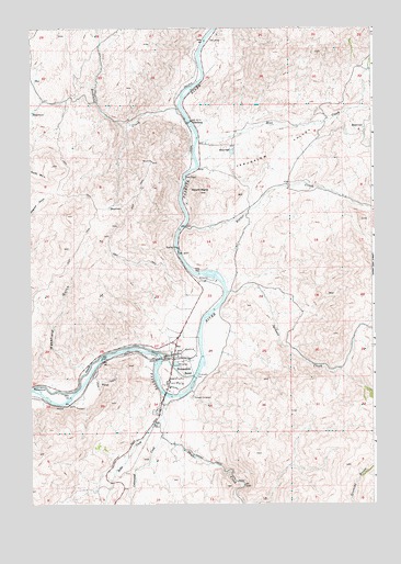
Horseshoe Bend, ID USGS Topographic Map
Click on map above to begin viewing in our Map Viewer.

This topographic map contains these locations and features:
Feature Name Type Latitude Longitude GNIS ID View Map
Brownlee CreekStreamN43.9791°W116.1954°378277View Map
City of Horseshoe BendCivilN43.9164°W116.1997°2410795View Map
Cottonwood CreekStreamN43.8932°W116.2029°379852View Map
GardenaPopulated PlaceN43.9757°W116.1910°376157View Map
Gardena Access AreaLocaleN43.9799°W116.1946°401357View Map
Hill CreekStreamN43.9707°W116.1890°383202View Map
Horseshoe BendPopulated PlaceN43.9146°W116.1979°396669View Map
Horseshoe Bend AmbulanceBuildingN43.9135°W116.1974°2642806View Map
Horseshoe Bend Elementary SchoolSchoolN43.9080°W116.2015°401029View Map
Horseshoe Bend Fire DistrictBuildingN43.9135°W116.1974°2618945View Map
Horseshoe Bend Middle - Senior High SchoolSchoolN43.9091°W116.2012°401380View Map
Horseshoe Bend Mill Pond Public Fishing AreaLocaleN43.9363°W116.1821°401388View Map
Horseshoe Bend Police DepartmentBuildingN43.9139°W116.1979°2722430View Map
Horseshoe Bend Post OfficePost OfficeN43.9153°W116.1975°2779560View Map
Jackass CreekStreamN43.9310°W116.1785°383817View Map
Jerusalem ValleyValleyN43.9632°W116.1829°373311View Map
Mount MariaSummitN43.9571°W116.1879°373828View Map
Pioneer CemeteryCemeteryN43.9034°W116.1919°374417View Map
Porter CreekStreamN43.9482°W116.1935°388784View Map
Power CanalCanalN43.9154°W116.2198°388841View Map
Robbs CreekStreamN43.8977°W116.2021°389436View Map
Shafer CreekStreamN43.9035°W116.2012°390132View Map
Wakefield GulchValleyN43.9110°W116.2315°375712View Map

Note: Coordinates in the location and feature list above are referenced to NAD83 datum.


Copyright (C) 2008-2025 Ryan Niemi / Sunset Dynamics ... All Rights Reserved