TopoQuest Logo
Do you find TopoQuest useful?
Help keep TopoQuest running and adding new maps/features by donating!
Bitcoin:  19c7KJd3qBynnjoSw5npx9KScwjBe4ifkT
Litecoin:  LXs6TkuXGGXo1vDsWCkWVdjQX94eUKd6ui
Home View Maps Find Maps Find Places Resources & Links


Montour, Idaho Topographic Map

USGS Map Title: Montour, ID
USGS Map MRC: 43116H3
DRG (GeoTIFF) Download: o43116h3.tif


Neighboring USGS Topographic Map Quads:


  Squaw Butte, ID  
44116A4
 

  Webb Creek, ID  
44116A3
 

  Dry Buck Valley, ID  
44116A2
 

  Northeast Emmett, ID  
43116H4
 

  Montour, ID  
43116H3
 

  Horseshoe Bend, ID  
43116H2
 

  Southeast Emmett, ID  
43116G4
 

  Pearl, ID  
43116G3
 

  Cartwright Canyon, ID  
43116G2


Map MRC Location:

N44°
W117°
N44°
W116°
H8 H7 H6 H5 H4 H3 H2 H1
G8 G7 G6 G5 G4 G3 G2 G1
F8 F7 F6 F5 F4 F3 F2 F1
E8 E7 E6 E5 E4 E3 E2 E1
D8 D7 D6 D5 D4 D3 D2 D1
C8 C7 C6 C5 C4 C3 C2 C1
B8 B7 B6 B5 B4 B3 B2 B1
A8 A7 A6 A5 A4 A3 A2 A1
N43°
W117°
N43°
W116°

Montour, ID USGS 1:24K Topographic Map Preview:
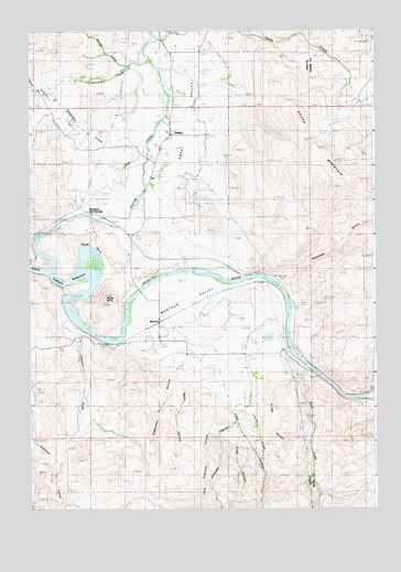
Montour, ID USGS Topographic Map
Click on map above to begin viewing in our Map Viewer.

This topographic map contains these locations and features:
Feature Name Type Latitude Longitude GNIS ID View Map
Arkansas CanyonValleyN43.8982°W116.3012°371289View Map
Baltic CanyonValleyN43.9091°W116.3201°371349View Map
Brush CanyonValleyN43.8971°W116.3001°371722View Map
Church CreekStreamN43.9199°W116.2971°372023View Map
Coon CreekStreamN43.9979°W116.3287°372116View Map
Cottonwood CreekStreamN43.9916°W116.3307°372159View Map
Deep CanyonValleyN43.9174°W116.3129°372349View Map
Gatfield Number Two DamDamN43.9199°W116.2893°398725View Map
Gem County Fire District 2 Sweet StationBuildingN43.9733°W116.3245°2619332View Map
Johnson CreekStreamN43.9224°W116.3568°373326View Map
Little Arkansas CanyonValleyN43.8943°W116.3076°373604View Map
Marsh (historical)Populated PlaceN43.9185°W116.3399°399118View Map
Monger CreekStreamN43.9913°W116.3393°373990View Map
MontourPopulated PlaceN43.9249°W116.3287°396913View Map
Montour ValleyBasinN43.9313°W116.3207°373995View Map
Peterson GulchValleyN43.9327°W116.2815°374377View Map
Regan BendBendN43.9452°W116.3554°374635View Map
Regan ButteSummitN43.9299°W116.3476°374636View Map
Rock CreekStreamN43.9129°W116.2754°374720View Map
Roystone Hot SpringsSpringN43.9543°W116.3562°374805View Map
Snyder CanyonValleyN43.9079°W116.2893°375105View Map
South MountainSummitN43.9585°W116.2649°375167View Map
Squaw CreekStreamN43.9377°W116.3671°391285View Map
Stagecoach CanyonValleyN43.9093°W116.3243°375242View Map
SweetPopulated PlaceN43.9729°W116.3246°397232View Map
Sweet - Montour Elementary - Junior High SchoolSchoolN43.9615°W116.3305°401665View Map
Sweet CemeteryCemeteryN43.9542°W116.3343°375372View Map
Sweet Post OfficePost OfficeN43.9727°W116.3246°2766824View Map
Sweet ValleyValleyN43.9377°W116.3671°375373View Map
Yergenson CreekStreamN43.9682°W116.3329°376011View Map

Note: Coordinates in the location and feature list above are referenced to NAD83 datum.


Copyright (C) 2008-2025 Ryan Niemi / Sunset Dynamics ... All Rights Reserved