TopoQuest Logo
Do you find TopoQuest useful?
Help keep TopoQuest running and adding new maps/features by donating!
Bitcoin:  19c7KJd3qBynnjoSw5npx9KScwjBe4ifkT
Litecoin:  LXs6TkuXGGXo1vDsWCkWVdjQX94eUKd6ui
Home View Maps Find Maps Find Places Resources & Links


House Mountain, Idaho Topographic Map

USGS Map Title: House Mountain, ID
USGS Map MRC: 43115D4
DRG (GeoTIFF) Download: o43115d4.tif


Neighboring USGS Topographic Map Quads:


  Prairie, ID  
43115E5
 

  Trinity Mountain, ID  
43115E4
 

  Featherville, ID  
43115E3
 

  Cathedral Rocks, ID  
43115D5
 

  House Mountain, ID  
43115D4
 

  Pine, ID  
43115D3
 

  Long Tom Reservoir, ID  
43115C5
 

  Anderson Ranch Dam, ID  
43115C4
 

  Cat Creek Summit, ID  
43115C3


Map MRC Location:

N44°
W116°
N44°
W115°
H8 H7 H6 H5 H4 H3 H2 H1
G8 G7 G6 G5 G4 G3 G2 G1
F8 F7 F6 F5 F4 F3 F2 F1
E8 E7 E6 E5 E4 E3 E2 E1
D8 D7 D6 D5 D4 D3 D2 D1
C8 C7 C6 C5 C4 C3 C2 C1
B8 B7 B6 B5 B4 B3 B2 B1
A8 A7 A6 A5 A4 A3 A2 A1
N43°
W116°
N43°
W115°

House Mountain, ID USGS 1:24K Topographic Map Preview:
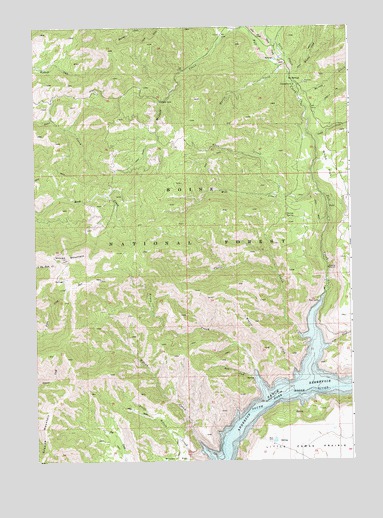
House Mountain, ID USGS Topographic Map
Click on map above to begin viewing in our Map Viewer.

This topographic map contains these locations and features:
Feature Name Type Latitude Longitude GNIS ID View Map
Camp CreekStreamN43.4674°W115.3887°378779View Map
Castle CreekStreamN43.4116°W115.3965°378997View Map
Castle Rock CampgroundLocaleN43.4113°W115.3948°394569View Map
Daveys SpringSpringN43.4457°W115.4008°380266View Map
Evans CreekStreamN43.4010°W115.4137°381507View Map
Evans Creek CampgroundLocaleN43.4002°W115.4143°394570View Map
Fall CreekStreamN43.4224°W115.3862°381550View Map
Fall Creek LodgeLocaleN43.4238°W115.3859°394568View Map
Fall Creek Recreation SiteLocaleN43.4263°W115.3848°394576View Map
Guay CreekStreamN43.4916°W115.3998°382769View Map
Herrin CreekStreamN43.4805°W115.3956°383122View Map
House MountainSummitN43.4332°W115.4876°383463View Map
Ice SpringsSpringN43.4838°W115.3984°383596View Map
Ice Springs CampgroundLocaleN43.4830°W115.3970°394575View Map
Knox CreekStreamN43.4510°W115.4001°373426View Map
Lake CreekStreamN43.4082°W115.3842°384358View Map
Little Wilson CreekStreamN43.3780°W115.4351°384995View Map
Little Wilson Creek CampgroundLocaleN43.3777°W115.4351°394565View Map
Magpie CreekStreamN43.4010°W115.3981°386359View Map
Meadow CreekStreamN43.4996°W115.4162°386678View Map
Mill CreekStreamN43.4530°W115.3876°386924View Map
Mineral CreekStreamN43.4863°W115.3979°373970View Map
Myrtle CreekStreamN43.4888°W115.4015°387441View Map
Rhead DamDamN43.3932°W115.4143°398984View Map
Rock CreekStreamN43.3996°W115.4140°389468View Map
Tally Baker CreekStreamN43.4852°W115.3993°400124View Map
White FlatFlatN43.4599°W115.3837°393338View Map
Wilson CreekStreamN43.3802°W115.4359°393543View Map

Note: Coordinates in the location and feature list above are referenced to NAD83 datum.


Copyright (C) 2008-2024 Ryan Niemi / Sunset Dynamics ... All Rights Reserved