TopoQuest Logo
Do you find TopoQuest useful?
Help keep TopoQuest running and adding new maps/features by donating!
Bitcoin:  19c7KJd3qBynnjoSw5npx9KScwjBe4ifkT
Litecoin:  LXs6TkuXGGXo1vDsWCkWVdjQX94eUKd6ui
Home View Maps Find Maps Find Places Resources & Links


Cathedral Rocks, Idaho Topographic Map

USGS Map Title: Cathedral Rocks, ID
USGS Map MRC: 43115D5
DRG (GeoTIFF) Download: o43115d5.tif


Neighboring USGS Topographic Map Quads:


  Long Gulch, ID  
43115E6
 

  Prairie, ID  
43115E5
 

  Trinity Mountain, ID  
43115E4
 

  Danskin Peak, ID  
43115D6
 

  Cathedral Rocks, ID  
43115D5
 

  House Mountain, ID  
43115D4
 

  Syrup Creek, ID  
43115C6
 

  Long Tom Reservoir, ID  
43115C5
 

  Anderson Ranch Dam, ID  
43115C4


Map MRC Location:

N44°
W116°
N44°
W115°
H8 H7 H6 H5 H4 H3 H2 H1
G8 G7 G6 G5 G4 G3 G2 G1
F8 F7 F6 F5 F4 F3 F2 F1
E8 E7 E6 E5 E4 E3 E2 E1
D8 D7 D6 D5 D4 D3 D2 D1
C8 C7 C6 C5 C4 C3 C2 C1
B8 B7 B6 B5 B4 B3 B2 B1
A8 A7 A6 A5 A4 A3 A2 A1
N43°
W116°
N43°
W115°

Cathedral Rocks, ID USGS 1:24K Topographic Map Preview:
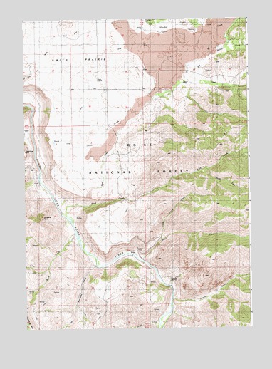
Cathedral Rocks, ID USGS Topographic Map
Click on map above to begin viewing in our Map Viewer.

This topographic map contains these locations and features:
Feature Name Type Latitude Longitude GNIS ID View Map
Bock CreekStreamN43.4132°W115.5979°377984View Map
Cathedral RocksPillarN43.4199°W115.6170°379048View Map
Cayuse CreekStreamN43.3771°W115.5518°379068View Map
Danskin Guard StationLocaleN43.4024°W115.5637°380243View Map
Dead Horse CreekStreamN43.4510°W115.6204°380300View Map
Deer CreekStreamN43.4252°W115.5920°380434View Map
Dry Buck CreekStreamN43.4743°W115.5334°380774View Map
Granite CreekStreamN43.3882°W115.5443°382525View Map
Granite SpringSpringN43.3948°W115.5450°382554View Map
Granite Spring CampgroundLocaleN43.3943°W115.5451°382557View Map
Little Pierce CreekStreamN43.4110°W115.5498°400505View Map
Mennecke CreekStreamN43.4010°W115.5862°386741View Map
Pierce CreekStreamN43.4030°W115.5606°388432View Map
Rock CreekStreamN43.4207°W115.6029°389491View Map
Smith PrairieBasinN43.4888°W115.5951°390701View Map
Smith Prairie AirportAirportN43.4972°W115.5514°400906View Map
South Fork Rock CreekStreamN43.4396°W115.5234°391009View Map
Tommy Field SpringSpringN43.4587°W115.6245°394093View Map
Trail CreekStreamN43.4371°W115.6184°392296View Map
Williams CreekStreamN43.4846°W115.5212°393466View Map

Note: Coordinates in the location and feature list above are referenced to NAD83 datum.


Copyright (C) 2008-2025 Ryan Niemi / Sunset Dynamics ... All Rights Reserved