TopoQuest Logo
Do you find TopoQuest useful?
Help keep TopoQuest running and adding new maps/features by donating!
Bitcoin:  19c7KJd3qBynnjoSw5npx9KScwjBe4ifkT
Litecoin:  LXs6TkuXGGXo1vDsWCkWVdjQX94eUKd6ui
Home View Maps Find Maps Find Places Resources & Links


Hubbard, Iowa Topographic Map

USGS Map Title: Hubbard, IA
USGS Map MRC: 42093C3
DRG (GeoTIFF) Download: o42093c3.tif


Neighboring USGS Topographic Map Quads:


  Buckeye West, IA  
42093D4
 

  Buckeye East, IA  
42093D3
 

  Owasa, IA  
42093D2
 

  Radcliffe, IA  
42093C4
 

  Hubbard, IA  
42093C3
 

  New Providence, IA  
42093C2
 

  McCallsburg, IA  
42093B4
 

  Zearing, IA  
42093B3
 

  State Center NW, IA  
42093B2


Map MRC Location:

N43°
W94°
N43°
W93°
H8 H7 H6 H5 H4 H3 H2 H1
G8 G7 G6 G5 G4 G3 G2 G1
F8 F7 F6 F5 F4 F3 F2 F1
E8 E7 E6 E5 E4 E3 E2 E1
D8 D7 D6 D5 D4 D3 D2 D1
C8 C7 C6 C5 C4 C3 C2 C1
B8 B7 B6 B5 B4 B3 B2 B1
A8 A7 A6 A5 A4 A3 A2 A1
N42°
W94°
N42°
W93°

Hubbard, IA USGS 1:24K Topographic Map Preview:
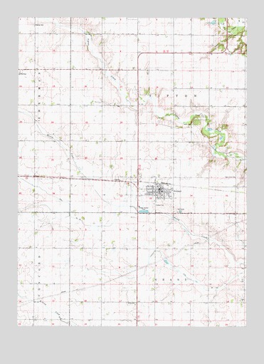
Hubbard, IA USGS Topographic Map
Click on map above to begin viewing in our Map Viewer.

This topographic map contains these locations and features:
Feature Name Type Latitude Longitude GNIS ID View Map
Boylan CemeteryCemeteryN42.3318°W93.2804°454794View Map
Brubaker-Hoelscher City ParkParkN42.3050°W93.2913°1997624View Map
City of HubbardCivilN42.3061°W93.3013°2394436View Map
Drainage Ditch Number 110CanalN42.2730°W93.2885°465762View Map
Drainage Ditch Number 55CanalN42.3000°W93.3497°465799View Map
Grave of Eli Hoover Historical MarkerParkN42.2994°W93.3008°1997685View Map
HubbardPopulated PlaceN42.3055°W93.3002°457702View Map
Hubbard (historical)LocaleN42.3075°W93.2988°1997623View Map
Hubbard Ambulance ServiceBuildingN42.3060°W93.2962°2599921View Map
Hubbard CemeteryCemeteryN42.2991°W93.3007°457704View Map
Hubbard City HallBuildingN42.3058°W93.2966°1997633View Map
Hubbard Fire DepartmentBuildingN42.3070°W93.2955°2577289View Map
Hubbard Golf and Recreation ClubLocaleN42.2972°W93.2863°1997625View Map
Hubbard Post OfficePost OfficeN42.3058°W93.2977°1997629View Map
Hubbard PrairieParkN42.3111°W93.3488°1997466View Map
Hubbard Public LibraryBuildingN42.3058°W93.2966°1997632View Map
IdahoLocaleN42.2694°W93.3297°466247View Map
Idaho CemeteryCemeteryN42.2595°W93.3151°457746View Map
Idaho Post Office (historical)Post OfficeN42.2694°W93.3297°1997501View Map
McFarland Family Health CenterHospitalN42.3053°W93.2960°1997630View Map
Saint John's Evangelical Lutheran ChurchChurchN42.3047°W93.2963°1997628View Map
Salem United Methodist ChurchChurchN42.3047°W93.2969°1997626View Map
ShermanPopulated PlaceN42.3539°W93.3738°464743View Map
Sherman Post Office (historical)Post OfficeN42.3539°W93.3738°1997503View Map
Sherman Township CemeteryCemeteryN42.3718°W93.3667°461570View Map
South Hardin Middle SchoolSchoolN42.3040°W93.2980°1997631View Map
Tipton Grove CemeteryCemeteryN42.3103°W93.2557°462259View Map
Tipton Grove Post Office (historical)Post OfficeN42.3189°W93.2585°466493View Map
Township of GrantCivilN42.2525°W93.2892°467941View Map
Township of TiptonCivilN42.3395°W93.2893°468793View Map
Zion United Church of ChristChurchN42.3047°W93.2980°1997627View Map

Note: Coordinates in the location and feature list above are referenced to NAD83 datum.


Copyright (C) 2008-2024 Ryan Niemi / Sunset Dynamics ... All Rights Reserved