TopoQuest Logo
Do you find TopoQuest useful?
Help keep TopoQuest running and adding new maps/features by donating!
Bitcoin:  19c7KJd3qBynnjoSw5npx9KScwjBe4ifkT
Litecoin:  LXs6TkuXGGXo1vDsWCkWVdjQX94eUKd6ui
Home View Maps Find Maps Find Places Resources & Links


Buckeye East, Iowa Topographic Map

USGS Map Title: Buckeye East, IA
USGS Map MRC: 42093D3
DRG (GeoTIFF) Download: o42093d3.tif


Neighboring USGS Topographic Map Quads:


  Popejoy, IA  
42093E4
 

  Iowa Falls West, IA  
42093E3
 

  Iowa Falls East, IA  
42093E2
 

  Buckeye West, IA  
42093D4
 

  Buckeye East, IA  
42093D3
 

  Owasa, IA  
42093D2
 

  Radcliffe, IA  
42093C4
 

  Hubbard, IA  
42093C3
 

  New Providence, IA  
42093C2


Map MRC Location:

N43°
W94°
N43°
W93°
H8 H7 H6 H5 H4 H3 H2 H1
G8 G7 G6 G5 G4 G3 G2 G1
F8 F7 F6 F5 F4 F3 F2 F1
E8 E7 E6 E5 E4 E3 E2 E1
D8 D7 D6 D5 D4 D3 D2 D1
C8 C7 C6 C5 C4 C3 C2 C1
B8 B7 B6 B5 B4 B3 B2 B1
A8 A7 A6 A5 A4 A3 A2 A1
N42°
W94°
N42°
W93°

Buckeye East, IA USGS 1:24K Topographic Map Preview:
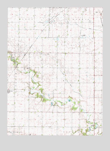
Buckeye East, IA USGS Topographic Map
Click on map above to begin viewing in our Map Viewer.

This topographic map contains these locations and features:
Feature Name Type Latitude Longitude GNIS ID View Map
BuckeyePopulated PlaceN42.4172°W93.3749°454934View Map
Buckeye City HallBuildingN42.4172°W93.3749°1997679View Map
Buckeye Co-op ElevatorLocaleN42.4172°W93.3749°1997678View Map
Buckeye Fire Department Station 1 HeadquartersBuildingN42.4175°W93.3746°2577458View Map
Buckeye Fire Department Station 2BuildingN42.4176°W93.3732°2577246View Map
Buckeye Post Office (historical)Post OfficeN42.4172°W93.3749°1997676View Map
CottageLocaleN42.4044°W93.3102°466249View Map
Cottage CemeteryCemeteryN42.4048°W93.3136°455651View Map
Cottage Community ChurchChurchN42.3972°W93.3085°455652View Map
Cottage Post Office (historical)Post OfficeN42.4044°W93.3102°1997512View Map
EllisLocaleN42.4555°W93.2985°466250View Map
Ellis ChurchChurchN42.4550°W93.2996°456318View Map
Ellis Post Office (historical)Post OfficeN42.4555°W93.2985°1997513View Map
Gehrke Wildlife AreaParkN42.4069°W93.3121°456865View Map
Gehrkes LakeReservoirN42.4057°W93.3169°1997469View Map
Hansen Swamp Public Hunting AreaParkN42.4989°W93.2835°457238View Map
Iowa Falls Municipal AirportAirportN42.4693°W93.2649°466831View Map
Izaak Walton County ParkParkN42.3853°W93.2585°1823474View Map
Lincoln CemeteryCemeteryN42.3963°W93.2545°458359View Map
Logsdon ParkParkN42.3825°W93.2646°1997468View Map
North Lawn Memory Gardens CemeteryCemeteryN42.4865°W93.2679°1997699View Map
Peace United Church of ChristChurchN42.4172°W93.3749°1997677View Map
Pilgrim Creek (historical)LocaleN42.4375°W93.3502°466251View Map
RacinePopulated PlaceN42.4703°W93.3294°464134View Map
Racine (historical)LocaleN42.4703°W93.3377°1997511View Map
Robinson Wildlife AreaParkN42.4258°W93.3383°460703View Map
Sielaff Helo Pad HeliportAirportN42.4722°W93.3044°466832View Map
Tipton Norwegian Lutheran CemeteryCemeteryN42.3753°W93.3462°462260View Map
Township of EllisCivilN42.4269°W93.2892°467786View Map
Twin Elms Access AreaLocaleN42.4491°W93.3683°1823473View Map

Note: Coordinates in the location and feature list above are referenced to NAD83 datum.


Copyright (C) 2008-2025 Ryan Niemi / Sunset Dynamics ... All Rights Reserved