TopoQuest Logo
Do you find TopoQuest useful?
Help keep TopoQuest running and adding new maps/features by donating!
Bitcoin:  19c7KJd3qBynnjoSw5npx9KScwjBe4ifkT
Litecoin:  LXs6TkuXGGXo1vDsWCkWVdjQX94eUKd6ui
Home View Maps Find Maps Find Places Resources & Links


Huckleberry Mountain, Montana Topographic Map

USGS Map Title: Huckleberry Mountain, MT
USGS Map MRC: 48114E2
DRG (GeoTIFF) Download: o48114e2.tif


Neighboring USGS Topographic Map Quads:


  Cyclone Lake, MT  
48114F3
 

  Demers Ridge, MT  
48114F2
 

  Camas Ridge West, MT  
48114F1
 

  Skookoleel Creek, MT  
48114E3
 

  Huckleberry Mountain, MT  
48114E2
 

  McGee Meadow, MT  
48114E1
 

  Whitefish, MT  
48114D3
 

  Columbia Falls North, MT  
48114D2
 

  Hungry Horse, MT  
48114D1


Map MRC Location:

N49°
W115°
N49°
W114°
H8 H7 H6 H5 H4 H3 H2 H1
G8 G7 G6 G5 G4 G3 G2 G1
F8 F7 F6 F5 F4 F3 F2 F1
E8 E7 E6 E5 E4 E3 E2 E1
D8 D7 D6 D5 D4 D3 D2 D1
C8 C7 C6 C5 C4 C3 C2 C1
B8 B7 B6 B5 B4 B3 B2 B1
A8 A7 A6 A5 A4 A3 A2 A1
N48°
W115°
N48°
W114°

Huckleberry Mountain, MT USGS 1:24K Topographic Map Preview:
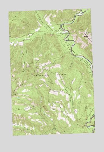
Huckleberry Mountain, MT USGS Topographic Map
Click on map above to begin viewing in our Map Viewer.

This topographic map contains these locations and features:
Feature Name Type Latitude Longitude GNIS ID View Map
1967 Huckleberry FireburnAreaN48.5897°W114.1615°794255View Map
Big CreekStreamN48.6039°W114.1640°779789View Map
Big Creek CampgroundLocaleN48.6005°W114.1632°798964View Map
Big Creek Work CenterLocaleN48.6014°W114.1676°779797View Map
Canyon CreekStreamN48.5075°W114.1396°780900View Map
Deep CreekStreamN48.5830°W114.1579°782198View Map
Depuy CreekStreamN48.5069°W114.1582°782305View Map
Dry CreekStreamN48.5505°W114.1262°782560View Map
Great Northern FlatsFlatN48.5725°W114.1343°784258View Map
Great Northern Flats use siteLocaleN48.5677°W114.1307°794258View Map
Hell Roaring CreekStreamN48.5777°W114.1523°784724View Map
Huckleberry MountainSummitN48.6003°W114.1343°785135View Map
Kimmerly CreekStreamN48.5052°W114.1868°785736View Map
Langford CreekStreamN48.6033°W114.1887°785951View Map
Lookout CreekStreamN48.5980°W114.2304°786548View Map
McGinnis CreekStreamN48.5072°W114.1418°787054View Map
Standard PeakSummitN48.5420°W114.2469°791422View Map
Steamer OakesLocaleN48.5197°W114.1298°801921View Map
Upper Big Creek CampgroundLocaleN48.6102°W114.1721°792609View Map
Vogt CreekStreamN48.6011°W114.2001°792729View Map

Note: Coordinates in the location and feature list above are referenced to NAD83 datum.


Copyright (C) 2008-2025 Ryan Niemi / Sunset Dynamics ... All Rights Reserved