TopoQuest Logo
Do you find TopoQuest useful?
Help keep TopoQuest running and adding new maps/features by donating!
Bitcoin:  19c7KJd3qBynnjoSw5npx9KScwjBe4ifkT
Litecoin:  LXs6TkuXGGXo1vDsWCkWVdjQX94eUKd6ui
Home View Maps Find Maps Find Places Resources & Links


Hudiburgh Reservoir SE, Montana Topographic Map

USGS Map Title: Hudiburgh Reservoir SE, MT
USGS Map MRC: 47105E5
DRG (GeoTIFF) Download: o47105e5.tif


Neighboring USGS Topographic Map Quads:


  Hudiburgh Reservoir NW, MT  
47105F6
 

  Hudiburgh Reservoir, MT  
47105F5
 

  Beery Reservoir, MT  
47105F4
 

  Haynie Reservoir, MT  
47105E6
 

  Hudiburgh Reservoir SE, MT  
47105E5
 

  Buffalo Creek, MT  
47105E4
 

  Youngquist Mine, MT  
47105D6
 

  Circle, MT  
47105D5
 

  Woodworth Hill, MT  
47105D4


Map MRC Location:

N48°
W106°
N48°
W105°
H8 H7 H6 H5 H4 H3 H2 H1
G8 G7 G6 G5 G4 G3 G2 G1
F8 F7 F6 F5 F4 F3 F2 F1
E8 E7 E6 E5 E4 E3 E2 E1
D8 D7 D6 D5 D4 D3 D2 D1
C8 C7 C6 C5 C4 C3 C2 C1
B8 B7 B6 B5 B4 B3 B2 B1
A8 A7 A6 A5 A4 A3 A2 A1
N47°
W106°
N47°
W105°

Hudiburgh Reservoir SE, MT USGS 1:24K Topographic Map Preview:
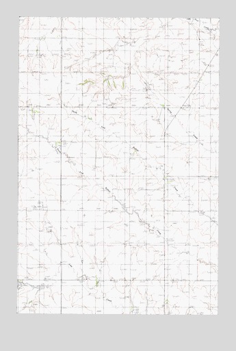
Hudiburgh Reservoir SE, MT USGS Topographic Map
Click on map above to begin viewing in our Map Viewer.

This topographic map contains these locations and features:
Feature Name Type Latitude Longitude GNIS ID View Map
20N48E01AADB01 WellWellN47.5264°W105.5358°823605View Map
20N48E02CCCC01 WellWellN47.5156°W105.5750°823531View Map
20N48E02CCCC02 WellWellN47.5156°W105.5750°823532View Map
20N48E04ACDC01 WellWellN47.5231°W105.6044°823590View Map
20N48E04DCDD01 WellWellN47.5156°W105.6039°823533View Map
20N48E08AAAC01 WellWellN47.5133°W105.6206°823506View Map
20N48E08AAAC02 WellWellN47.5133°W105.6206°823507View Map
20N48E08AABA01 WellWellN47.5142°W105.6225°823515View Map
20N48E10ABAB01 WellWellN47.5142°W105.5831°823513View Map
20N48E10ABAB02 WellWellN47.5142°W105.5831°823514View Map
20N48E11BBCC01 WellWellN47.5120°W105.5750°823496View Map
20N48E11BBCC02 WellWellN47.5120°W105.5750°823497View Map
20N49E06BDBD01 WellWellN47.5236°W105.5272°823597View Map
20N49E07CBCA01 WellWellN47.5047°W105.5308°823454View Map
21N48E02ADDD01 WellWellN47.6097°W105.5131°824042View Map
21N48E09BACA01 WellWellN47.5989°W105.5694°823977View Map
21N48E10BDDD01 WellWellN47.5953°W105.5453°823956View Map
21N48E10DDDC01 WellWellN47.5878°W105.5353°823914View Map
21N48E10DDDC02 WellWellN47.5878°W105.5353°823915View Map
21N48E12BBCB01 WellWellN47.5989°W105.5111°823976View Map
21N48E12BBDC01 WellWellN47.5986°W105.5061°823975View Map
21N48E15ADBD01 WellWellN47.5820°W105.5372°823878View Map
21N48E22BCAC01 WellWellN47.5675°W105.5514°823806View Map
21N48E22CCCD01 WellWellN47.5589°W105.5533°823763View Map
21N48E22DDAB01 WellWellN47.5611°W105.5353°823777View Map
21N48E25BABB01 WellWellN47.5720°W105.5056°823823View Map
21N48E26BBBC01 WellWellN47.5567°W105.5325°823754View Map
21N48E26BBCC01 WellWellN47.5553°W105.5325°823746View Map
21N48E26BBCD01 WellWellN47.5553°W105.5317°823745View Map
21N48E27BDCC01 WellWellN47.5517°W105.5486°823732View Map
21N48E30CDAA01 WellWellN47.5467°W105.6097°823713View Map
21N48E31DACB01 WellWellN47.5336°W105.6022°823644View Map
22N48E34DDDC01 WellWellN47.6170°W105.5361°824091View Map
Lost Creek (historical)Populated PlaceN47.5167°W105.5839°1716185View Map
Pawlowski Number 1 DamDamN47.5117°W105.6056°795506View Map

Note: Coordinates in the location and feature list above are referenced to NAD83 datum.


Copyright (C) 2008-2025 Ryan Niemi / Sunset Dynamics ... All Rights Reserved