TopoQuest Logo
Do you find TopoQuest useful?
Help keep TopoQuest running and adding new maps/features by donating!
Bitcoin:  19c7KJd3qBynnjoSw5npx9KScwjBe4ifkT
Litecoin:  LXs6TkuXGGXo1vDsWCkWVdjQX94eUKd6ui
Home View Maps Find Maps Find Places Resources & Links


Hudson, Wyoming Topographic Map

USGS Map Title: Hudson, WY
USGS Map MRC: 42108H5
DRG (GeoTIFF) Download: o42108h5.tif


Neighboring USGS Topographic Map Quads:


  Mule Butte, WY  
43108A6
 

  Pavillion SE, WY  
43108A5
 

  Riverton West, WY  
43108A4
 

  Lander NW, WY  
42108H6
 

  Hudson, WY  
42108H5
 

  Arapahoe, WY  
42108H4
 

  Lander, WY  
42108G6
 

  Lander SE, WY  
42108G5
 

  Ninemile Hill, WY  
42108G4


Map MRC Location:

N43°
W109°
N43°
W108°
H8 H7 H6 H5 H4 H3 H2 H1
G8 G7 G6 G5 G4 G3 G2 G1
F8 F7 F6 F5 F4 F3 F2 F1
E8 E7 E6 E5 E4 E3 E2 E1
D8 D7 D6 D5 D4 D3 D2 D1
C8 C7 C6 C5 C4 C3 C2 C1
B8 B7 B6 B5 B4 B3 B2 B1
A8 A7 A6 A5 A4 A3 A2 A1
N42°
W109°
N42°
W108°

Hudson, WY USGS 1:24K Topographic Map Preview:
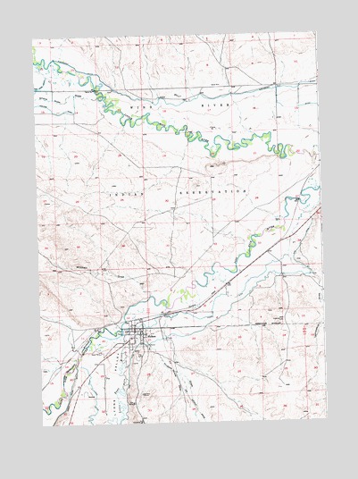
Hudson, WY USGS Topographic Map
Click on map above to begin viewing in our Map Viewer.

This topographic map contains these locations and features:
Feature Name Type Latitude Longitude GNIS ID View Map
Alkali DrawValleyN42.9927°W108.6001°1584771View Map
Big Corral DitchCanalN42.9122°W108.5490°1585434View Map
Concetta Palicichio MineMineN42.8852°W108.5815°1746503View Map
Fremont County Fire Protection District Battalion 10 HudsonBuildingN42.9035°W108.5833°2673529View Map
HudsonPopulated PlaceN42.9061°W108.5834°1609105View Map
Hudson CemeteryCemeteryN42.8991°W108.5773°2774461View Map
Hudson DrawValleyN42.9038°W108.5879°1589788View Map
Hudson Post OfficePost OfficeN42.9040°W108.5838°2765605View Map
Hudson SchoolSchoolN42.9061°W108.5834°1795487View Map
Lamoreaux DrawValleyN42.9255°W108.5126°1590499View Map
Little Popo Agie RiverStreamN42.9055°W108.5890°1601021View Map
Lyons ValleyValleyN42.9022°W108.5907°1591140View Map
Mitchell DrawValleyN42.9161°W108.5762°1591662View Map
Schroeder MineMineN42.8752°W108.5862°1746504View Map
Sharp Nose DrawValleyN42.9802°W108.5968°1594162View Map
Town of HudsonCivilN42.9027°W108.5820°2412777View Map
Warren DrainCanalN42.9758°W108.5212°1596049View Map
Wise DitchCanalN42.9077°W108.5493°1596565View Map
Wyoming Central MineMineN42.8888°W108.5854°1746505View Map

Note: Coordinates in the location and feature list above are referenced to NAD83 datum.


Copyright (C) 2008-2025 Ryan Niemi / Sunset Dynamics ... All Rights Reserved