TopoQuest Logo
Do you find TopoQuest useful?
Help keep TopoQuest running and adding new maps/features by donating!
Bitcoin:  19c7KJd3qBynnjoSw5npx9KScwjBe4ifkT
Litecoin:  LXs6TkuXGGXo1vDsWCkWVdjQX94eUKd6ui
Home View Maps Find Maps Find Places Resources & Links


Arapahoe, Wyoming Topographic Map

USGS Map Title: Arapahoe, WY
USGS Map MRC: 42108H4
DRG (GeoTIFF) Download: o42108h4.tif


Neighboring USGS Topographic Map Quads:


  Pavillion SE, WY  
43108A5
 

  Riverton West, WY  
43108A4
 

  Riverton East, WY  
43108A3
 

  Hudson, WY  
42108H5
 

  Arapahoe, WY  
42108H4
 

  Arapahoe NE, WY  
42108H3
 

  Lander SE, WY  
42108G5
 

  Ninemile Hill, WY  
42108G4
 

  Bringolf Ranch, WY  
42108G3


Map MRC Location:

N43°
W109°
N43°
W108°
H8 H7 H6 H5 H4 H3 H2 H1
G8 G7 G6 G5 G4 G3 G2 G1
F8 F7 F6 F5 F4 F3 F2 F1
E8 E7 E6 E5 E4 E3 E2 E1
D8 D7 D6 D5 D4 D3 D2 D1
C8 C7 C6 C5 C4 C3 C2 C1
B8 B7 B6 B5 B4 B3 B2 B1
A8 A7 A6 A5 A4 A3 A2 A1
N42°
W109°
N42°
W108°

Arapahoe, WY USGS 1:24K Topographic Map Preview:
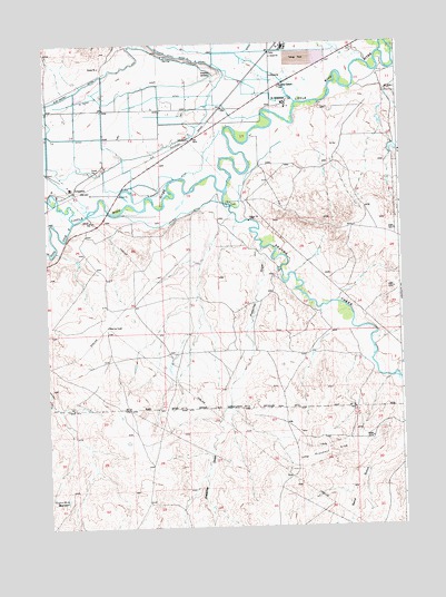
Arapahoe, WY USGS Topographic Map
Click on map above to begin viewing in our Map Viewer.

This topographic map contains these locations and features:
Feature Name Type Latitude Longitude GNIS ID View Map
Arapaho Elementary SchoolSchoolN42.9642°W108.4901°1795514View Map
ArapahoePopulated PlaceN42.9622°W108.4898°1584915View Map
Arapahoe Catholic CemeteryCemeteryN42.9887°W108.4165°1584917View Map
Arapahoe CemeteryCemeteryN42.9922°W108.4421°1584918View Map
Arapahoe Census Designated PlaceCensusN42.9911°W108.4563°2407752View Map
Arapahoe Middle SchoolSchoolN42.9622°W108.4898°1795513View Map
Beaver CreekStreamN42.9616°W108.4359°1598061View Map
Double DitchCanalN42.9563°W108.4518°1587735View Map
Fort Washakie Post CemeteryCemeteryN42.9873°W108.4987°2774460View Map
Gustin Number 2 ReservoirReservoirN42.8830°W108.4937°1605295View Map
Lefthand DitchCanalN42.9969°W108.4521°1590632View Map
Mission DitchCanalN42.9650°W108.4557°1591652View Map
Popo Agie RiverStreamN42.9541°W108.4901°1609142View Map
Preacher DrawValleyN42.9472°W108.4240°1593026View Map
Saint StephensPopulated PlaceN42.9838°W108.4165°1609148View Map
Saint Stephens Post OfficePost OfficeN42.9845°W108.4160°2765620View Map
Sub-Agency DitchCanalN42.9883°W108.4879°1595137View Map

Note: Coordinates in the location and feature list above are referenced to NAD83 datum.


Copyright (C) 2008-2024 Ryan Niemi / Sunset Dynamics ... All Rights Reserved