TopoQuest Logo
Do you find TopoQuest useful?
Help keep TopoQuest running and adding new maps/features by donating!
Bitcoin:  19c7KJd3qBynnjoSw5npx9KScwjBe4ifkT
Litecoin:  LXs6TkuXGGXo1vDsWCkWVdjQX94eUKd6ui
Home View Maps Find Maps Find Places Resources & Links


Hunger Mountain, Washington Topographic Map

USGS Map Title: Hunger Mountain, WA
USGS Map MRC: 47124H1
DRG (GeoTIFF) Download: o47124h1.tif


Neighboring USGS Topographic Map Quads:


  Deadmans Hill, WA  
48124A2
 

  Snider Peak, WA  
48124A1
 

  Mount Muller, WA  
48123A8
 

  Indian Pass, WA  
47124H2
 

  Hunger Mountain, WA  
47124H1
 

  Slide Peak, WA  
47123H8
 

  Winfield Creek, WA  
47124G2
 

  Spruce Mountain, WA  
47124G1
 

  Owl Mountain, WA  
47123G8


Map MRC Location:

N48°
W125°
N48°
W124°
H8 H7 H6 H5 H4 H3 H2 H1
G8 G7 G6 G5 G4 G3 G2 G1
F8 F7 F6 F5 F4 F3 F2 F1
E8 E7 E6 E5 E4 E3 E2 E1
D8 D7 D6 D5 D4 D3 D2 D1
C8 C7 C6 C5 C4 C3 C2 C1
B8 B7 B6 B5 B4 B3 B2 B1
A8 A7 A6 A5 A4 A3 A2 A1
N47°
W125°
N47°
W124°

Hunger Mountain, WA USGS 1:24K Topographic Map Preview:
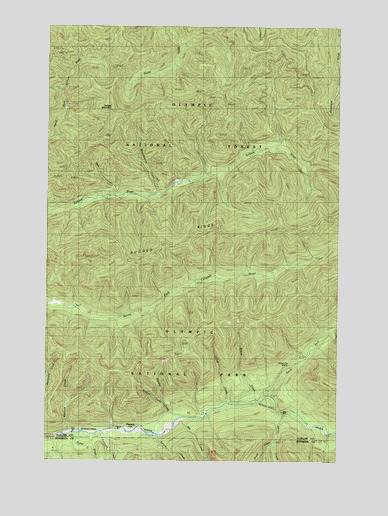
Hunger Mountain, WA USGS Topographic Map
Click on map above to begin viewing in our Map Viewer.

This topographic map contains these locations and features:
Feature Name Type Latitude Longitude GNIS ID View Map
All-In CreekStreamN47.8804°W124.0283°1515814View Map
Bee CreekStreamN47.8856°W124.0699°1516364View Map
Brandeberry CreekStreamN47.9517°W124.0788°1516924View Map
Brush CreekStreamN47.8887°W124.0258°1517004View Map
Elbow CreekStreamN47.8920°W124.0352°1519225View Map
Fifteenmile ShelterLocaleN47.9029°W124.0219°1519519View Map
Flapjack ShelterLocaleN47.8837°W124.0888°1519635View Map
Fraker CreekStreamN47.8826°W124.1066°1519764View Map
Hunger MountainSummitN47.9762°W124.0987°1521064View Map
Lotloh CreekStreamN47.8915°W124.0483°1522509View Map
Mineral CreekStreamN47.8909°W124.0758°1523208View Map
North Fork Bogachiel RiverStreamN47.8937°W124.0299°1523738View Map
Pete CreekStreamN47.9512°W124.0974°1524349View Map
Rugged RidgeRidgeN47.9420°W124.0258°1525283View Map
Spruce CreekStreamN47.8817°W124.0788°1526434View Map
Sunday CreekStreamN47.8854°W124.0719°1526737View Map
Tumwata CreekStreamN47.8826°W124.1063°1527448View Map
Vast CreekStreamN47.9567°W124.0596°1529532View Map
Warkum CreekStreamN47.8837°W124.1158°1527808View Map

Note: Coordinates in the location and feature list above are referenced to NAD83 datum.


Copyright (C) 2008-2025 Ryan Niemi / Sunset Dynamics ... All Rights Reserved