TopoQuest Logo
Do you find TopoQuest useful?
Help keep TopoQuest running and adding new maps/features by donating!
Bitcoin:  19c7KJd3qBynnjoSw5npx9KScwjBe4ifkT
Litecoin:  LXs6TkuXGGXo1vDsWCkWVdjQX94eUKd6ui
Home View Maps Find Maps Find Places Resources & Links


Mount Muller, Washington Topographic Map

USGS Map Title: Mount Muller, WA
USGS Map MRC: 48123A8
DRG (GeoTIFF) Download: o48123a8.tif


Neighboring USGS Topographic Map Quads:


  Pysht, WA  
48124B1
 

  Twin Rivers, WA  
48123B8
 

  Disque, WA  
48123B7
 

  Snider Peak, WA  
48124A1
 

  Mount Muller, WA  
48123A8
 

  Lake Crescent, WA  
48123A7
 

  Hunger Mountain, WA  
47124H1
 

  Slide Peak, WA  
47123H8
 

  Bogachiel Peak, WA  
47123H7


Map MRC Location:

N49°
W124°
N49°
W123°
H8 H7 H6 H5 H4 H3 H2 H1
G8 G7 G6 G5 G4 G3 G2 G1
F8 F7 F6 F5 F4 F3 F2 F1
E8 E7 E6 E5 E4 E3 E2 E1
D8 D7 D6 D5 D4 D3 D2 D1
C8 C7 C6 C5 C4 C3 C2 C1
B8 B7 B6 B5 B4 B3 B2 B1
A8 A7 A6 A5 A4 A3 A2 A1
N48°
W124°
N48°
W123°

Mount Muller, WA USGS 1:24K Topographic Map Preview:
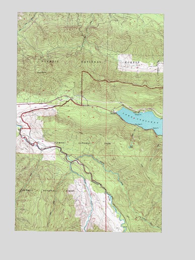
Mount Muller, WA USGS Topographic Map
Click on map above to begin viewing in our Map Viewer.

This topographic map contains these locations and features:
Feature Name Type Latitude Longitude GNIS ID View Map
Aurora TrailTrailN48.0340°W123.8910°1515986View Map
Clallam CountyCivilN48.1104°W123.9343°1531341View Map
Cole CreekStreamN48.0693°W123.9041°1530103View Map
Cross CreekStreamN48.0556°W123.8769°1518346View Map
Eagle CreekStreamN48.0618°W123.8983°1519037View Map
Eagle LakesLakeN48.0483°W123.9046°1519048View Map
Eagle PointCapeN48.0615°W123.8977°1519056View Map
FairholmeLocaleN48.0681°W123.9160°1519431View Map
Fairholme CampgroundLocaleN48.0679°W123.9163°1529542View Map
Fairholme Ranger StationLocaleN48.0687°W123.9163°1529548View Map
Goodman CreekStreamN48.0462°W123.9799°1520135View Map
Meldrim PointCapeN48.0595°W123.8849°1522997View Map
Mount MullerSummitN48.0898°W123.9797°1523510View Map
North Fork Sol Duc RiverStreamN48.0406°W123.9502°1523846View Map
South Fork Sol Duc RiverStreamN48.0393°W123.9546°1526255View Map
Thompson PointCapeN48.0676°W123.8983°1527111View Map
Tom CreekStreamN48.0348°W123.9535°1527289View Map

Note: Coordinates in the location and feature list above are referenced to NAD83 datum.


Copyright (C) 2008-2024 Ryan Niemi / Sunset Dynamics ... All Rights Reserved