TopoQuest Logo
Do you find TopoQuest useful?
Help keep TopoQuest running and adding new maps/features by donating!
Bitcoin:  19c7KJd3qBynnjoSw5npx9KScwjBe4ifkT
Litecoin:  LXs6TkuXGGXo1vDsWCkWVdjQX94eUKd6ui
Home View Maps Find Maps Find Places Resources & Links


Huntington, Oregon Topographic Map

USGS Map Title: Huntington, OR
USGS Map MRC: 44117C3
DRG (GeoTIFF) Download: o44117c3.tif


Neighboring USGS Topographic Map Quads:


  Rye Valley, OR  
44117D4
 

  Lime, OR  
44117D3
 

  Henley Basin, ID  
44117D2
 

  Birch Creek Meadow, OR  
44117C4
 

  Huntington, OR  
44117C3
 

  Olds Ferry, ID  
44117C2
 

  Jamieson, OR  
44117B4
 

  McCarthy Ridge, OR  
44117B3
 

  Tub Mountain, OR  
44117B2


Map MRC Location:

N45°
W118°
N45°
W117°
H8 H7 H6 H5 H4 H3 H2 H1
G8 G7 G6 G5 G4 G3 G2 G1
F8 F7 F6 F5 F4 F3 F2 F1
E8 E7 E6 E5 E4 E3 E2 E1
D8 D7 D6 D5 D4 D3 D2 D1
C8 C7 C6 C5 C4 C3 C2 C1
B8 B7 B6 B5 B4 B3 B2 B1
A8 A7 A6 A5 A4 A3 A2 A1
N44°
W118°
N44°
W117°

Huntington, OR USGS 1:24K Topographic Map Preview:
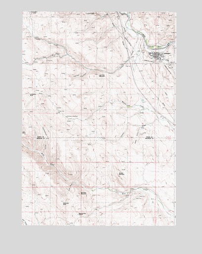
Huntington, OR USGS Topographic Map
Click on map above to begin viewing in our Map Viewer.

This topographic map contains these locations and features:
Feature Name Type Latitude Longitude GNIS ID View Map
Adobe GulchValleyN44.3071°W117.2788°1116779View Map
Andersen CreekStreamN44.3471°W117.2593°1131847View Map
Baker County Library Huntington Branch LibraryBuildingN44.3500°W117.2671°2700376View Map
Benson DamDamN44.3220°W117.2758°1131308View Map
Benson ReservoirReservoirN44.3230°W117.2769°1158808View Map
Brosman MountainSummitN44.2671°W117.3282°1118115View Map
Buck GulchValleyN44.2746°W117.3321°1118186View Map
Cavanaugh CreekStreamN44.3738°W117.2957°1118706View Map
City of HuntingtonCivilN44.3501°W117.2668°2410808View Map
Compton SpringSpringN44.3750°W117.3666°1119189View Map
Cottonwood GulchValleyN44.2910°W117.3580°1119338View Map
Dry CreekStreamN44.3179°W117.2760°1131846View Map
Durbin CreekStreamN44.3624°W117.2799°1120223View Map
HuntingtonPopulated PlaceN44.3513°W117.2666°1122160View Map
Huntington City HallBuildingN44.3504°W117.2674°2700377View Map
Huntington Historical MuseumBuildingN44.3492°W117.2665°2699472View Map
Huntington Independent Order of Odd Fellows CemeteryCemeteryN44.3440°W117.2532°1131848View Map
Huntington Old CemeteryCemeteryN44.3480°W117.2696°1131849View Map
Huntington Post OfficePost OfficeN44.3512°W117.2678°1165423View Map
Huntington Public Works Department OfficeBuildingN44.3503°W117.2674°2700424View Map
Huntington SchoolSchoolN44.3478°W117.2628°1639044View Map
Huntington SchoolSchoolN44.3478°W117.2628°2466086View Map
Huntington Volunteer Fire DepartmentBuildingN44.3504°W117.2677°2576709View Map
Huntington Wastewater Treatment PondsLocaleN44.3562°W117.2558°2697059View Map
Limestone ButteSummitN44.3263°W117.3719°1123091View Map
Little ValleyValleyN44.3090°W117.3202°1123302View Map
Lost Tom CreekStreamN44.3410°W117.3202°1123518View Map
Lost Tom MountainSummitN44.3377°W117.3160°1123519View Map
McDowell ButteSummitN44.2635°W117.3435°1123944View Map
McDowell Butte ReservoirReservoirN44.2563°W117.3293°1133362View Map
Smith GulchValleyN44.3082°W117.2524°1131853View Map
Striped MountainSummitN44.2785°W117.2971°1127661View Map
Trail GulchValleyN44.3499°W117.3413°1131845View Map
Vane Ranch DamDamN44.2637°W117.2681°1133696View Map
Vane Ranch ReservoirReservoirN44.2637°W117.2687°1131860View Map
Willow Springs CreekStreamN44.2721°W117.2802°1131858View Map

Note: Coordinates in the location and feature list above are referenced to NAD83 datum.


Copyright (C) 2008-2025 Ryan Niemi / Sunset Dynamics ... All Rights Reserved