TopoQuest Logo
Do you find TopoQuest useful?
Help keep TopoQuest running and adding new maps/features by donating!
Bitcoin:  19c7KJd3qBynnjoSw5npx9KScwjBe4ifkT
Litecoin:  LXs6TkuXGGXo1vDsWCkWVdjQX94eUKd6ui
Home View Maps Find Maps Find Places Resources & Links


Rye Valley, Oregon Topographic Map

USGS Map Title: Rye Valley, OR
USGS Map MRC: 44117D4
DRG (GeoTIFF) Download: o44117d4.tif


Neighboring USGS Topographic Map Quads:


  Lost Basin, OR  
44117E5
 

  Durkee, OR  
44117E4
 

  Big Lookout Mountain, OR  
44117E3
 

  Mormon Basin, OR  
44117D5
 

  Rye Valley, OR  
44117D4
 

  Lime, OR  
44117D3
 

  Becker Creek, OR  
44117C5
 

  Birch Creek Meadow, OR  
44117C4
 

  Huntington, OR  
44117C3


Map MRC Location:

N45°
W118°
N45°
W117°
H8 H7 H6 H5 H4 H3 H2 H1
G8 G7 G6 G5 G4 G3 G2 G1
F8 F7 F6 F5 F4 F3 F2 F1
E8 E7 E6 E5 E4 E3 E2 E1
D8 D7 D6 D5 D4 D3 D2 D1
C8 C7 C6 C5 C4 C3 C2 C1
B8 B7 B6 B5 B4 B3 B2 B1
A8 A7 A6 A5 A4 A3 A2 A1
N44°
W118°
N44°
W117°

Rye Valley, OR USGS 1:24K Topographic Map Preview:
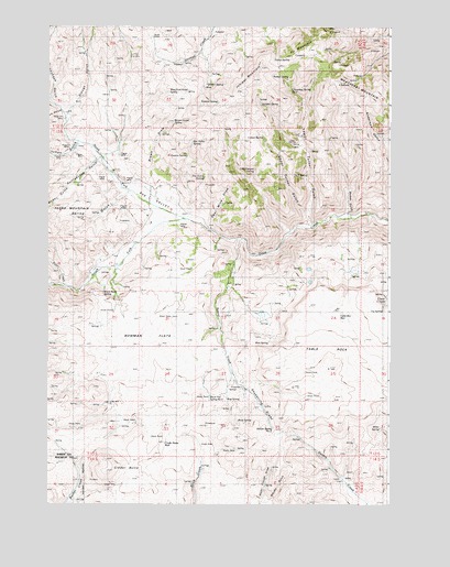
Rye Valley, OR USGS Topographic Map
Click on map above to begin viewing in our Map Viewer.

This topographic map contains these locations and features:
Feature Name Type Latitude Longitude GNIS ID View Map
Abram SpringSpringN44.3948°W117.4179°1133378View Map
Beaver CreekStreamN44.4443°W117.4294°1117424View Map
Black Flat SpringSpringN44.4027°W117.4410°1133377View Map
Black Rock SpringSpringN44.4300°W117.4800°1117778View Map
Bog SpringSpringN44.4026°W117.4347°1133376View Map
Bowman FlatsFlatN44.4210°W117.4582°1117997View Map
Brouchaux GulchValleyN44.4807°W117.4996°1118116View Map
Brown DrawValleyN44.4593°W117.4627°1118128View Map
Brown Gulch SpringSpringN44.4749°W117.4545°1133383View Map
Buck FlatFlatN44.4027°W117.4316°1160834View Map
Buck Flat WaterholeReservoirN44.4033°W117.4410°1160835View Map
Buck SpringSpringN44.3969°W117.4309°1160836View Map
Cinder ButteSummitN44.3835°W117.4782°1118943View Map
Cinder Butte WellWellN44.3909°W117.4575°1133363View Map
Clough GulchValleyN44.4763°W117.4938°1119028View Map
Cloverleaf Spring Number TwoSpringN44.4834°W117.4116°1133382View Map
Colton SpringSpringN44.4710°W117.4217°1133366View Map
Cosena SpringSpringN44.4655°W117.4460°1133367View Map
Deer CreekStreamN44.4321°W117.4944°1119823View Map
Dry Gulch SpringSpringN44.4606°W117.4433°1133374View Map
Dumas GulchValleyN44.4504°W117.3910°1120207View Map
East Fork Rattlesnake GulchValleyN44.4652°W117.4808°1120321View Map
Fence SpringSpringN44.4911°W117.4179°1133365View Map
First Canyon SpringSpringN44.4628°W117.4248°1133375View Map
Fur MountainSummitN44.4935°W117.4049°1121026View Map
Hoffman RanchLocaleN44.4352°W117.4846°1638552View Map
Huntington DivisionCivilN44.4410°W117.4459°1938029View Map
Juniper MountainSummitN44.4860°W117.4235°1122597View Map
Juniper SpringSpringN44.4800°W117.4225°1133369View Map
Kitchen GulchValleyN44.4696°W117.4894°1122786View Map
L T SpringSpringN44.4612°W117.4102°1133368View Map
Lower Turner GulchValleyN44.4496°W117.4055°1123598View Map
Miller SpringSpringN44.3950°W117.3787°1158375View Map
Mun SpringSpringN44.4174°W117.4196°1133370View Map
North Dixie DitchCanalN44.4735°W117.4996°1131861View Map
North Fork Dixie CreekStreamN44.4493°W117.4507°1124770View Map
Opal Mine DrawValleyN44.4471°W117.4407°1125005View Map
Pedro MountainSummitN44.4407°W117.4941°1125272View Map
Pole GulchValleyN44.4771°W117.4958°1125538View Map
Quaker SpringSpringN44.4848°W117.4425°1133372View Map
Rye ValleyValleyN44.4507°W117.4449°1126389View Map
Rye ValleyPopulated PlaceN44.4638°W117.4774°1131852View Map
Rye Valley CemeteryCemeteryN44.4652°W117.4718°1131851View Map
Rye Valley Post Office (historical)Post OfficeN44.4638°W117.4774°1165900View Map
Rye Valley SpringSpringN44.4699°W117.4476°1133381View Map
Shoestring GradeSlopeN44.3990°W117.4207°1161508View Map
South Dixie DitchCanalN44.4429°W117.4760°1131840View Map
South Fork Dixie CreekStreamN44.4493°W117.4507°1127281View Map
Spring GulchValleyN44.4557°W117.4730°1127442View Map
Suitter SpringSpringN44.4871°W117.4186°1133364View Map
Summit SpringSpringN44.4802°W117.4384°1133373View Map
Table Mountain WellWellN44.4240°W117.3947°1133379View Map
Table RockSummitN44.4107°W117.3971°1127867View Map
Try SpringSpringN44.4257°W117.3779°1133371View Map
Upper Turner GulchValleyN44.4493°W117.4052°1128479View Map
Weatherby MountainSummitN44.4849°W117.3930°1128747View Map
Weber GulchValleyN44.4582°W117.4913°1128760View Map
West Fork Road SpringSpringN44.4829°W117.4564°1133380View Map

Note: Coordinates in the location and feature list above are referenced to NAD83 datum.


Copyright (C) 2008-2024 Ryan Niemi / Sunset Dynamics ... All Rights Reserved