TopoQuest Logo
Do you find TopoQuest useful?
Help keep TopoQuest running and adding new maps/features by donating!
Bitcoin:  19c7KJd3qBynnjoSw5npx9KScwjBe4ifkT
Litecoin:  LXs6TkuXGGXo1vDsWCkWVdjQX94eUKd6ui
Home View Maps Find Maps Find Places Resources & Links


Hutch Mountain, Arizona Topographic Map

USGS Map Title: Hutch Mountain, AZ
USGS Map MRC: 34111G4
DRG (GeoTIFF) Download: o34111g4.tif


Neighboring USGS Topographic Map Quads:


  Mormon Mountain, AZ  
34111H5
 

  Mormon Lake, AZ  
34111H4
 

  Kinnikinick Lake, AZ  
34111H3
 

  Stoneman Lake, AZ  
34111G5
 

  Hutch Mountain, AZ  
34111G4
 

  Jaycox Mountain, AZ  
34111G3
 

  Apache Maid Mountain, AZ  
34111F5
 

  Happy Jack, AZ  
34111F4
 

  Turkey Mountain, AZ  
34111F3


Map MRC Location:

N35°
W112°
N35°
W111°
H8 H7 H6 H5 H4 H3 H2 H1
G8 G7 G6 G5 G4 G3 G2 G1
F8 F7 F6 F5 F4 F3 F2 F1
E8 E7 E6 E5 E4 E3 E2 E1
D8 D7 D6 D5 D4 D3 D2 D1
C8 C7 C6 C5 C4 C3 C2 C1
B8 B7 B6 B5 B4 B3 B2 B1
A8 A7 A6 A5 A4 A3 A2 A1
N34°
W112°
N34°
W111°

Hutch Mountain, AZ USGS 1:24K Topographic Map Preview:
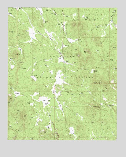
Hutch Mountain, AZ USGS Topographic Map
Click on map above to begin viewing in our Map Viewer.

This topographic map contains these locations and features:
Feature Name Type Latitude Longitude GNIS ID View Map
Allan Lake LandingPopulated PlaceN34.8253°W111.4365°25592View Map
Allan Lake TankReservoirN34.8276°W111.4392°25593View Map
Bear ParkFlatN34.8728°W111.4643°26099View Map
Bill Back ButteSummitN34.7575°W111.4590°26323View Map
Bill Back ParkFlatN34.7639°W111.4526°26324View Map
Bill Dick SpringSpringN34.7847°W111.4751°26326View Map
Blade TankReservoirN34.8589°W111.3869°26473View Map
Blind Lake TankReservoirN34.8104°W111.4714°26489View Map
Borrow Pit Number One TankReservoirN34.7511°W111.4232°37660View Map
Borrow Pit Number Two TankReservoirN34.7549°W111.4274°37662View Map
Boswell TankReservoirN34.7671°W111.3935°26629View Map
Brolliar ParkFlatN34.8503°W111.4729°26761View Map
Brolliar TankReservoirN34.8532°W111.4797°26762View Map
Bull TankReservoirN34.8006°W111.4270°37685View Map
Butch TankReservoirN34.7990°W111.4956°27072View Map
Cattrack TankReservoirN34.8253°W111.3907°27371View Map
Chilson TankReservoirN34.8622°W111.3818°27585View Map
Clover TankReservoirN34.8662°W111.4946°27741View Map
Cow TankReservoirN34.8173°W111.4842°28092View Map
Coyote BasinBasinN34.8445°W111.4257°28108View Map
Coyote Basin RanchPopulated PlaceN34.8425°W111.4310°28109View Map
Coyote TankReservoirN34.8347°W111.3991°28136View Map
Deer Seep TankReservoirN34.8255°W111.3798°28387View Map
Diversion ParkFlatN34.7809°W111.4390°28490View Map
Divide TankReservoirN34.7773°W111.4869°28494View Map
Double Cabin ParkFlatN34.8059°W111.4440°28550View Map
East TankReservoirN34.8260°W111.4578°28794View Map
Elk TankReservoirN34.8487°W111.4897°28865View Map
Elkhorn TankReservoirN34.7667°W111.4045°28872View Map
FH-three TankReservoirN34.7931°W111.4406°28945View Map
Fulton Canyon TankReservoirN34.8688°W111.4453°29232View Map
Gash FlatFlatN34.8339°W111.4876°29273View Map
Gash MountainSummitN34.8303°W111.4913°29274View Map
Gash TankReservoirN34.8349°W111.4853°29275View Map
Gooseberry SpringsSpringN34.8153°W111.4021°29423View Map
Grade TankReservoirN34.8593°W111.4436°29461View Map
Horseshoe SpringSpringN34.7820°W111.4026°30199View Map
Howard TankReservoirN34.8719°W111.4711°2515336View Map
Hutch MountainSummitN34.8020°W111.3901°30302View Map
J Railroad TankReservoirN34.8738°W111.4848°2515335View Map
Jackson ButteSummitN34.7556°W111.4504°30481View Map
Jackson ParkFlatN34.7672°W111.4660°30484View Map
Jones MountainSummitN34.7725°W111.4824°30608View Map
Jones Mountain TankReservoirN34.7582°W111.4870°30609View Map
Jones SpringsSpringN34.7634°W111.4988°30614View Map
K-T RanchLocaleN34.7934°W111.4918°30692View Map
La Cienega TankReservoirN34.8518°W111.4947°30827View Map
Lake MountainSummitN34.7895°W111.4985°30846View Map
Lane TankReservoirN34.7962°W111.4082°30874View Map
Little Draw TankReservoirN34.7956°W111.4303°31060View Map
Logger TankReservoirN34.8635°W111.4030°31194View Map
Lookout TankReservoirN34.7966°W111.3931°31280View Map
Lost TankReservoirN34.8270°W111.4693°31316View Map
Mahan MountainSummitN34.7817°W111.3982°31448View Map
Mahan RanchLocaleN34.7828°W111.3929°31451View Map
Mahan SpringSpringN34.7916°W111.4052°37922View Map
Mahan TankReservoirN34.7755°W111.3984°37923View Map
Mahan TankReservoirN34.7728°W111.3810°37924View Map
Malapai TankReservoirN34.8207°W111.4560°31462View Map
Maxie TankReservoirN34.7938°W111.4173°31596View Map
MB Smith TankReservoirN34.8448°W111.4211°31423View Map
Meadow TankReservoirN34.8041°W111.4018°31695View Map
Mint SpringSpringN34.8641°W111.4097°31929View Map
Mint TankReservoirN34.8657°W111.4117°31930View Map
Mule ParkFlatN34.7584°W111.4263°32170View Map
Mulholland TankReservoirN34.8612°W111.4594°32177View Map
Natural TankReservoirN34.7733°W111.4534°32249View Map
Park TankReservoirN34.7923°W111.4888°37978View Map
Patch TankReservoirN34.8725°W111.4573°32728View Map
Picnic TankReservoirN34.8011°W111.4554°32869View Map
Pierce TankReservoirN34.8331°W111.4135°32881View Map
Pit TankReservoirN34.8668°W111.4345°33039View Map
Pouroff TankReservoirN34.8710°W111.3787°33164View Map
Pratt ParkFlatN34.7875°W111.4560°33187View Map
Railroad SpringSpringN34.8748°W111.4505°33328View Map
Roundup ParkFlatN34.8200°W111.4965°38046View Map
Roundup Park SpringSpringN34.8236°W111.4874°33845View Map
Roundup Park TankReservoirN34.8262°W111.4982°33846View Map
Sawmill SpringsSpringN34.8373°W111.3770°34114View Map
Schell SpringSpringN34.7827°W111.3846°34130View Map
Schroeder TankReservoirN34.7841°W111.4580°34151View Map
Section Twenty-six TankReservoirN34.7520°W111.4733°34221View Map
Seven Anchor SpringSpringN34.8167°W111.4133°34269View Map
Shipping Pasture TankReservoirN34.7681°W111.4440°34382View Map
Shuffs TankReservoirN34.7746°W111.4206°34395View Map
Southeast TankReservoirN34.8566°W111.3993°34689View Map
Split TankReservoirN34.7576°W111.3810°34716View Map
Spruce TankReservoirN34.8177°W111.3788°34752View Map
Stevens TankReservoirN34.7714°W111.4746°34840View Map
Tie ParkFlatN34.8503°W111.4551°35316View Map
Tinny SpringSpringN34.8353°W111.4241°35345View Map
Tinny TankReservoirN34.8390°W111.4352°35348View Map
Van Deren SpringSpringN34.8356°W111.4458°35753View Map

Note: Coordinates in the location and feature list above are referenced to NAD83 datum.


Copyright (C) 2008-2025 Ryan Niemi / Sunset Dynamics ... All Rights Reserved