TopoQuest Logo
Do you find TopoQuest useful?
Help keep TopoQuest running and adding new maps/features by donating!
Bitcoin:  19c7KJd3qBynnjoSw5npx9KScwjBe4ifkT
Litecoin:  LXs6TkuXGGXo1vDsWCkWVdjQX94eUKd6ui
Home View Maps Find Maps Find Places Resources & Links


Hyatt Reservoir, Oregon Topographic Map

USGS Map Title: Hyatt Reservoir, OR
USGS Map MRC: 42122B4
DRG (GeoTIFF) Download: o42122b4.tif


Neighboring USGS Topographic Map Quads:


  Grizzly Peak, OR  
42122C5
 

  Robinson Butte, OR  
42122C4
 

  Brown Mountain, OR  
42122C3
 

  Emigrant Lake, OR  
42122B5
 

  Hyatt Reservoir, OR  
42122B4
 

  Little Chinquapin Mountain, OR  
42122B3
 

  Siskiyou Pass, OR  
42122A5
 

  Soda Mountain, OR  
42122A4
 

  Parker Mountain, OR  
42122A3


Map MRC Location:

N43°
W123°
N43°
W122°
H8 H7 H6 H5 H4 H3 H2 H1
G8 G7 G6 G5 G4 G3 G2 G1
F8 F7 F6 F5 F4 F3 F2 F1
E8 E7 E6 E5 E4 E3 E2 E1
D8 D7 D6 D5 D4 D3 D2 D1
C8 C7 C6 C5 C4 C3 C2 C1
B8 B7 B6 B5 B4 B3 B2 B1
A8 A7 A6 A5 A4 A3 A2 A1
N42°
W123°
N42°
W122°

Hyatt Reservoir, OR USGS 1:24K Topographic Map Preview:
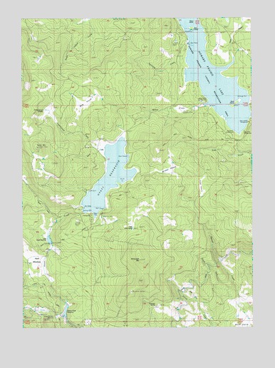
Hyatt Reservoir, OR USGS Topographic Map
Click on map above to begin viewing in our Map Viewer.

This topographic map contains these locations and features:
Feature Name Type Latitude Longitude GNIS ID View Map
Asperkaha County CampgroundParkN42.2037°W122.3859°1160751View Map
Buck IslandIslandN42.2143°W122.3847°1133234View Map
Buck PrairieFlatN42.2151°W122.4684°1118209View Map
Burnt CreekStreamN42.1671°W122.4809°1118349View Map
Burnt Creek RanchLocaleN42.1849°W122.4986°1118351View Map
Chinquapin MountainSummitN42.1522°W122.4373°1118920View Map
Cottonwood CreekStreamN42.1976°W122.4578°1119318View Map
Cottonwood GladesFlatN42.2126°W122.4875°1119335View Map
Crane PrairieFlatN42.1820°W122.4042°1119512View Map
Doe IslandIslandN42.2443°W122.4084°1133226View Map
East Fork Corral CreekStreamN42.1346°W122.4053°1120303View Map
Fairchild SpringSpringN42.1335°W122.4288°1120557View Map
Fawn IslandIslandN42.2482°W122.4084°1133227View Map
Green Springs SummitGapN42.1276°W122.4875°1136340View Map
Grizzly Prairie (historical)FlatN42.2424°W122.4084°1161383View Map
Howard Prairie (historical)FlatN42.2190°W122.3961°1161391View Map
Howard Prairie County Recreation AreaParkN42.2415°W122.4122°1160750View Map
Howard Prairie County ResortParkN42.2454°W122.4156°1987698View Map
Howard Prairie DamDamN42.2165°W122.3764°1155579View Map
Howard Prairie LakeReservoirN42.2315°W122.4022°1158895View Map
Howard Prairie Lake Resort MarinaHarborN42.2395°W122.4083°2699466View Map
Howard Prairie Resort Jackson County Boat RampLocaleN42.2398°W122.4102°2699467View Map
Hoxie CreekStreamN42.2243°W122.3903°1143861View Map
Hyatt Lake Bureau of Land Management Boat RampLocaleN42.1711°W122.4624°2699474View Map
Hyatt Lake Bureau of Land Management Boat RampLocaleN42.1730°W122.4572°2699475View Map
Hyatt Lake Bureau of Land Management Boat RampLocaleN42.1838°W122.4493°2699476View Map
Hyatt Lake CampgroundLocaleN42.1704°W122.4634°1167631View Map
Hyatt Lake Resort Boat RampLocaleN42.1736°W122.4678°2699477View Map
Hyatt Lake Resort Campers Cove DockLocaleN42.1798°W122.4651°2699478View Map
Hyatt Lake Resort MarinaLocaleN42.1735°W122.4675°2699479View Map
Hyatt MeadowsFlatN42.1499°W122.4934°1133228View Map
Hyatt ReservoirReservoirN42.1862°W122.4540°1122177View Map
Keene Creek DamDamN42.1715°W122.4678°1158800View Map
Keene Creek Diversion DamDamN42.1315°W122.4775°1159121View Map
Keene Creek ReservoirReservoirN42.1314°W122.4780°1133229View Map
Klum Landing County CampgroundParkN42.2079°W122.3775°1988449View Map
Klum Landing Jackson County Boat RampLocaleN42.2105°W122.3765°2699525View Map
Little Hyatt ReservoirReservoirN42.1606°W122.4869°1123207View Map
Little Rock SpringSpringN42.1648°W122.4412°1123268View Map
South Fork Beaver CreekStreamN42.1399°W122.3845°1127254View Map
Southeast Jackson DivisionCivilN42.2265°W122.4955°1938126View Map
Sugar Pine County Group CampgroundParkN42.2043°W122.3800°1160749View Map
Summit RanchLocaleN42.1332°W122.4917°1127719View Map
Swinning CreekStreamN42.2318°W122.4111°1159079View Map
Swinning SpringSpringN42.2290°W122.4164°1132689View Map
Table MountainSummitN42.1982°W122.4926°1127859View Map
Wildcat GladesFlatN42.1874°W122.4239°1129064View Map
Willow CreekStreamN42.2215°W122.3859°1129133View Map
Willow Point County CampgroundParkN42.2162°W122.4009°1160747View Map
Willow Point Jackson County Boat RampLocaleN42.2152°W122.4004°2699957View Map

Note: Coordinates in the location and feature list above are referenced to NAD83 datum.


Copyright (C) 2008-2024 Ryan Niemi / Sunset Dynamics ... All Rights Reserved