TopoQuest Logo
Do you find TopoQuest useful?
Help keep TopoQuest running and adding new maps/features by donating!
Bitcoin:  19c7KJd3qBynnjoSw5npx9KScwjBe4ifkT
Litecoin:  LXs6TkuXGGXo1vDsWCkWVdjQX94eUKd6ui
Home View Maps Find Maps Find Places Resources & Links


Grizzly Peak, Oregon Topographic Map

USGS Map Title: Grizzly Peak, OR
USGS Map MRC: 42122C5
DRG (GeoTIFF) Download: o42122c5.tif


Neighboring USGS Topographic Map Quads:


  Brownsboro, OR  
42122D6
 

  Lakecreek, OR  
42122D5
 

  Willow Lake, OR  
42122D4
 

  Rio Canyon, OR  
42122C6
 

  Grizzly Peak, OR  
42122C5
 

  Robinson Butte, OR  
42122C4
 

  Ashland, OR  
42122B6
 

  Emigrant Lake, OR  
42122B5
 

  Hyatt Reservoir, OR  
42122B4


Map MRC Location:

N43°
W123°
N43°
W122°
H8 H7 H6 H5 H4 H3 H2 H1
G8 G7 G6 G5 G4 G3 G2 G1
F8 F7 F6 F5 F4 F3 F2 F1
E8 E7 E6 E5 E4 E3 E2 E1
D8 D7 D6 D5 D4 D3 D2 D1
C8 C7 C6 C5 C4 C3 C2 C1
B8 B7 B6 B5 B4 B3 B2 B1
A8 A7 A6 A5 A4 A3 A2 A1
N42°
W123°
N42°
W122°

Grizzly Peak, OR USGS 1:24K Topographic Map Preview:
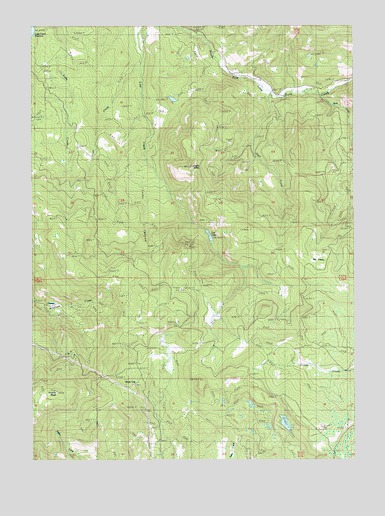
Grizzly Peak, OR USGS Topographic Map
Click on map above to begin viewing in our Map Viewer.

This topographic map contains these locations and features:
Feature Name Type Latitude Longitude GNIS ID View Map
Big GladesFlatN42.3065°W122.5156°1133240View Map
Big LakeLakeN42.2603°W122.5280°1132465View Map
Bybee GulchValleyN42.3054°W122.5442°1132466View Map
Charley CreekStreamN42.3499°W122.5817°1132469View Map
ClimaxPopulated PlaceN42.2951°W122.6198°1136158View Map
Climax Post Office (historical)Post OfficeN42.2951°W122.6198°1165064View Map
Cold Spring CreekStreamN42.3210°W122.5928°1133243View Map
Coon CreekStreamN42.3646°W122.5864°1119232View Map
Deer CreekStreamN42.3560°W122.5356°1119809View Map
Donsmore SpringSpringN42.2510°W122.5587°1132777View Map
Eagle ButteSummitN42.3341°W122.5637°1133241View Map
Grizzly PeakSummitN42.2696°W122.6164°1121450View Map
Guidottie ReservoirReservoirN42.3656°W122.5654°1157801View Map
Harrison CreekStreamN42.3332°W122.5817°1132467View Map
Lake Creek CemeteryCemeteryN42.3665°W122.5511°1159037View Map
Light Valley Tree Farm HeliportAirportN42.3579°W122.5118°2699547View Map
Lost LakeLakeN42.3138°W122.5572°1123504View Map
Lost Lake DamDamN42.3165°W122.5578°1131393View Map
Lucky CanyonValleyN42.3365°W122.5806°1133242View Map
Red Fir SpringSpringN42.3331°W122.6224°1132752View Map
Shale CityLocaleN42.2735°W122.5881°1136743View Map
Shale City ReservoirsReservoirN42.2751°W122.5896°1157802View Map
Soda CreekStreamN42.3551°W122.5153°1149847View Map
Spring CreekStreamN42.3276°W122.5945°1133253View Map

Note: Coordinates in the location and feature list above are referenced to NAD83 datum.


Copyright (C) 2008-2024 Ryan Niemi / Sunset Dynamics ... All Rights Reserved