TopoQuest Logo
Do you find TopoQuest useful?
Help keep TopoQuest running and adding new maps/features by donating!
Bitcoin:  19c7KJd3qBynnjoSw5npx9KScwjBe4ifkT
Litecoin:  LXs6TkuXGGXo1vDsWCkWVdjQX94eUKd6ui
Home View Maps Find Maps Find Places Resources & Links


Indian Mountain, Idaho Topographic Map

USGS Map Title: Indian Mountain, ID
USGS Map MRC: 45116B3
DRG (GeoTIFF) Download: o45116b3.tif


Neighboring USGS Topographic Map Quads:


  Heavens Gate, ID  
45116C4
 

  Pollock, ID  
45116C3
 

  Patrick Butte, ID  
45116C2
 

  Pollock Mountain, ID  
45116B4
 

  Indian Mountain, ID  
45116B3
 

  Hazard Lake, ID  
45116B2
 

  Railroad Saddle, ID  
45116A4
 

  Bally Mountain, ID  
45116A3
 

  Brundage Mountain, ID  
45116A2


Map MRC Location:

N46°
W117°
N46°
W116°
H8 H7 H6 H5 H4 H3 H2 H1
G8 G7 G6 G5 G4 G3 G2 G1
F8 F7 F6 F5 F4 F3 F2 F1
E8 E7 E6 E5 E4 E3 E2 E1
D8 D7 D6 D5 D4 D3 D2 D1
C8 C7 C6 C5 C4 C3 C2 C1
B8 B7 B6 B5 B4 B3 B2 B1
A8 A7 A6 A5 A4 A3 A2 A1
N45°
W117°
N45°
W116°

Indian Mountain, ID USGS 1:24K Topographic Map Preview:
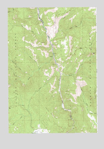
Indian Mountain, ID USGS Topographic Map
Click on map above to begin viewing in our Map Viewer.

This topographic map contains these locations and features:
Feature Name Type Latitude Longitude GNIS ID View Map
Bascom CanyonValleyN45.1443°W116.2621°376996View Map
Boulder CreekStreamN45.2041°W116.3132°378087View Map
Brush CreekStreamN45.1429°W116.3435°376106View Map
Camp CreekStreamN45.2124°W116.3137°397522View Map
Elk CreekStreamN45.2177°W116.3182°381360View Map
Fall CreekStreamN45.2254°W116.3232°381555View Map
Fall Creek Access AreaLocaleN45.2193°W116.3185°401335View Map
Hard CreekStreamN45.1824°W116.2843°382894View Map
Hard Creek meadowsFlatN45.1396°W116.2573°394390View Map
Hazard CreekStreamN45.1835°W116.3024°383008View Map
Hazard FallsFallsN45.2038°W116.2565°383009View Map
Hillman CreekStreamN45.1899°W116.3337°397788View Map
Hyatt CreekStreamN45.2010°W116.2565°383583View Map
Indian MountainSummitN45.1532°W116.3265°383693View Map
Little Elk CreekStreamN45.2263°W116.3048°384823View Map
Lockwood CreekStreamN45.2499°W116.3674°395689View Map
Pony CreekStreamN45.1785°W116.3587°388727View Map
Squirrel CreekStreamN45.1827°W116.3437°391323View Map
Tepee SpringsSpringN45.2088°W116.2718°391940View Map
Trail CreekStreamN45.1871°W116.3035°392277View Map

Note: Coordinates in the location and feature list above are referenced to NAD83 datum.


Copyright (C) 2008-2025 Ryan Niemi / Sunset Dynamics ... All Rights Reserved