TopoQuest Logo
Do you find TopoQuest useful?
Help keep TopoQuest running and adding new maps/features by donating!
Bitcoin:  19c7KJd3qBynnjoSw5npx9KScwjBe4ifkT
Litecoin:  LXs6TkuXGGXo1vDsWCkWVdjQX94eUKd6ui
Home View Maps Find Maps Find Places Resources & Links


Heavens Gate, Idaho Topographic Map

USGS Map Title: Heavens Gate, ID
USGS Map MRC: 45116C4
DRG (GeoTIFF) Download: o45116c4.tif


Neighboring USGS Topographic Map Quads:


  Old Timer Mountain, ID  
45116D5
 

  Kessler Creek, ID  
45116D4
 

  Riggins, ID  
45116D3
 

  He Devil, ID  
45116C5
 

  Heavens Gate, ID  
45116C4
 

  Pollock, ID  
45116C3
 

  Purgatory Saddle, ID  
45116B5
 

  Pollock Mountain, ID  
45116B4
 

  Indian Mountain, ID  
45116B3


Map MRC Location:

N46°
W117°
N46°
W116°
H8 H7 H6 H5 H4 H3 H2 H1
G8 G7 G6 G5 G4 G3 G2 G1
F8 F7 F6 F5 F4 F3 F2 F1
E8 E7 E6 E5 E4 E3 E2 E1
D8 D7 D6 D5 D4 D3 D2 D1
C8 C7 C6 C5 C4 C3 C2 C1
B8 B7 B6 B5 B4 B3 B2 B1
A8 A7 A6 A5 A4 A3 A2 A1
N45°
W117°
N45°
W116°

Heavens Gate, ID USGS 1:24K Topographic Map Preview:
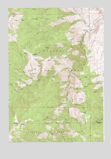
Heavens Gate, ID USGS Topographic Map
Click on map above to begin viewing in our Map Viewer.

This topographic map contains these locations and features:
Feature Name Type Latitude Longitude GNIS ID View Map
Aitken SpringSpringN45.3290°W116.4267°376488View Map
Alder SpringSpringN45.3330°W116.4793°376523View Map
Alvin GulchValleyN45.3679°W116.3774°376586View Map
Blue GulchValleyN45.3374°W116.4062°377907View Map
Blue Gulch SpringSpringN45.3375°W116.4468°377909View Map
Bridge CreekStreamN45.3071°W116.4632°378226View Map
Bryan MountainSummitN45.2671°W116.4849°378346View Map
Cannon Ball MountainSummitN45.3313°W116.4687°378845View Map
Cannon Ball SpringSpringN45.3273°W116.4658°378846View Map
Cannon CreekStreamN45.3152°W116.4807°378848View Map
Castle CreekStreamN45.2610°W116.4310°379004View Map
Chain SpringSpringN45.2729°W116.4515°379151View Map
Clyde SpringSpringN45.3647°W116.4294°379458View Map
Coconut GroveWoodsN45.3182°W116.4671°396314View Map
Coconut Grove CreekStreamN45.3096°W116.4693°397561View Map
Copper CreekStreamN45.2507°W116.4376°379708View Map
Cora GulchValleyN45.2985°W116.4221°379732View Map
Cora SpringSpringN45.3000°W116.4110°379733View Map
Cottonwood CreekStreamN45.3082°W116.4610°379830View Map
Cottonwood SpringSpringN45.3210°W116.4570°379870View Map
Cougar CreekStreamN45.2741°W116.4215°379883View Map
Deep CreekStreamN45.3002°W116.4829°380373View Map
DeVeny PlacePopulated PlaceN45.3574°W116.3951°396381View Map
Dutch Oven CreekStreamN45.2863°W116.4199°380960View Map
Game Warden SaddleGapN45.3277°W116.4493°382163View Map
Hall CreekStreamN45.2563°W116.4329°382829View Map
Hanson CreekStreamN45.2974°W116.4871°382879View Map
Heavens GateSummitN45.3688°W116.4949°396639View Map
Howard SpringSpringN45.3637°W116.4834°383476View Map
Log Trough SpringSpringN45.3139°W116.4723°385971View Map
McCrea CreekStreamN45.3052°W116.4679°386594View Map
McCrea PlacePopulated PlaceN45.3038°W116.4774°396867View Map
Morrison RidgeRidgeN45.3643°W116.4446°387239View Map
Morrison Ridge SpringSpringN45.3646°W116.4610°387240View Map
Mount SampsonSummitN45.3285°W116.4454°389879View Map
Mullin SpringSpringN45.3107°W116.4007°387401View Map
Oregon Tipton MnineMineN45.3138°W116.4332°394103View Map
Potter PlacePopulated PlaceN45.3077°W116.4407°397065View Map
Rapid River Fish HatcheryLocaleN45.3538°W116.3962°400296View Map
Rattlesnake BasinBasinN45.2896°W116.4057°389131View Map
Rattlesnake CreekStreamN45.2849°W116.4199°389141View Map
Rattlesnake SpringSpringN45.2778°W116.3988°398029View Map
Rodger SpringSpringN45.3634°W116.4879°389575View Map
Saddle CampLocaleN45.3382°W116.4810°389773View Map
Salmon River Rural Fire District Station 2BuildingN45.3196°W116.3839°2619044View Map
Salmon River Rural Fire District Station 3BuildingN45.3674°W116.3764°2619279View Map
Shingle CreekStreamN45.3552°W116.3912°390325View Map
Silvers StationLocaleN45.3627°W116.4012°390462View Map
Smoky SpringSpringN45.2583°W116.4416°390720View Map
South Fork Shingle CreekStreamN45.3635°W116.4037°391026View Map
Thorn GulchValleyN45.3454°W116.4043°392058View Map
Vista Point LookoutLocaleN45.3693°W116.4946°394102View Map
West Fork Rapid RiverStreamN45.3068°W116.4204°398337View Map
White Bird RidgeRidgeN45.3285°W116.3935°393317View Map
Wildhorse SaddleGapN45.3013°W116.4010°393449View Map
Wurl CabinLocaleN45.3082°W116.4782°393713View Map
Wyant CampLocaleN45.2707°W116.4237°393715View Map
Wyant CreekStreamN45.2710°W116.4224°393716View Map

Note: Coordinates in the location and feature list above are referenced to NAD83 datum.


Copyright (C) 2008-2024 Ryan Niemi / Sunset Dynamics ... All Rights Reserved