TopoQuest Logo
Do you find TopoQuest useful?
Help keep TopoQuest running and adding new maps/features by donating!
Bitcoin:  19c7KJd3qBynnjoSw5npx9KScwjBe4ifkT
Litecoin:  LXs6TkuXGGXo1vDsWCkWVdjQX94eUKd6ui
Home View Maps Find Maps Find Places Resources & Links


Indian Point, Colorado Topographic Map

USGS Map Title: Indian Point, CO
USGS Map MRC: 38108H2
DRG (GeoTIFF) Download: o38108h2.tif


Neighboring USGS Topographic Map Quads:


  Palisade, CO  
39108A3
 

  Lands End, CO  
39108A2
 

  Mesa Lakes, CO  
39108A1
 

  Juniata Reservoir, CO  
38108H3
 

  Indian Point, CO  
38108H2
 

  Hells Kitchen, CO  
38108H1
 

  Dominguez, CO  
38108G3
 

  Point Creek, CO  
38108G2
 

  North Delta, CO  
38108G1


Map MRC Location:

N39°
W109°
N39°
W108°
H8 H7 H6 H5 H4 H3 H2 H1
G8 G7 G6 G5 G4 G3 G2 G1
F8 F7 F6 F5 F4 F3 F2 F1
E8 E7 E6 E5 E4 E3 E2 E1
D8 D7 D6 D5 D4 D3 D2 D1
C8 C7 C6 C5 C4 C3 C2 C1
B8 B7 B6 B5 B4 B3 B2 B1
A8 A7 A6 A5 A4 A3 A2 A1
N38°
W109°
N38°
W108°

Indian Point, CO USGS 1:24K Topographic Map Preview:
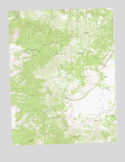
Indian Point, CO USGS Topographic Map
Click on map above to begin viewing in our Map Viewer.

This topographic map contains these locations and features:
Feature Name Type Latitude Longitude GNIS ID View Map
Alkali BasinBasinN38.8833°W108.1562°185267View Map
Blue LakeLakeN38.9447°W108.1604°185258View Map
Chambers DamDamN38.9378°W108.1329°200790View Map
Chambers ReservoirReservoirN38.9358°W108.1319°185261View Map
Cheever CreekStreamN38.9741°W108.1756°185259View Map
Coal CreekStreamN38.9666°W108.1920°174658View Map
Coal Creek BasinBasinN38.9916°W108.1979°202264View Map
Coal Creek TrailTrailN38.9919°W108.1592°203055View Map
Cottonwood CreekStreamN38.9741°W108.1659°185256View Map
Deep CreekStreamN38.9789°W108.1498°174655View Map
Doughspoon ReservoirReservoirN38.8995°W108.1268°185265View Map
East Two CreekStreamN38.9591°W108.2123°185252View Map
Gill CreekStreamN38.9741°W108.1690°174657View Map
Indian PointCliffN38.9155°W108.1801°185255View Map
Indian Point TrailTrailN38.9333°W108.1940°185264View Map
KKLY-FM (Delta)TowerN38.8778°W108.2256°204894View Map
KQIX-FM (Grand Junction)TowerN38.8778°W108.2267°204900View Map
KSTR-FM (Montrose)TowerN38.8778°W108.2265°204905View Map
Point PeninsulaCliffN38.8958°W108.1512°185263View Map
Reservoir CreekStreamN38.9869°W108.1276°174737View Map
Service CreekStreamN38.9694°W108.1937°185257View Map
Sheep CreekStreamN38.9778°W108.1529°185260View Map
Shirtail CreekStreamN38.9611°W108.2301°185254View Map
Skunk CreekStreamN38.9769°W108.1592°174656View Map
Spring Camp TrailTrailN38.9472°W108.2137°185262View Map
Two CreekStreamN38.9633°W108.2151°185251View Map
West Two CreekStreamN38.9591°W108.2123°185250View Map

Note: Coordinates in the location and feature list above are referenced to NAD83 datum.


Copyright (C) 2008-2024 Ryan Niemi / Sunset Dynamics ... All Rights Reserved