TopoQuest Logo
Do you find TopoQuest useful?
Help keep TopoQuest running and adding new maps/features by donating!
Bitcoin:  19c7KJd3qBynnjoSw5npx9KScwjBe4ifkT
Litecoin:  LXs6TkuXGGXo1vDsWCkWVdjQX94eUKd6ui
Home View Maps Find Maps Find Places Resources & Links


North Delta, Colorado Topographic Map

USGS Map Title: North Delta, CO
USGS Map MRC: 38108G1
DRG (GeoTIFF) Download: o38108g1.tif


Neighboring USGS Topographic Map Quads:


  Indian Point, CO  
38108H2
 

  Hells Kitchen, CO  
38108H1
 

  Cedaredge, CO  
38107H8
 

  Point Creek, CO  
38108G2
 

  North Delta, CO  
38108G1
 

  Orchard City, CO  
38107G8
 

  Roubideau, CO  
38108F2
 

  Delta, CO  
38108F1
 

  Olathe NW, CO  
38107F8


Map MRC Location:

N39°
W109°
N39°
W108°
H8 H7 H6 H5 H4 H3 H2 H1
G8 G7 G6 G5 G4 G3 G2 G1
F8 F7 F6 F5 F4 F3 F2 F1
E8 E7 E6 E5 E4 E3 E2 E1
D8 D7 D6 D5 D4 D3 D2 D1
C8 C7 C6 C5 C4 C3 C2 C1
B8 B7 B6 B5 B4 B3 B2 B1
A8 A7 A6 A5 A4 A3 A2 A1
N38°
W109°
N38°
W108°

North Delta, CO USGS 1:24K Topographic Map Preview:
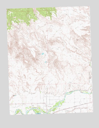
North Delta, CO USGS Topographic Map
Click on map above to begin viewing in our Map Viewer.

This topographic map contains these locations and features:
Feature Name Type Latitude Longitude GNIS ID View Map
Adobe ButtesSummitN38.8366°W108.0215°185389View Map
Barber FieldAirportN38.7734°W108.0451°2443909View Map
Beebe GulchValleyN38.8599°W108.0023°185296View Map
Beebe MesaSummitN38.8664°W108.0692°185388View Map
Blake FieldAirportN38.7809°W108.0674°185392View Map
City of DeltaCivilN38.7561°W108.0774°2410319View Map
Delta Control DamDamN38.8100°W108.0706°199198View Map
Delta ReservoirReservoirN38.8108°W108.0688°185384View Map
Devils ThumbPillarN38.8150°W108.0840°185383View Map
Doctor MesaSummitN38.8494°W108.0287°203075View Map
Doctors Mesa AirportAirportN38.8524°W108.0141°2443907View Map
Dry Fork ReservoirReservoirN38.8206°W108.0727°185385View Map
Dry GulchValleyN38.7706°W108.0499°185253View Map
Hartland DitchCanalN38.7617°W108.0840°203068View Map
Hoosier DitchCanalN38.8550°W108.0256°185390View Map
January MesaSummitN38.8678°W108.0570°185386View Map
KDTA-AM (Delta)TowerN38.7605°W108.0917°203997View Map
Lewis DamDamN38.8166°W108.0723°199232View Map
Lewis ReservoirReservoirN38.8166°W108.0723°199233View Map
Memory Gardens CemeteryCemeteryN38.7530°W108.0403°185395View Map
Mesa View CemeteryCemeteryN38.7527°W108.0402°1795141View Map
Mountain Gilead Bethel ChurchChurchN38.8683°W108.0567°185387View Map
Negro CreekStreamN38.8069°W108.0023°201768View Map
Negro MesaSummitN38.8505°W108.0884°185382View Map
North DeltaPopulated PlaceN38.7586°W108.0692°185393View Map
North Delta CanalCanalN38.7778°W108.0284°203069View Map
Park DitchCanalN38.7916°W108.0009°203072View Map
Petrie MesaSummitN38.8375°W108.1070°185381View Map
Relief DitchCanalN38.7555°W108.0117°203071View Map
SaundersPopulated PlaceN38.7603°W108.0101°185394View Map
Tongue CreekStreamN38.7767°W108.0190°185396View Map
Uncompahgre RiverStreamN38.7567°W108.0903°185397View Map
Winkler ReservoirReservoirN38.7725°W108.1159°185391View Map

Note: Coordinates in the location and feature list above are referenced to NAD83 datum.


Copyright (C) 2008-2025 Ryan Niemi / Sunset Dynamics ... All Rights Reserved